I provide a free route map, but you can also download a hike/drive GPX to assist you and to help support my site. Before sharing my GPX tracks with others, please remember my site is a free resource and I'm charging nominal fees to offset my substantial costs.
GPX track added to your cart.
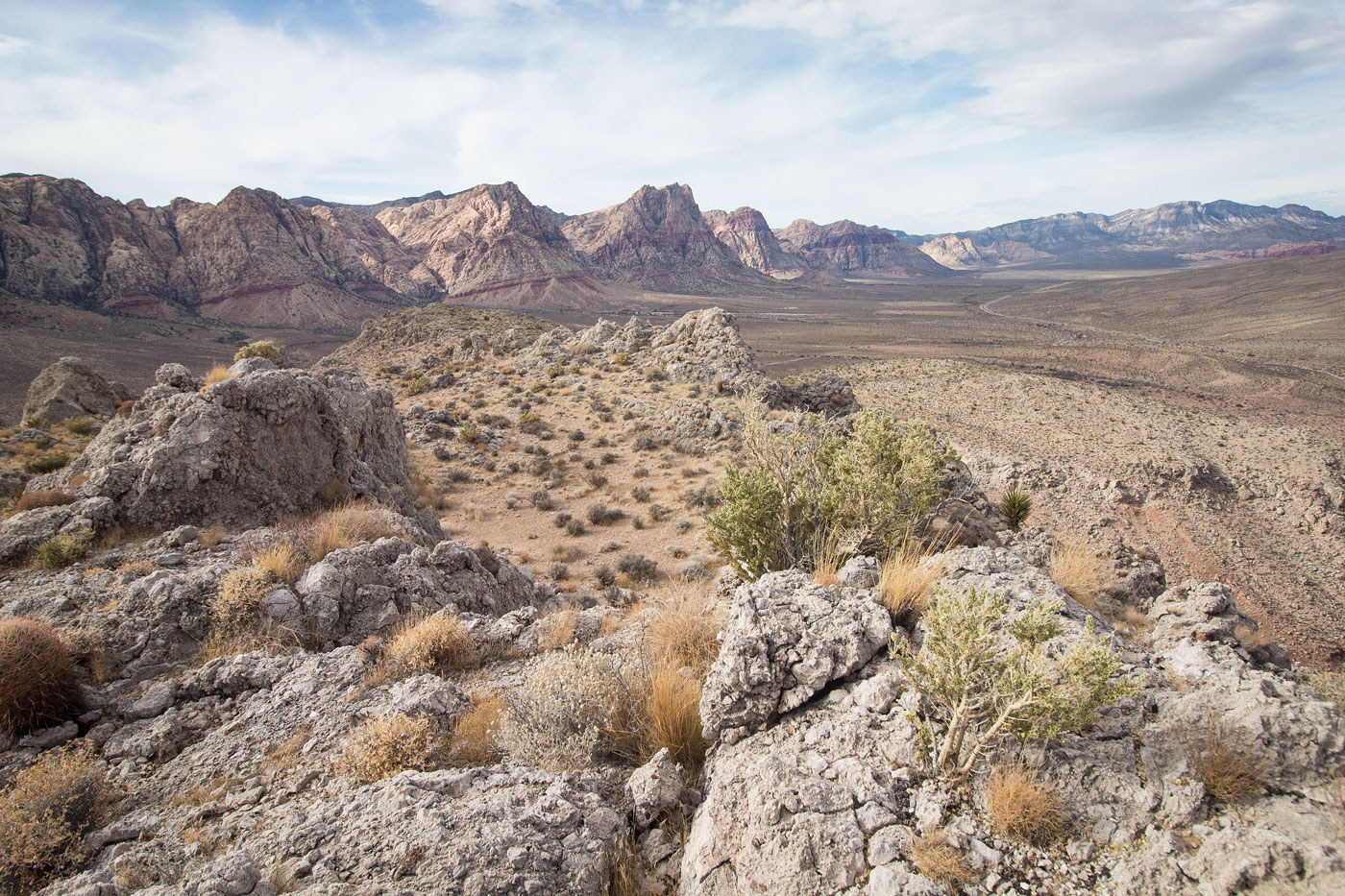
Feb 11, 2021 — The foothills south of the town of Blue Diamond is known better for its mountain biking trails than hiking, but the route Austin and I took to explore the area required some off-trail peakbagging. We parked at a pull-out just before entering town and located the start of the mountain biking trail system, leaving it shortly to headed along the west slope of Peak 4109. I marked the off-trail sections of our route in blue on the attached map. The slope was steep, but barely even Class 2. We headed along the ridge to the summit and chose a ridgeline to get down. Our route back down was fine overall, with one Class 2 move to get through a minor cliff band. Other options slightly south would work fine , but might be more loose.
Once back on the trail system, we headed along the officially named "Inner Hurl Trail", which stayed just below some cliff bands of a long mesa. The "Hurl Trail" leads along the top of the mesa, but getting to it would have required scrambling up the cliff bands, and we were in the mood for some pleasant trail walking. The Inner Hurl Trail worked its way along the slopes and switchbacked up to higher ground, continuing west along the mesa top along another officially named trail called the "Hurl Backdoor Trail". We got some delightful views toward Red Rock Canyon's bigger peaks along this section and soon found ourselves at the base of Peak 4182. We left the official trail and continued on a social trail to the summit.
Rather than backtrack, we decided to drop down from the somewhat steep and loose drainage leading east from Peak 4182. This led down to the "Landmine Loop Trail", which we followed into the town of Blue Diamond. The hike finished with a tour of the town before we ended back at our trailhead.
Please consider helping me out if you find my site useful. I'm not sponsored, so all site fees are out-of-pocket and my time preparing these trip reports is unpaid. You can also hire me as a web developer. I really appreciate it!


If you find my site helpful, please help me replace my many broken cameras, fund my website fees (hosting, APIs, security), or just support my countless hours of work. I pay for all expenses myself, and all trip reports I post are unpaid and unsponsored, so any support is really appreciated!
If using PayPal, please select their option for "Sending to a friend" so they don't take out fees, thank you.
My site is free to use, but consider sending me a few bucks to help keep it running. Thanks in advance!