I provide a free route map, but you can also download a hike/drive GPX to assist you and to help support my site. Before sharing my GPX tracks with others, please remember my site is a free resource and I'm charging nominal fees to offset my substantial costs.
GPX track added to your cart.
Jun 08, 2023 — The Bristlecone Wilderness High Point is located near Ely Nevada, but the steep terrain and lack of trails means it gets little visitation, plus it's surrounded by gorgeous and taller peaks that are more interesting. With poor weather forecasted I knew I only had a few hours to hike in the area, so it made sense to check this less committing peak out. The summit is best reached from the west. To reach the trailhead, keep right here (39.46952, -114.98202), leaving the good dirt road. I parked where I did because the road got rutted shortly after and with potential rain I didn't want to risk getting stuck. You can cut about a mile or so round trip from the hike if you drive higher, but I wasn't upset to hike the road alongside pretty meadows and wildflowers.
My first goal was to reach the ridgeline, but to do this I needed to ascend the absurdly steep west slope. I'm not sure what the best option is for reaching the summit is since it's a steep slog anywhere you go, but at least it was slightly less so to the northwest of the peak. I took the dirt road up until it curved north, where I left it and continued cross-country on initially easy terrain. This steepened and since the brush was sparse and easy to avoid, I actually got some lovely views for most of the ascent. I picked my way up the slope and the ground became riddled with scree. Isn't it super fun to slip up a mountain? I found it was best to ascend while traversing rather than go up directly since doing so kept the grade a bit more gradual.
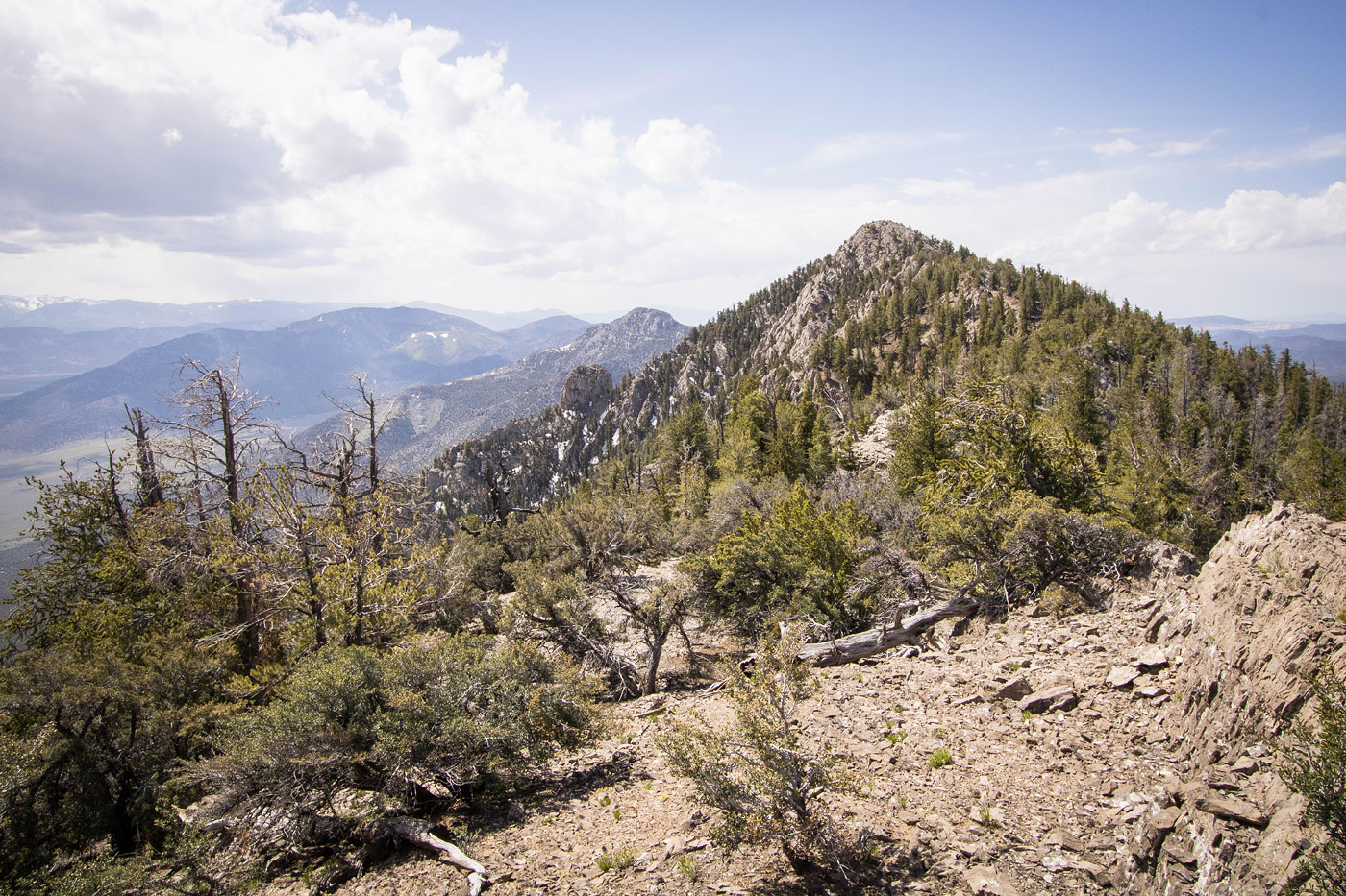
The ridge crest above seemed potentially rocky, so rather than head all the way up I stuck to just below and side-hilled on pretty chill terrain. Along this section I recommend keeping a bit low or risk running into little outcroppings that you'll need to bypass by dropping back down. About a half mile from the summit I decided to head up to the crest and off the slope, where I got a great view of the high point ahead. Taking the ridge from here, I encountered some Class 2 on solid limestone and some minor undulations along the ridge. The summit view was really nice, but I was chased off by a particularly scary-looking cloud.
Please consider helping me out if you find my site useful. I'm not sponsored, so all site fees are out-of-pocket and my time preparing these trip reports is unpaid. You can also hire me as a web developer. I really appreciate it!


If you find my site helpful, please help me replace my many broken cameras, fund my website fees (hosting, APIs, security), or just support my countless hours of work. I pay for all expenses myself, and all trip reports I post are unpaid and unsponsored, so any support is really appreciated!
If using PayPal, please select their option for "Sending to a friend" so they don't take out fees, thank you.
My site is free to use, but consider sending me a few bucks to help keep it running. Thanks in advance!