

From my parking spot, I dropped into the wash on the right.
I stumbled on an ATV road, which I followe.
The road made the hike quite easy for the first bit.
I reached a junction, left would be my descent later. Right is where the ATV road continued, and I followed it.
The ATV road ended and I ended up boulder-hopping up the wash.
Looking back at my progress up the wash.
Nearing a minor saddle at the head of the wash.
Looking back the way I came from the minor saddle.
View from the minor saddle, looking down the opposite side. My route dropped down a bit, then skirted around the rock outcropping on the left. From there, I entered the drainage next to the one pictured here.
Starting up the drainage, "Drainage 2". I stayed in it only for a short time, deciding I wanted to start ascending on the right in one of numerous possible gullies.
Looking back as I start my ascent out of "drainage 2". You can see the rock outcropping I avoided in the center, and the minor saddle I just descended from hidden just behind the rock outcropping on the left.
Continuing up my chosen Class 2/2+ gully.
Looking back at my progress. It was a pretty fun scramble, even though some of the rock was loose.
Final push to the summit.
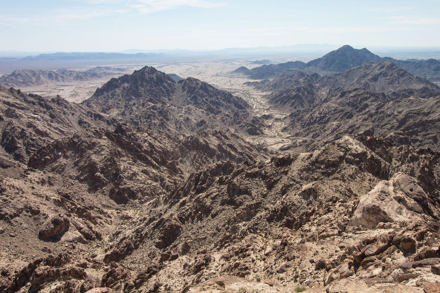
Cargo Muchacho Mountains High Point summit. You can see the rock outcropping I avoided on the left, and the minor saddle I descended from left of it. Right of center is the wash I hiked up. In the center of the photo is my soon-to-be chosen descent gully that would meet up with the fork I had left earlier.
Close-up toward my descent gully route, and the wash I hiked up. My car is somewhere top center. Stud Mountain visible top right.
Close-up toward Picacho Peak in the distance.
I descended a random gully and made it back into "drainage 2". I then began descending the left fork (southern line in attached map), pictured here.
Some Class 2/3 stuff to contend with, but it's nothing out of the ordinary for the Mojave.
Hire me or show me some love!
Hire/refer me as a web developer or send me a few bucks if you find my site useful. I’m not sponsored, so all fees are out-of-pocket and my time preparing trip reports is unpaid. I really appreciate it!