I provide a free route map, but you can also download a hike/drive GPX to assist you and to help support my site. Before sharing my GPX tracks with others, please remember my site is a free resource and I'm charging nominal fees to offset my substantial costs.
GPX track added to your cart.
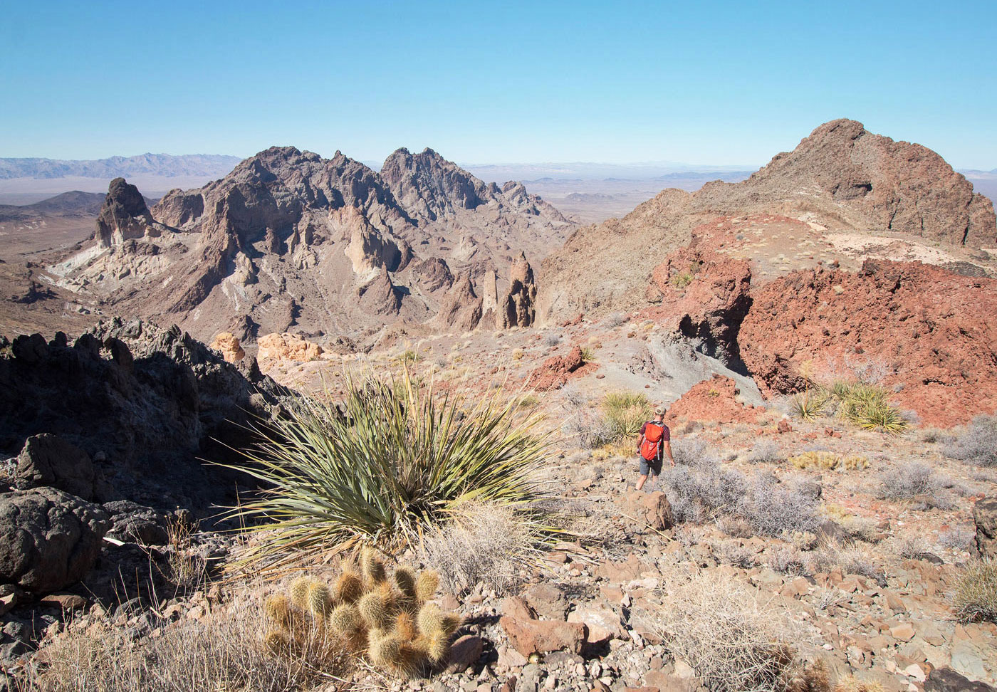
Mar 01, 2021 — Any car can make it here (34.43005, -114.82584), but high clearance is required for a couple of big dips and decent tires for rocky sections past this leading to the trailhead. Not being able to drive this section would result in an additional two miles round-trip. We set out along a deteriorated dirt road into the wilderness area, following it until it entered the major wash north of Carsons Benchmark. Along the wash were some delighful rock formations and cliffs on either side, and we gawked at the sheer cliff surrounding Lincoln's Nose (our final peak of this loop). We headed up the drainage directly south on our way to Peak 3585. Reaching this peak required Class 2 scrambling up a bouldery and sometimes somewhat brushy drainage leading to the saddle shared by Peak 3585 and Carsons Benchmark, followed by some straightforward slope walking with a single Class 2 move about halfway up. The Class 2 move keeps to the right of the obvious cliff band that looks way more intimidating than it turned out to be. The summit views of the more serious northern Mopah peaks were visible to the north.
Back at the saddle, we continued east up the slope and followed a pretty good animal trail that avoided a bump along the ridge, which spit us out at the base of Carsons Benchmark. The terrain was mostly gradual with some easy Class 2 and the summit views were quite nice. The most technical section of the day commenced from Carsons Benchmark, but it really only involves some easy Class 3. We followed the northeastern ridge which quickly became broken and jagged, a short down-climb required. Ahead along the ridge were a series of scary-looking pinnacle, which we avoided by dropping through a notch on a steep slope and side-hilling along the west face of the pinnacles. This terrain is loose and not great, but the views are fantastic. A short Class 2+/3 climb led over a rock outcropping and back onto the main ridgeline. This section of ridge was mostly flat and not rocky, except for one Class 2 section to get over a cliff band. The route from here leading to Lincoln's Nose was Class 2.
We toyed with the idea of descending from Lincoln's Nose into the canyon on its east to make the loop more efficient, but it looked incredibly steep and like more effort thna it would be worth. Instead, we backtracked from Lincoln's Nose and descended on Class 2 terrain to the south. This route had a couple of cairns and it was clear it would be the best option. Some Class 2+ moves within the narrowing drainage led into a very short section of narrows and then we found ourselves boulder-hopping on massive boulders as we made our way out of the drainage. The mouth of the drainage hosted Coffin Spring and an old water containment system of some sort. An old road led from the ruins back into our approach wash, where we retraced our steps back to the cars.
Please consider helping me out if you find my site useful. I'm not sponsored, so all site fees are out-of-pocket and my time preparing these trip reports is unpaid. You can also hire me as a web developer. I really appreciate it!


If you find my site helpful, please help me replace my many broken cameras, fund my website fees (hosting, APIs, security), or just support my countless hours of work. I pay for all expenses myself, and all trip reports I post are unpaid and unsponsored, so any support is really appreciated!
If using PayPal, please select their option for "Sending to a friend" so they don't take out fees, thank you.
My site is free to use, but consider sending me a few bucks to help keep it running. Thanks in advance!