I provide a free route map, but you can also download a hike/drive GPX to assist you and to help support my site. Before sharing my GPX tracks with others, please remember my site is a free resource and I'm charging nominal fees to offset my substantial costs.
GPX track added to your cart.
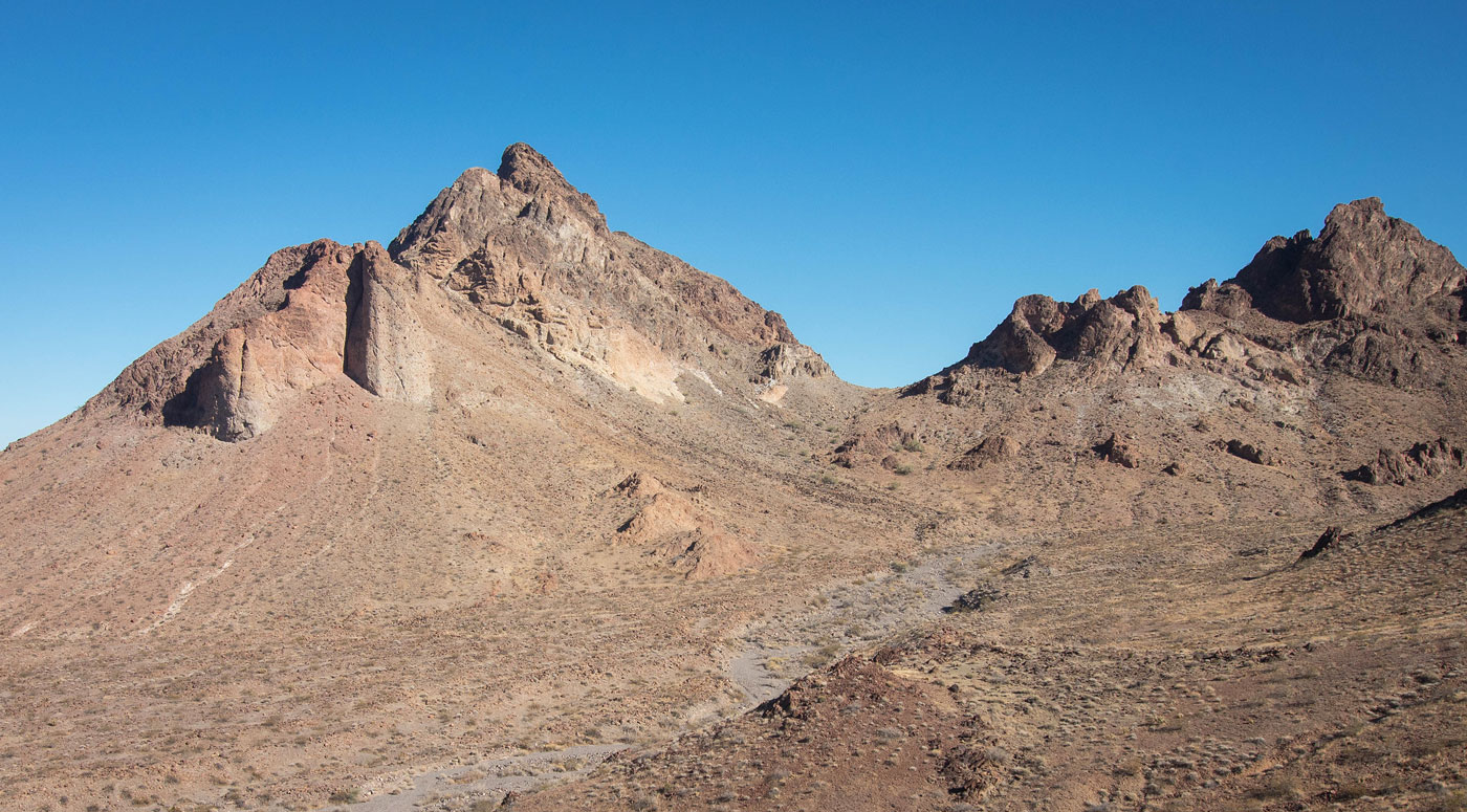
Mar 01, 2021 — Chalcedony Peak is a really nice add-on to other peaks in the northern Mopah range. It's got some fun scrambling and route-finding. Any car can make it here (34.43005, -114.82584), but high clearance is required for a couple of big dips and decent tires for rocky sections past this leading to the trailhead. Not being able to drive this section would result in an additional two miles round-trip. Due to the huge number of chalcedony specimens (no, I didn't know this until I looked it up), we named this otherwise unnamed peak Chalcedony Peak.
We set out along a deteriorated dirt road into the wilderness area, leaving it to cross a wash and enter the mostly flat and pleasant desert hills. We found ourselves within a wash on the west side of Chalcedony Peak and followed this for a bit until it was clear we had to leave to reach the saddle on the peak's south side. The slope leading here was Class 2 and we found lots of cool rocks along the way. Once over the saddle, a Class 2 slope led to a narrowing Class 2 gully leading to its terminus. A fun Class 3 scramble through a hole formed by a chockstone served as the easiest route up. My friends didn't spend a single second trying to locate this easier option, instead ascending via a Class 4 climb on the left. I was glad I looked around and found this fun little chockstone instead. Just above was the ridge crest, but it certainly wouldn't go. Instead, just along the cliff wall was a Class 3 set of moves, followed by a bench-link feature that hugged the cliffs on the left. My friends headed along the bench to its end and ascended on Class 3/4 terrain, but I was able to locate an easier Class 3 option shortly after emerging from the Class 3 cliff wall set of moves.
The route I chose headed up some big boulders in an open gully with some light brush, followed by a Class 2 flat ledge, and then a Class 3 move to gain a small slab. The slab was exposed Class 2, and it led to the final stretch where I could see the summit. Matt and Tyler beat me there since their route was scarier, though more direct. I had a lot of fun navigating the route I took, and had no regrets at showing up late to the party. Reaching the summit only required navigating up and around some big granite-looking boulders.
Please consider helping me out if you find my site useful. I'm not sponsored, so all site fees are out-of-pocket and my time preparing these trip reports is unpaid. You can also hire me as a web developer. I really appreciate it!


If you find my site helpful, please help me replace my many broken cameras, fund my website fees (hosting, APIs, security), or just support my countless hours of work. I pay for all expenses myself, and all trip reports I post are unpaid and unsponsored, so any support is really appreciated!
If using PayPal, please select their option for "Sending to a friend" so they don't take out fees, thank you.
My site is free to use, but consider sending me a few bucks to help keep it running. Thanks in advance!