

Sarasota Trailhead. Little Cat Mountain is seen on the top right.
Along the Sarasota Trail, Golden Gate Mountain seen on the left.
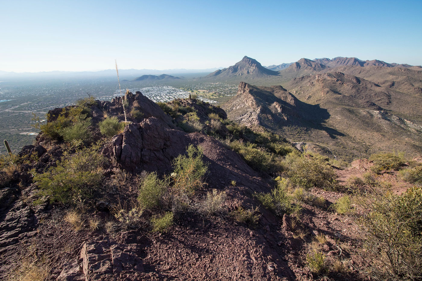
Junction with the Explorer Trail. Bobcat Ridge seen center.
I left the Explorer Trail to ascend to Bobcat Ridge using this rocky social trail.
The trail leads nicely to the summit of Bobcat Ridge.
View back as I head along the ridge toward Little Cat (right) and Cat Mountain (left).
Bobcat Ridge ahead.
Approaching the summit.
Bobcat Ridge summit, view toward the Santa Catalina Montains.
Bobcat Ridge summit, a view toward my next two peaks.
Close-up toward Little Cat Mountain.
From the saddle on Little Cat Mountain's north side, I found this social trail that led to the rim above.
Steep, but not brushy.
The social trail fades on the flatter summit area and I headed to the high point on mostly open terrain.
Little Cat Mountain summit, view toward Bobcat ridge (left) and Mount Lemmon (top right).
Little Cat Mountain summit just ahead.
Back on the Explorer Trail, now heading to Cat Mountain's northwestern base.
Cat Mountain ahead.
About to leave the trail and head up the slope ahead. You might notice the lighting changed quite a bit for the next few photos - the following are from another day when hiking Cat Mountain. I didn't want to retake all the photos.
Working up the slope and heading to the notch in the center.
Above the notch (visible center bottom), looking back the way I came. You can see the trail below.
Class 2 side-hilling to avoid the Class 4 ridgeline above, if you want.
Class 4 optional ridgeline.
Looking back along some of the Class 4 ridgeline obstacles. It's short-lived, but has some fun kick.
Along the Class 4 short section of the Cat Mountain ridgeline.
After the Class 4, where the easier route meets up. This is a view looking back the way I came.
Cat Mountain is ahead, just past the steep cliffy rock. That rock outcropping looked quite serious as I approached, but there was a Class 3 route up.
Looking back again.
Approaching the steep rocky cliff where I'd find the crux - a slab leading up a weakness. You can see it in the center of this photo.
The slab, with a minor amount of exposure.
Looking back along the northwest ridge as I ascend the slickrock slab that shifted into being a gully.
Slickrock gully.
Looking back down the slickrock gully just before the end.
Just above the slickrock gully, there was a short Class 2+/3 section. This shot was taken from the top of that move.
Cat Mountain ahead.
Cat Mountain summit, view northwest. You can see Golden Gate Mountain and Bren Benchmark in the far back center.
On the way back along the Sarasota Trail, a view back toward the northwest ridge of Cat Mountain.
Hire me or show me some love!
Hire/refer me as a web developer or send me a few bucks if you find my site useful. I’m not sponsored, so all fees are out-of-pocket and my time preparing trip reports is unpaid. I really appreciate it!