I provide a free route map, but you can also download a hike/drive GPX to assist you and to help support my site. Before sharing my GPX tracks with others, please remember my site is a free resource and I'm charging nominal fees to offset my substantial costs.
GPX track added to your cart.
Mar 31, 2023 — The Resting Spring Range is a string of peaks just outside of Death Valley and is usually referenced by its high point, Stewart Point. This traverse visits some of the lesser-visited peaks to the south of the high point. I parked on the side of CA-178 at the midpoint of the traverse to come and just started hiking northwest through the desert on easy terrain. I entered a major drainage on the south side of my first objective, the tallest of my peaks for the loop, Peak 4481. The drainage ascended on typical limestone boulder-hopping and introduced some fun Class 2/2+ dryfall obstacles. Anything harder can be avoided easily.
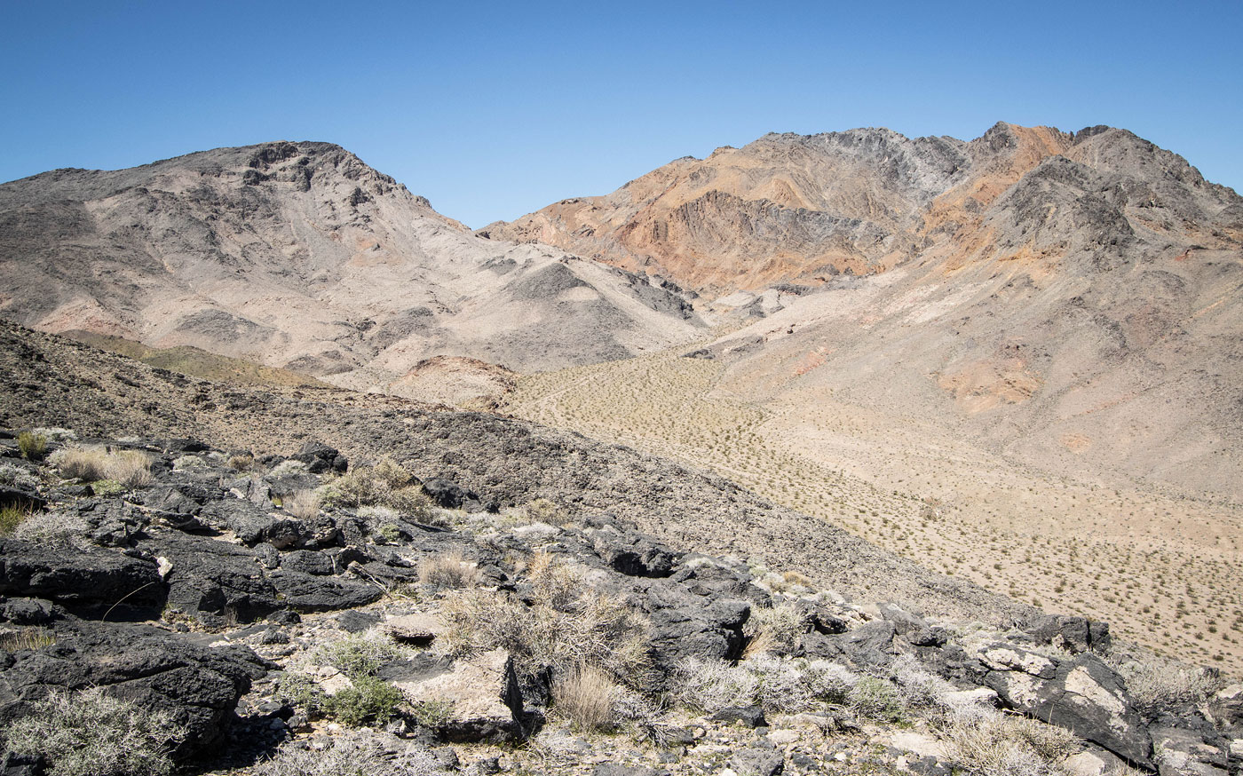
Once at the top of the drainage I continued north along the ridgeline toward the peak. The ridgeline was surprisingly tame, really just a steep slope with minimal rockiness. The last quarter mile had some rock outcroppings to avoid along the crest, first by wrapping on the right and then on the left, both wrap-arounds Class 2. The views were pretty standard for the desert, but nice nonetheless. I backtracked to the saddle and started up Peak 4272, really just a slope with some light brush and otherwise very little difficulty in regard to the terrain. This was turning out to be a much less serious endeavor than I thought it might be. Reaching Top Benchmark, my third peak, was much of the same, light rockiness and mostly just pleasant dirt walking amongst some low brush. Across the valley to the east, I had a panoramic view of the Nopah Range.
The route I took leading down from Top Benchmark was a bit different in character compared to the rest of the traverse, a progressively steepening Class 2 endeavor that started off kind enough and then shifted to being more loose and slow. I reached the saddle with Peak 3724, a much lower summit that's separated from the previous peaks I'd just done in the range. If this add-on doesn't interest you, just take the drainage out from here and back to the highway. However, I knew skipping this last peak would haunt me since this is probably the closest I'll ever be to it. After avoiding a small outcropping along the way to the peak's base, I then ascended its steep Class 2 northern ridge. From below, the summit seemed potentially hazardous, a significant cliff wrapping around its base, but a weakness seemed a reasonable option to the left of the summit. Just below the cliff band in question, I hung a left and wrapped beneath the cliff (Class 2) and was able to ascend with more ease than expected through the weakness. Class 2 got me to the summit. Looking back toward Top Benchmark offered some unique views of the oddly-colored cliffy slopes.
I started dropping east off Peak 3724, but the significant sliff band from earlier seemed to wrap all the way over here. I avoided it by dropping down on the slope to the right (Class 2), then traversed beneath it back to the primary ridge. I continued down on the ridge until it made sense to head back through the desert and return to my car.
Please consider helping me out if you find my site useful. I'm not sponsored, so all site fees are out-of-pocket and my time preparing these trip reports is unpaid. You can also hire me as a web developer. I really appreciate it!


If you find my site helpful, please help me replace my many broken cameras, fund my website fees (hosting, APIs, security), or just support my countless hours of work. I pay for all expenses myself, and all trip reports I post are unpaid and unsponsored, so any support is really appreciated!
If using PayPal, please select their option for "Sending to a friend" so they don't take out fees, thank you.
My site is free to use, but consider sending me a few bucks to help keep it running. Thanks in advance!