I provide a free route map, but you can also download a hike/drive GPX to assist you and to help support my site. Before sharing my GPX tracks with others, please remember my site is a free resource and I'm charging nominal fees to offset my substantial costs.
GPX track added to your cart.
Apr 16, 2022 — Courthouse Butte is a majestic feature outside of Sedona AZ, situated just east of the popular Bell Rock. The summit has some impressive views, but really the route is what I find to be the highlight of this peak. A series of ledges and gullies wrap around the southern face until finally reaching the wide top of the butte. Our group met up to use this as a nice half-day peak before starting our AZ adventures over the next few days. We set out from the busy trailhead and used a developed trail system to reach the southern face of Courthouse Butte. The sheer walls were impressive and a route seemed unlikely when viewed from below.
From the base we located a social trail leading into a Class 2 gully. At the top of the gully, a hairpin turn led to the right along a really cool ledge, which hugged the base of the cliff face. This led into another gully, this one darker and longer. At the top of this gully a similar hairpin turn led up to a Class 2+ move on some big roots and then onto another pleasant ledge. The ledge wrapped around, passing the foundation of some old ruins, and continued north into a wide amphitheater-like feature. We stayed along the ledge until we reached the farthest northern part of the amphitheater, where Class 2 bushwhacking and boulder-hopping got us to a Class 3 short slab and up to a higher ledge. This slanted ledge wrapped us to the east and to the base of the crux of the route.
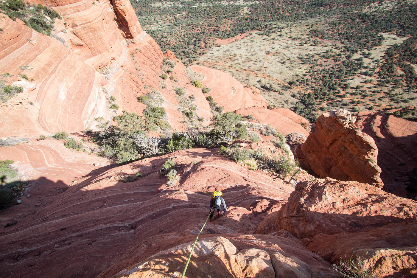
We looked up at a fixed line dangling above. Fortunately someone had left this, or the technical climb that would have ensued would have forced us to turn back. Quite exposed, a series of vertical moves were bypassed by using this rope. Don't assume the rope will always be there, and it may degrade and be insufficient for use in the future. The route seems popular enough that it may get replaced before that point, though. The crux is characterized by a 30 foot blocky face leading to a small ledge suitable to hold us all, followed by a (bolted) 15-foot vertical section and ultimately to a couple of bolts where the fixed line was anchored. The exposure to the left on the way up was a little unnerving, and we chose to play it safe on the descent later on by rappelling on the ropes we brought with us rather than hand-lining the fixed rope.
Once past the crux we scrambled up a final unexposed Class 4 move, and continued on the Class 2 slope to gain the summit.
Please consider helping me out if you find my site useful. I'm not sponsored, so all site fees are out-of-pocket and my time preparing these trip reports is unpaid. You can also hire me as a web developer. I really appreciate it!


If you find my site helpful, please help me replace my many broken cameras, fund my website fees (hosting, APIs, security), or just support my countless hours of work. I pay for all expenses myself, and all trip reports I post are unpaid and unsponsored, so any support is really appreciated!
If using PayPal, please select their option for "Sending to a friend" so they don't take out fees, thank you.
My site is free to use, but consider sending me a few bucks to help keep it running. Thanks in advance!