stav is lost logo
  • Find Hikes
    • Most recent
    • Trip Report Index
    • Hikes by Region
    • Search Hikes
  • Map
  • About
  • Love
Hike Cricket Mountains High Point in Cricket Mountains BLM, Utah - Stav is Lost

Hike Cricket Mountains High Point Cricket Mountains BLM, UT

Class 2 2.8 miles 1100 gain 1-2 hr Out and Back
Effort
Beauty
Personality
Solitude
DirectionsRoute MapDownload GPX

Cricket Mountains High Point GPX Track

I will always provide a free route map, but you can also download a hike/drive GPX to assist you and to help support my site. Before sharing my GPX tracks with others, please remember my site is a free resource and I'm charging nominal fees to offset my substantial costs.

GPX track added to your cart.

Add to Cart ($2.50)
View Cart

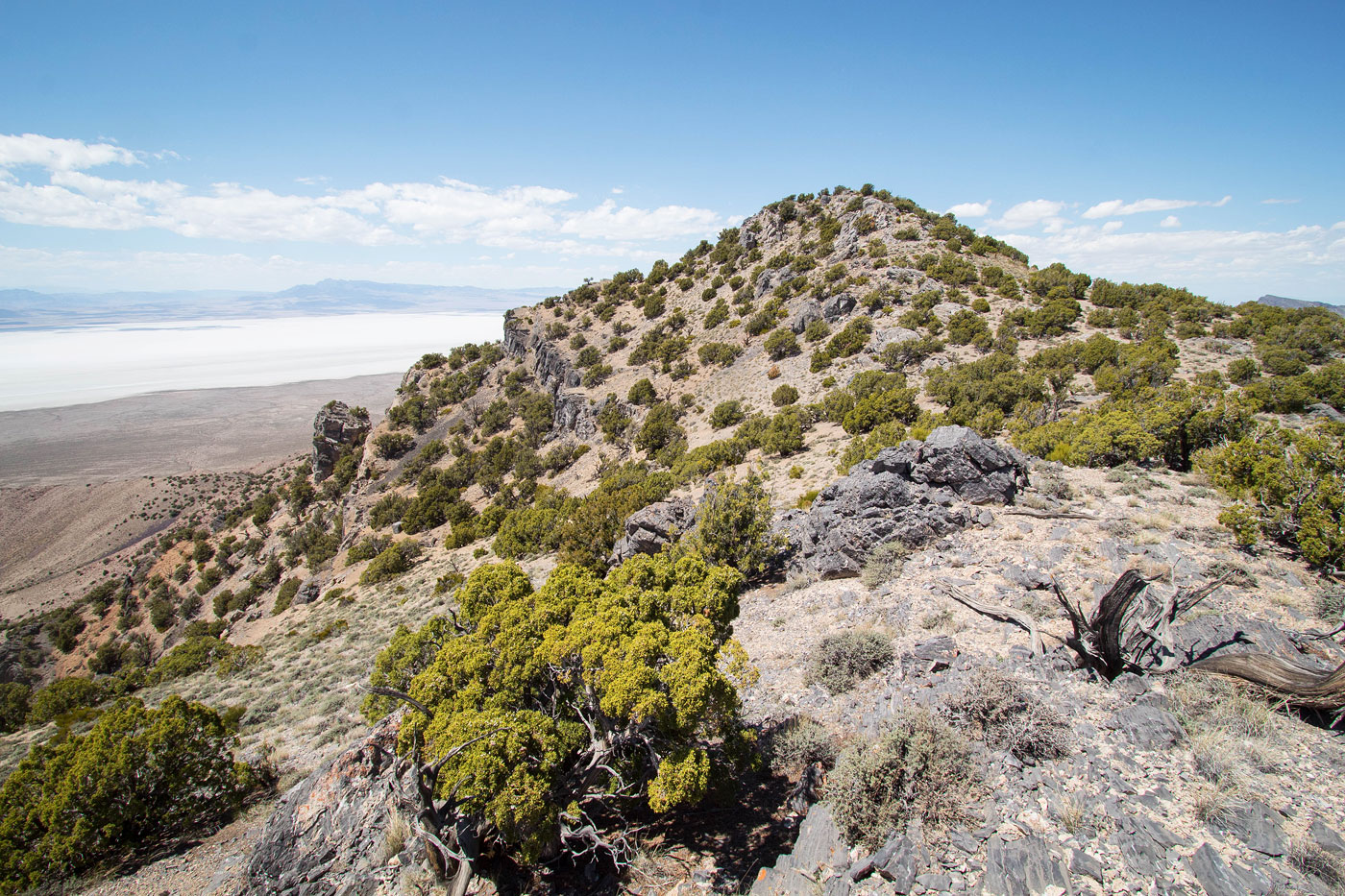
May 18, 2021 — The Cricket Mountains High Point is a straightforward hike to a nice viewpoint of Sevier Lake. I came in from the south and the road was passable by any vehicle. From my parking spot, which was just a spot I decided to pull off the road, I started northwest into a minor drainage hugged by small hills on either side. I left the drainage on its right as brush seemed to start encroaching and ascended to the southern ridge of Cricket Mountains High Point on a pleasant slope with easy walking free from brush. Once on the ridge, I started north to the peak. There was some minor Class 2 and minimal tree-dodging to reach the summit, all easy to navigate obstacles.

PEAKS ON HIKE
Elevation (ft) / Prominence (ft)
Peaks on hike
Elevation
Prominence
1
Cricket Mountains High Point
7231 ft
2071 rise

Show me some love

Please consider helping me out if you find my site useful. I'm not sponsored, so all site fees are out-of-pocket and my time preparing these trip reports is unpaid. You can also hire me as a web developer. I really appreciate it!

Thank you

Next HikePrev Hike
  • Next Hike
  • More Near Here
  • Prev Hike
photo protector Cricket Mountains High Point visible right of center. I headed through the lightly brushy terrain toward a minor gully in the center of this photo.
Cricket Mountains High Point visible right of center. I headed through the lightly brushy terrain toward a minor gully in the center of this photo.
photo protector Minor gully between two hills. I left it on the right eventually, gaining the slope.
Minor gully between two hills. I left it on the right eventually, gaining the slope.
photo protector After leaving the gully, I headed up to the ridge seen center on straightforward terrain.
After leaving the gully, I headed up to the ridge seen center on straightforward terrain.
photo protector Cricket Mountains High Point  up top.
Cricket Mountains High Point up top.
photo protector View back down, my car is somewhere in the center of this photo.
View back down, my car is somewhere in the center of this photo.
photo protector Easy walking up to the ridge.
Easy walking up to the ridge.
photo protector On the ridge, headed toward Cricket Mountains High Point.
On the ridge, headed toward Cricket Mountains High Point.
photo protector View back along the ridge, some minor Class 2 along the way.
View back along the ridge, some minor Class 2 along the way.
photo protector Along the ridge.
Along the ridge.
photo protector Cricket Mountains High Point ahead.
Cricket Mountains High Point ahead.
photo protector Cricket Mountains High Point summit, view north.
Cricket Mountains High Point summit, view north.
photo protector Cricket Mountains High Point, view south.
Cricket Mountains High Point, view south.
photo protector Close up south.
Close up south.

Show Me Some Love

If you find my site helpful, please help me replace my many broken cameras, fund my website fees (hosting, APIs, security), or just support my countless hours of work. I pay for all expenses myself, and all trip reports I post are unpaid and unsponsored, so any support is really appreciated!

If using PayPal, please select their option for "Sending to a friend" so they don't take out fees, thank you.

PayPalVenmoCash App

About  Contact  Love

© 2023 Stavros Basis.

DISCLAIMER: All activities you find on this site are dangerous. I am not responsible for anything you do in the outdoors. Please practice good ethics, and don't take any risks that put yourself or others in danger.


Thanks for visiting!

My site is free to use, but consider sending me a few bucks to help keep it running. Thanks in advance!

Sure!Nope.