I provide a free route map, but you can also download a hike/drive GPX to assist you and to help support my site. Before sharing my GPX tracks with others, please remember my site is a free resource and I'm charging nominal fees to offset my substantial costs.
GPX track added to your cart.
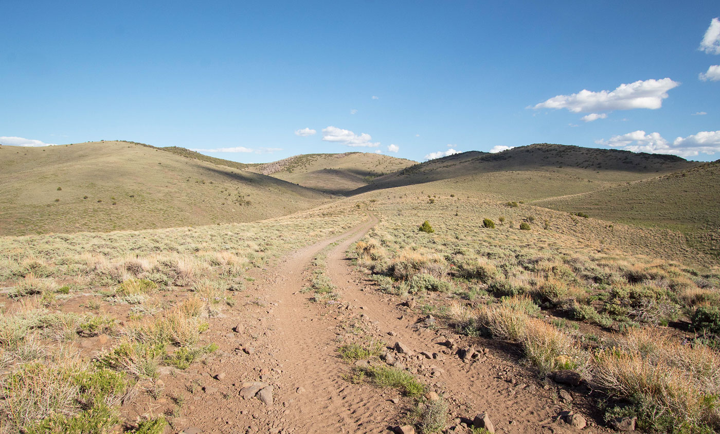
May 18, 2021 — Poorman Benchmark's black and cliffy south face when viewed from the east along Interstate 15 is usally ignored by most driving past. It somehow just blends into the rest of the Utah West Desert landscape, but its impressive if you take a minute to really look at it. I initially was hoping to find a fun scramble route via the south, but realized that would have been a hell of an undertaking. Instead, I decided to approach this peak via the standard direction, from the north. The personality of the north side of Poorman Benchmark couldn't be more different from the prcipices of its south side, hilly and green and with no cliffs to speak of.
I came in from the north on a road passable by any vehicle. Navigate here (38.23881, -112.7443) and head south. The road is obvious the whole way, but make sure to veer left here (38.13773, -112.76522). There are ATV roads all over this area, and part of my hike followed an ATV trail called the Parowan Gap Trail, though I didn't see any ATVers out on my hike. Burly vehicles can drive these roads to the base of the peak here (38.08461, -112.76597), but that would defeat the purpose of this hike in my opinion.
I decided to park at the start of an old doubletrack that doesn't seem to get any traffic, wildflowers and greenery encroaching enough that I think this road is likely abandoned. It felt almost like a trail. I headed along this doubletrack as it ascended really gradually through the hilly, pastoral-feeling landscape. Eventually this road/trail merged with the true ATV trail and I followed it to the base of Poorman Benchmark. The views here were really nice. At the base of the peak, the ATV trail continues up to its northeast side, but a foot traffic only option exists that leads to the peak's west side. I took this option, passing some sort of water containment hole and some signage outlining the ATV trail. The whole thing was surrounded by a wooden fence. I continued south on a heavily eroded old road (likely because it's closed to vehicles) and made it to the impressive rim of Poorman Benchmark. I followed the rim to the high point, where the dropoff that's seen from I-15 is exponentially more cool when seen from above.
Please consider helping me out if you find my site useful. I'm not sponsored, so all site fees are out-of-pocket and my time preparing these trip reports is unpaid. You can also hire me as a web developer. I really appreciate it!


If you find my site helpful, please help me replace my many broken cameras, fund my website fees (hosting, APIs, security), or just support my countless hours of work. I pay for all expenses myself, and all trip reports I post are unpaid and unsponsored, so any support is really appreciated!
If using PayPal, please select their option for "Sending to a friend" so they don't take out fees, thank you.
My site is free to use, but consider sending me a few bucks to help keep it running. Thanks in advance!