

Starting up the old dirt road. Currant Mountain visible top center.
Continuing north along the dirt road along the eastern slope of the White Pine Range.
Close-up of Currant Mountain's east face. Wow.
Another View back along the road. The car is out of frame on the left.
Continuing along the road, headed north.
View back, some nice wildflowers.
We left the road and ascended the minor spur ridge above Jon's head, which leads directly to the summit of Duckwater Peak.
View back as we start up the ridge.
The terrain looks like this the majority of the way up this ridge.
View back into the trees, pretty steep.
Progress up the spur ridge. You can see the ridge crest above.
Class 2 slabs often along the crest.
Approaching the summit of Duckwater Peak.
Close-up toward Currant Mountain.
Duckwater Peak summit, view toward Currant Mountain.
Duckwater Peak summit, view north.
Along the ridge, headed south from Duckwater Peak.
Much of the terrain along this section of the ridge looks like this.
View back toward Duckwater Peak.
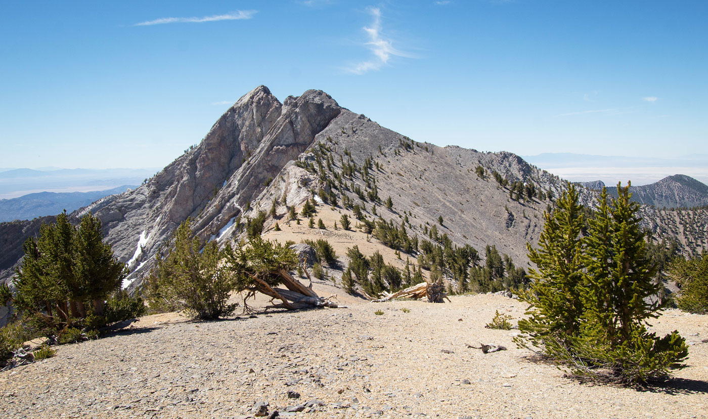
On a hump along the ridge on the way to Currant Mountain, visible ahead.
Close-up toward Currant Mountain.
View back along the ridgeline, Duckwater Peak top left.
Class 2 along the ridgeline.
Another shot back at our progress.
Approaching the base of Currant Mountain.
Currant Mountain is gorgeous from here. We ascended the scree ahead on an animal trail.
Animal trail up the scree.
View back along the ridge as we ascend the scree section.
The animal trail leads to the right of the ridge crest. Currant Mountain visible center. Getting there would first require some side-hilling.
Progress along the base of the limestone cliffs, close-up toward Currant Mountain.
View back at our side-hilling progress.
The terrain gets a bit more steep, but ample ledges keep it straightforward with some Class 2 sprinkled in. As you can see, it's possible to stay low and deal with garbage terrain and then ascend to Currant Mountain from the west. However, that would skip all the best, most beautiful stuff of the route.
Our goal is to get up to the ledge that's hard to see from here. For reference, the ledge begins between the snow patch in shadow and the snow patch in shade above. I recommend heading generally for the notch visible top left to get there.
View back as we ascend Class 2/2+ stuff toward the ledge.
Close-up of the ledges, some light Class 3.
Within the eroded, loose Class 2 gully created by the notch. See those snow patches? I referenced them a few photos ago.
View at the Class 2/3 moves to reach the ledge.
The Class 3 exposed ledge.
Close-up of Jon on the ledge.
Scariest section of the ledge traverse There are plenty of holds and I felt solid the whole time, always able to keep three points of contact. In fact, I scooted on my butt a couple of times just to add a butt point of contact.
View back along the ledge and the exposure.
Wider shot of our progress along the ledge.
Jon continuing ahead. It's a long, fun Class 3 ledge traverse.
Nearing the end.
End of the ledge, where a Class 2 slope (seen top left) leads to higher ground.
View back at the ledge traverse.
You can see our general side-hilling route beneath the cliffs in the center, followed by the Class 3 ledge traverse on the right in this photo. We were happy.
Just past the ledge and subsequent Class 2 slope, we came across this gorgeous rounded wannabe-knife-edge.
Close-up of the feature. At the end of the feature is a big boulder, Jon climbed around it on a Class 3 option. I kept left at the end and ascended on the ramp directly above Jon's head.
View back at the feature.
Class 3 option visible to the right of Jon, who is on the summit. I chose the Class 2 ramp option, which is where I took this photo from.
Summit of Currant Mountain, view south toward White Pine Peak.
Descending from Currant Mountain, this rock outcrop was avoidable on the left (Class 2).
Pretty limestone slabs as we descended from Currant Mountain. White Pine Peak visible center.
Close-up of the minor Class 2 obstacles along the ridgeline.
View back toward Currant Mountain as we weave around and over some Class 2 obstacles.
White Pine Peak ahead, but first a drop to its saddle.
View back toward Currant Mountain as we ascend the short steep section from White Pine Peak's saddle.
More class 2 stuff to navigate around. The limestone slabs are fun.
Jon on the Class 2 stuff.
White Pine Peak ahead on the right.
Easy walking to the summit, Currant Mountain visible top left. We would be returning to the hump above Jon's head after getting the summit and descend via its ridge on the right in this photo.
White Pine Peak summit, view south.
On the previously mentioned hump, headed down the ridge. You can see a shark fin on the right, which is what the ridge we're on would turn into.
We dropped left off the ridge just before it introduced scrambling and the shark fin. It's steep and unpleasant.
View back up the steep descent from the ridge.
Within the drainage below. I highly recommend keeping left within the trees and not descending directly down the drainage.
Descending on easier terrain within the trees.
View back up as we descend.
Forest walking.
It's easy-going with no bushwhacking.
We made it back to the road, view back up toward the traverse.
Hire me or show me some love!
Hire/refer me as a web developer or send me a few bucks if you find my site useful. I’m not sponsored, so all fees are out-of-pocket and my time preparing trip reports is unpaid. I really appreciate it!