I provide a free route map, but you can also download a hike/drive GPX to assist you and to help support my site. Before sharing my GPX tracks with others, please remember my site is a free resource and I'm charging nominal fees to offset my substantial costs.
GPX track added to your cart.
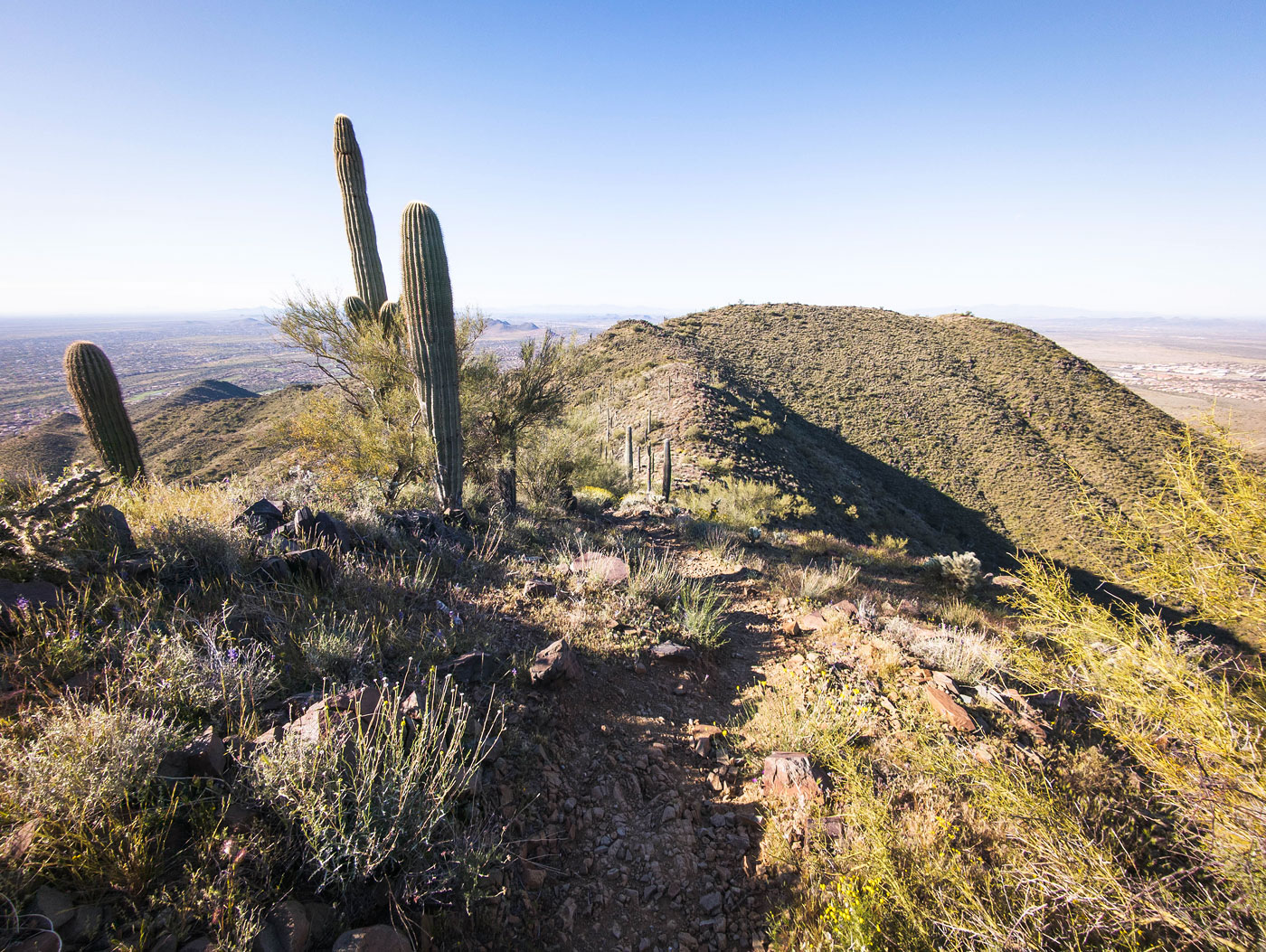
Mar 30, 2024 — On my drive into Phoenix, I noticed Daisy Mountain from the interstate and decided to hike it on a whim. The peak is located in suburbia, so it's not some gorgeous hike, but being amongst lots of people meant a nice trail system to warm up on. You could cut this hike by many miles if you choose to drive to the upper trailhead here (33.89376, -112.10490), which I passed along my loop later. I was content to enjoy the morning by taking this more extended loop instead, so I parked in a little neighborhood that only had "no parking" signs directly next to the trailhead, but a side street worked fine.
The hike began on a wide trail leading generally northeast, gradually gaining elevation until meeting a junction a bit over a mile into the hike. I took a right, doing the loop counterclockwise. Eventually, the wide trail funneled into a true singletrack, which traversed Daisy Mountain's slopes for a bit before wiggling up tight switchbacks to the southwestern ridge. The trail continued nicely up to Daisy Mountain's southern peak, where I was awarded the suburban view I was anticipating. A large American flag waved in the breeze, reminding me that I was still in America, in case I wasn't sure.
I continued along the ridge, losing some minor elevation before ascending to Daisy Mountain's true summit. Here, another waving American flag wanted to make it clear that I was, in fact, still in America. I started down to the north along the trail leading to the upper trailhead, a dirt road that apparently has some rutting and is 4WD-required. Rather than take the more obvious wide trail back to complete my lollipop loop, I hiked the road for a hundred feet and located an unmarked singletrack that provided a more pleasant and isolated route down. It was in good shape, traversing along the slopes and descending slowly back to the wide, popular local trail I'd hiked in on. It was tricky to follow only for a couple of moments when it dipped in and out of little washes, so if you want a more straightforward descent, take the standard trail down from the upper parking lot.
Please consider helping me out if you find my site useful. I'm not sponsored, so all site fees are out-of-pocket and my time preparing these trip reports is unpaid. You can also hire me as a web developer. I really appreciate it!


If you find my site helpful, please help me replace my many broken cameras, fund my website fees (hosting, APIs, security), or just support my countless hours of work. I pay for all expenses myself, and all trip reports I post are unpaid and unsponsored, so any support is really appreciated!
If using PayPal, please select their option for "Sending to a friend" so they don't take out fees, thank you.
My site is free to use, but consider sending me a few bucks to help keep it running. Thanks in advance!