I provide a free route map, but you can also download a hike/drive GPX to assist you and to help support my site. Before sharing my GPX tracks with others, please remember my site is a free resource and I'm charging nominal fees to offset my substantial costs.
GPX track added to your cart.
Apr 02, 2021 — Damsel Peak is a limstone peak set north of the popular Calico Basin in Red Rock Canyon National Conservation Area. It gets little visitation due to its relatively long approach, assuming you aren't trespassing. The land east of Brownstone Basin is owned by a construction company, and I asssume the area is going to be overridden with the Las Vegas sprawl soon enough. Rather than deal with trying to bypass the security, Austin and I hiked in via a legal, and pretty, route. This route takes more time than you'd think, since the first half wanders up a rocky canyon and navigates some sandstone chaos.
We started at the standard Kraft Mountain parking lot and headed up and over Pink Goblin Pass on the west side of Kraft Mountain, dropping down into Gateway Canyon. Alternatively, you could wrap around the east side ofr Kraft Mountain and ascend through Gateway Canyon, but this adds a bit of extra mileage. I also included a purple line in my attached map that outlines a longer option, but more on that at the end of my trip report.
Once within Gateway Canyon, we ascended to the north, encountering a bunch of fun Class 2/3 canyon obstacles. There are a few dryfalls that can be bypassed on steep terrain on either side, and overall it's a fun little section. Gateway Canyon starts to open up into a sandstone wonderland. We stayed within the drainage for a while, but as soon as a bright red series of slickrock dryfalls came in on the left, we ascended out of the sandstone and up into limestone territory. Staying within the drainage would likely result in cliffs, but I'm not sure. We wandered on higher ground at the base of Turtlehead Mountain's east slope, and cairns led us through some interesting sandstone terrain. We managed to drop down into Brownstone Basin to the north, but I honestly couldn't tell you the best option. There are many, and our scramble resulted in some Class 3 down-climbing to get into the wash below.
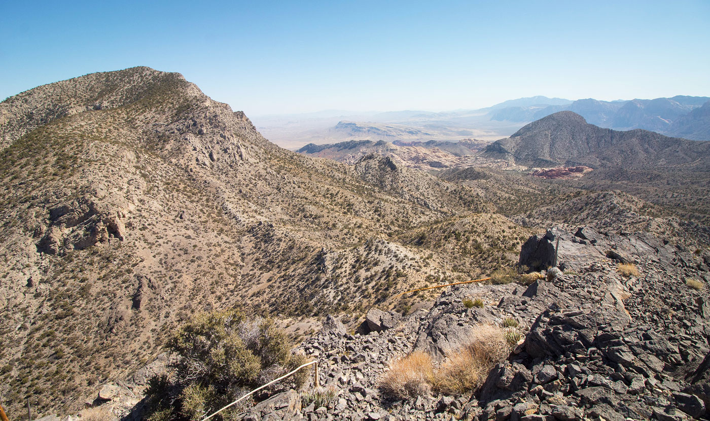
Damsel Peak was now situated just to our north, but the easiest access would be from its northwest side, serious cliffs blocking direct access through the desert. We headed up the gravel wash, gaining a fair amount of elevation as we progressed into the more forested landscape. The last half mile up this wash became a bit more choked with brush, but not enough to cause too much inconvenience. There was also a minor dryfall toward the head of the drainage, passable on the right via a social trail. We found ourselves at the saddle of Gateway Peak and Damsel Peak and continued east toward Damsel. A wide gully provided a nice social trail to the summit ridge, but it wasn't super easy to follow at times and we had to zig-zag around some brush. The views along the rim to the summit of Damsel Peak were nice. We could trace our entire route from the sandstone chaos to our current location.
Back at the saddle, we headed toward Gateway Peak, a steep slope leading to a Class 2 scree gully, and ultimately to this minor summit, where the views toward Damsel were actually pretty cool. Somehow these two peaks have been orphaned on my to-do list for such a long time that I had almost no excitement for them, but they ended up being a really good time.
Austin and I decided to run back a different way in an attempt to avoid the rocky and somewhat tedious upper Gateway Canyon. The result was the purple line on my attached map. The first mile follows the wash we used for our approach to Damsel Peak, but soon exits the wilderness area and follows a dirt road as it descends through Brownstone Basin. A ridge on the right prevented direct access back to the car, so we headed up and over it and located a Class 3 down-climb over the rocky south side. We then headed through the desert and back to the Kraft Mountain trail system. It's certainly less pretty and interesting than our approach route. The stats for this hike do not reflect this "alternate route", assuming you do it as an out-and-back via the orange line.
Please consider helping me out if you find my site useful. I'm not sponsored, so all site fees are out-of-pocket and my time preparing these trip reports is unpaid. You can also hire me as a web developer. I really appreciate it!


If you find my site helpful, please help me replace my many broken cameras, fund my website fees (hosting, APIs, security), or just support my countless hours of work. I pay for all expenses myself, and all trip reports I post are unpaid and unsponsored, so any support is really appreciated!
If using PayPal, please select their option for "Sending to a friend" so they don't take out fees, thank you.
My site is free to use, but consider sending me a few bucks to help keep it running. Thanks in advance!