

At the trailhead, Yoshi inspecting the kiosk. We thought it odd it mentioned the multi-pitch route up Mrs. Butterworth. Eagle Crags seen on the left.
Along the Eagle Crags Trail, which descends a short time. You can see Eagle Crags East and Mrs. Butterworth poking out to the left of the much more formidable-looking Eagle Crags West.
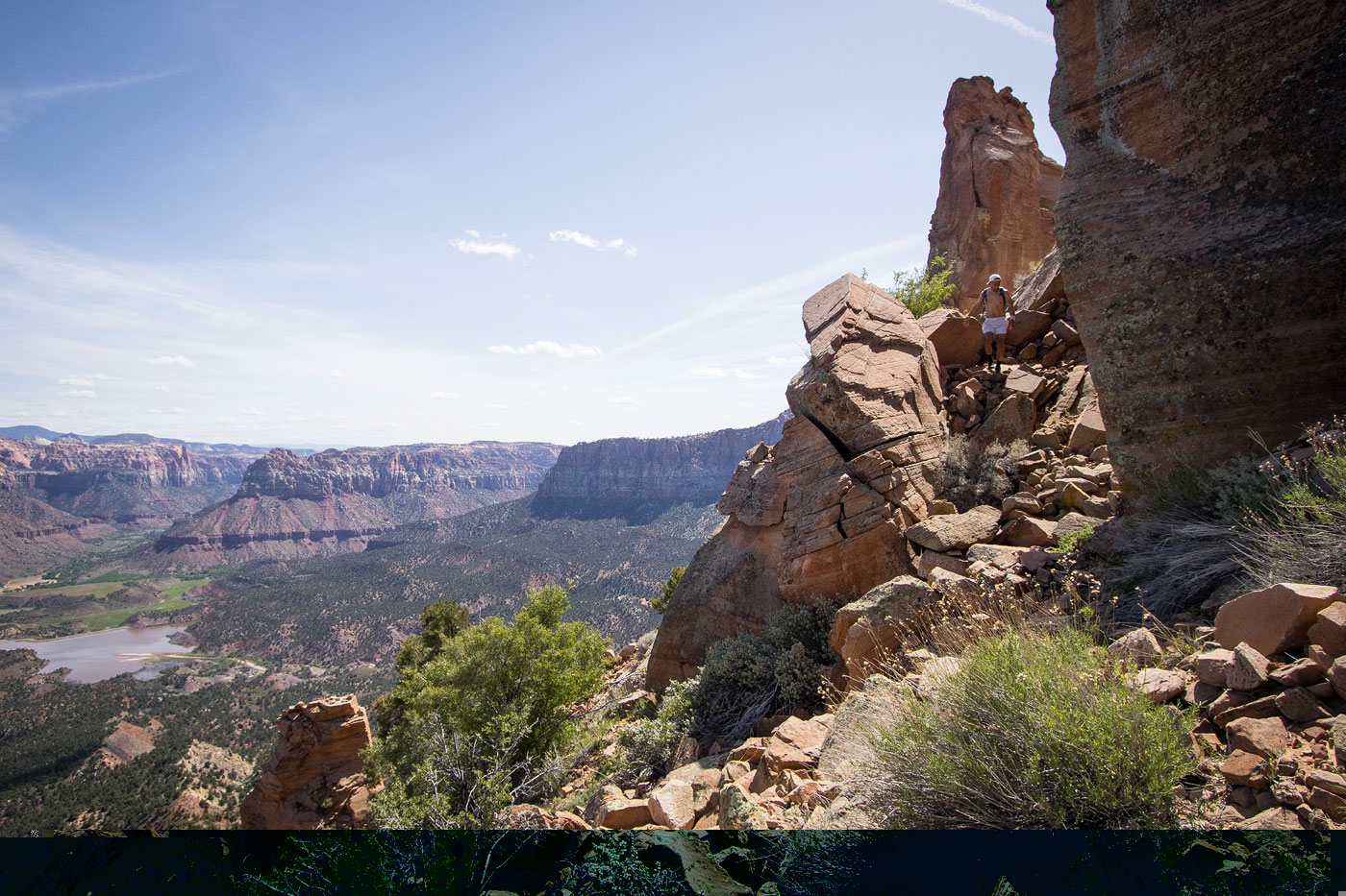
Progress along the Eagle Crags Trail, Zion seen on the left.
Getting closer to the spires.
Mrs. Butterworth and Eagle Crags East seen center.
Trees Ranch Reservoir seen below, and the mouth of Parunuweap Canyon behind it.
Reaching the base of the spires, the Eagle Crags Trail becomes a bit more steep as it switchbacks up to the should seen on the left.
Yoshi stopping to smell the flowers.
Johnson Mountain, The West Temple, etc. seen at the mouth of Zion Canyon.
The trail continues along the east side of Mrs. Butterworth.
A social trail leads up toward Mrs. Butterworth, seen ahead.
Steep Class 2.
View back down at the social trail.
Class 2/3 up the slope along the social trail.
Then we lost the trail and just ascended for 100 feet or so to reach the base of Mrs. Butterworth.
Steep Class 2/3.
Mrs. Butterworth on the left.
Ascending next to Mrs. butterworth.
View back toward Mrs. Butterworth.
Fun Class 3 boulders.
A shot back toward Mrs. Butterworth before we drop away from the now-craggy and scary terrain.
Class 2 along the base of the cliffs.
View back at Yoshi wrapping around the cliffs.
Animal trails and brush as we wrap around the base of Eagle Crags East.
Eagle Crags West comes into view. No thanks.
Class 2/3 up to the ridge.
Class 2/3 along the west ridge of Eagle Crags East.
View back at Yoshi coming up the ridge.
Wider shot, Eagle Crags West behind. The saddle separating the two Crags seen center left.
The summit block. Yoshi ascended using a wildly exposed Class 3/4 move up to the little tree on the left.
Yoshi on his dumb choice.
I had him pose for a shot on what I consider a fun and less dangerous option, Class 4.
View down at the Class 4 move.
Yoshi on the summit of Eagle Crags East.
Eagle Crags East, view northeast.
Back at the saddle, we headed north through brush.
View back toward the saddle and Eagle Crags West.
We avoided a bunch of little outcroppings and brushy clusters.
Steep descent back to the Eagle Crags Trail.
View back up at the cool pinnacles.
Hire me or show me some love!
Hire/refer me as a web developer or send me a few bucks if you find my site useful. I’m not sponsored, so all fees are out-of-pocket and my time preparing trip reports is unpaid. I really appreciate it!