I provide a free route map, but you can also download a hike/drive GPX to assist you and to help support my site. Before sharing my GPX tracks with others, please remember my site is a free resource and I'm charging nominal fees to offset my substantial costs.
GPX track added to your cart.
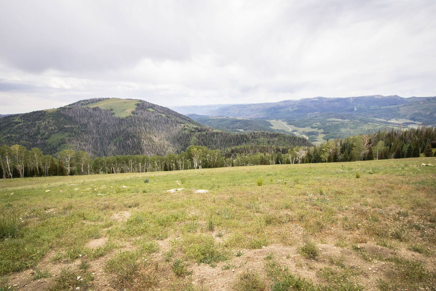
Jul 21, 2022 — East Mountain is mostly known for being a Utah county high point, but I was more interested in this big green lump because it would be nice to get to the top of another mountain on the lush, gorgeous Wasatch Plateau. Its neighbor Seeley Mountain would serve as a nice add-on to spend some more time in the area. Both peaks are nice and have trails to about half a mile from the summit. Reaching the trailhead shouldn't be a problem for any vehicle, though it might depend on the time of year and how much rutting has developed. I started out from the car through a glorious wildflower-covered meadow and made my way generally northeast to the base of the peaks.
The trail initially follows an old roadbed as it ascends to the north, and then wraps east and to the saddle separating East Mountain and Seeley Mountain. First I'd head to East Mountain, so I continued south and enjoyed the forest and wildflower-filled meadows. About halfway from the junction to the summit, I reached an unsigned split in the trail. Keeping to the left seemed like the right choice since the trail was far more obvious, but this trail seems to actually wrap around East Mountain, while sticking to the right would gain more elevation quickly and lead up toward the summit. I marked this spot on the attached map. After a few hundred feet of vertical gain, the forest opened up into a grassy meadow and the trail basically disappeared. I stopped trying to follow it and just ascended to the south along the open ridge and East Mountain came into view. Hints of a social trail revealed themselves as I neared the summit.
After backtracking to the saddle, I started north toward Seeley Mountain. I actually wasn't expecting a trail for this portion of the hike since there wasn't any information about it that I could find online. However, this trail was in excellent shape for most of the way and had really nice views toward East Mountain through a sparsely-vegetated section. The trail entered a small clearing, and on the other side of this clearing was a canvas tent that I'm not sure was there legally. The trail seemed to lead right to the tent where some horses were grazing and then disappeared, so it's possible the trail has actually been developed recently to shuttle horses back and forth, though I have no idea. Instead of heading through the clearing along the more obvious trail, keep to the right and follow the clearing's perimeter. Then continue north and head through the forest (marked on my attached map). Although another trail continues to the northeast, going that way results in a much steeper ascent to Seeley Mountain. I know this because I messed up on my ascent, but only included my descent on the map. Heading up the ridge meant some very light bushwhacking and a steep ascent, but there's likely not a better way up. After a few hundred feet of vertical gain the slope relaxed and the forest opened into a bald summit area. I reached the summit of Seeley Mountain and took in the nice views toward Candland Mountain and the surrounding area.
Please consider helping me out if you find my site useful. I'm not sponsored, so all site fees are out-of-pocket and my time preparing these trip reports is unpaid. You can also hire me as a web developer. I really appreciate it!


If you find my site helpful, please help me replace my many broken cameras, fund my website fees (hosting, APIs, security), or just support my countless hours of work. I pay for all expenses myself, and all trip reports I post are unpaid and unsponsored, so any support is really appreciated!
If using PayPal, please select their option for "Sending to a friend" so they don't take out fees, thank you.
My site is free to use, but consider sending me a few bucks to help keep it running. Thanks in advance!