

View back down the northern ridge of Bitter Ridge Peak East. You can see my car down there.
Ascending to Bitter Ridge Peak East, pretty chill terrain.
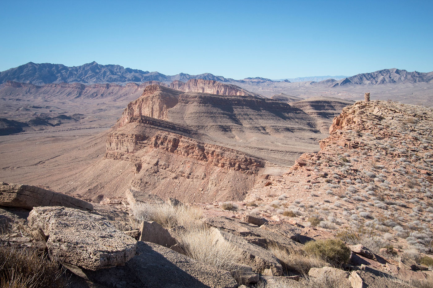
View back just below the summit. The wash we started in is visible in the center. The Fire Range is seen top center.
Summit view with big cairns, looking east.
Summit view, looking west. Our route ahead. Muddy Mountains visible in the distance.
Heading west.
Stopped by a cliff. Peak 3035 seen center, but we'd have to descend to the north (right in this photo) first in order to get over to it. We weren't in the mood to puzzle out a potentially sketchy descent.
A Class 2 descent option, finally. Peak 3035 seen top right. We would head over to the gully seen top right in this photo.
Approaching the Class 2 gully.
View back as we ascend to Peak 3035. You can see the cliffy nonsense we avoided top center by descending from top right to left along the rim.
Class 2 up Peak 3035.
Peak 3035 ahead.
Peak 3035 summit, view back along the cliffline.
Peak 3035 summit, view toward East Bitter Ridge. We descended into the wash below, then ascended a weakness in the cliff band just right of center.
View back up at Peak 3035.
Descending from Peak 3035.
Passing over the wash separating Peak 3035 from East Bitter Ridge. We used the broken ramp seen center to get over the small cliff on the west side of the wash. East Bitter Ridge ahead has a pretty impressive southern face.
Approaching our Class 2 weakness option (far right) to gain the ridge.
Class 2 weakness.
Along the ridge.
Class 2 up East Bitter Ridge.
Progress along the ridgeline.
View back, Peak 3035 seen top right.
East Bitter Ridge summit ahead.
Approaching the summit (true summit is actually the next hump past the one seen ahead, a short jaunt away).
East Bitter Ridge summit, view toward Peak 3035 (right).
Straightforward descent from East Bitter Ridge along a northern trending ridgeline. Peak 2753 is out of frame on the far right.
Heading through the desert via washes and roads on the way to Peak 2753. East Bitter Ridge is visible top center.
A random road on the way to Peak 2753.
At the base of Peak 2753. If you don't care to do this peak you could just descend the wash here.
View back down as we ascend Peak 2753.
Close-up at the Class 2 ascent.
Peak 2753 summit, view southeast. Bitter Ridge Peak East (our first peak) visible left of center, Peak 3035 on the right. The car is somewhere on the far left.
View back up as we descend from Peak 2753 on pleasant terrain.
Down from Peak 2753 into the wash seen center. Bitter Ridge Peak East seen top right.
Close-up into the combination of washes and roads we'd follow back to our car.
Hire me or show me some love!
Hire/refer me as a web developer or send me a few bucks if you find my site useful. I’m not sponsored, so all fees are out-of-pocket and my time preparing trip reports is unpaid. I really appreciate it!