I provide a free route map, but you can also download a hike/drive GPX to assist you and to help support my site. Before sharing my GPX tracks with others, please remember my site is a free resource and I'm charging nominal fees to offset my substantial costs.
GPX track added to your cart.
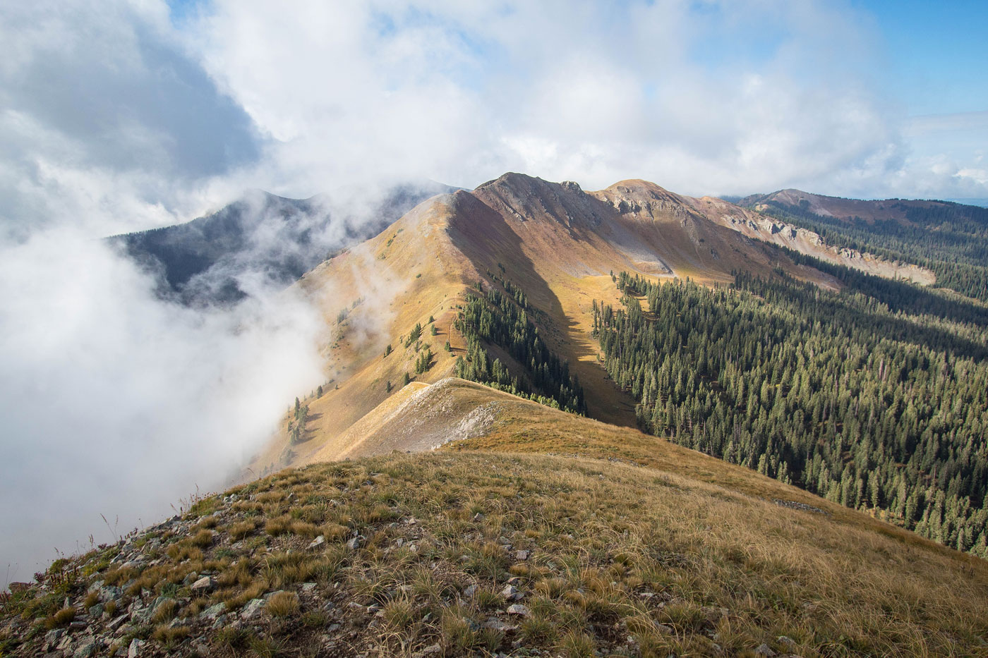
Sep 19, 2021 — Elliott Mountain is a high-pominence 12er in the San Miguel Mountains of Colorado. I chose to access to the peak via the Calico National Recreation Trail from the north. Although a longer route to access the peak, I was looking forward to a nice forested excursion to wrap up my Colorado summer. To reach the peak more easily you could instead take the East Fall Creek Trail, which starts here (37.74435, -108.07513). I don't know that road's condition, but accessing my start trailhead is doable by any vehicle.
I headed south through alternating forest and meadows as the Calico Trail slowly made progress up the northern slope of Elliott Mountain. I had a lot of fog for the morning, but forutnately the weather cleared up and the views became lovely. After ascending above treeline, the trail began to wrap around the west face of Elliott Mountain, but a vert fainy social trail led up the peak's steep grassy northern slope. The Calico Trail doesn't actually reach the summit. The north slope is pleasant, though steep, and I found myself on the summit after some light undulation along the crest. Initially I intended to just head back from here, but Sockrider Peak to the south looked too tempting with its near-equal height and trail to the summit, so I decided to head over to it.
I dropped along the south side of Elliott Mountain a steep tundra slope. Toward the base just before reaching the Calico Trail again there was some loose Class 2, but it's likely avoidable if you leave the ridgeline a little earlier. This was the only Class 2 of the route. Once I was back on the Calico Trail, I quickly got up to Sockrider Peak and noted the many more peaks to the south. They were tempting, but it was cold and I had a long drive. I resolved to come back at some point in my life, and followed the Calico Trail back to my car. Really pleasant outing to a lesser-visited couple of peaks.
Please consider helping me out if you find my site useful. I'm not sponsored, so all site fees are out-of-pocket and my time preparing these trip reports is unpaid. You can also hire me as a web developer. I really appreciate it!


If you find my site helpful, please help me replace my many broken cameras, fund my website fees (hosting, APIs, security), or just support my countless hours of work. I pay for all expenses myself, and all trip reports I post are unpaid and unsponsored, so any support is really appreciated!
If using PayPal, please select their option for "Sending to a friend" so they don't take out fees, thank you.
My site is free to use, but consider sending me a few bucks to help keep it running. Thanks in advance!