I provide a free route map, but you can also download a hike/drive GPX to assist you and to help support my site. Before sharing my GPX tracks with others, please remember my site is a free resource and I'm charging nominal fees to offset my substantial costs.
GPX track added to your cart.
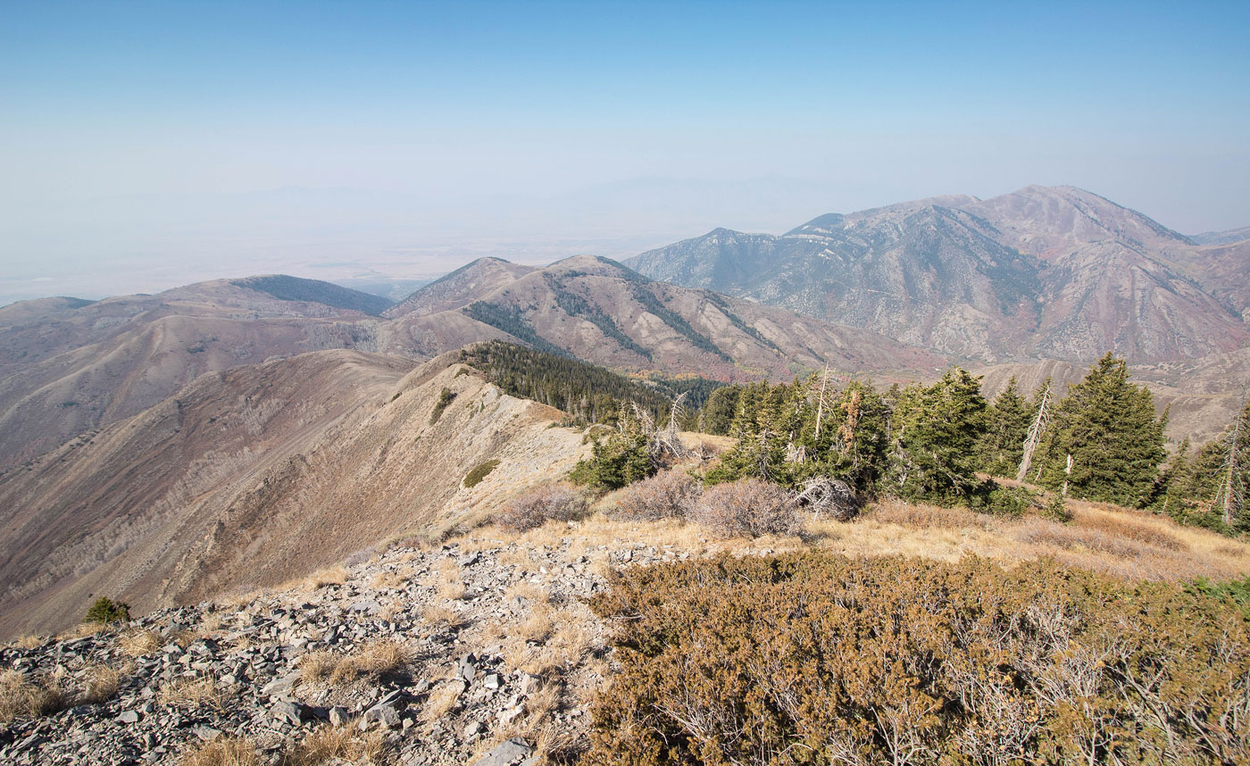
Oct 04, 2020 — Flat Top Mountain is the high point of the Oquirrh Mountains, and an ultra-prominent peak in Utah. Despite its proximity to Salt Lake City, it took me this long to hike it because the route requires getting permission from the landowner to access the summit and I hate dealing with getting permission to go hiking. I knew it was a peak I had to do at some point, and Weston Ault (the landowner) was very nice and gave me permission quickly. His email is aultw [at] msn [dot] com. Assuming you get permission, the drive to the trailhead is fine for any vehicle. 4WD vehicles can make it all the way up to here: 40.35249, -112.21685, but I wasn't willing to risk it. The road was in overall decent shape except for a few rough spots.
I hiked along the road from the trailhead up to the 4WD parking area, where I expected to find a bushwhack, but in fact a well-defined trail switchbacked up the slopes. I got a few minor scratches, but it's a great little trail. I added a couple of cairns where the switchbacks weren't as clear, so just pay attention and if you're not on a really well-defined trail, you're off-route. Once above the switchbacks, the trail continued along the slopes, mostly avoiding the hilly ridgeline by staying on the north side and instead forming big switchbacks to avoid excessive steepness. At one point, the trail enters a forest and passes "No Trespassing" signs, which I assume is the spot where the permission to access the route was required. The trail emerges from the woods on the west ridge of Lewiston Peak, and continues more steeply with a couple of small Class 2 sections. The trail actually skirts Lewiston Peak on its northwest slope, but a social trail continues away from the main trail and up to this minor summit. I read somewhere that Lewiston Peak required a bushwhack, but I encountered no brush. The social trail continued steeply and brush-free down on Lewiston Peak's north side and back to the main trail.
I continued along the ridge up to Flat Top Mountain, only a short Class 2 talus field serving as an obstacle. The views were nice from Flat Top Mountain's summit, despite the wildfire smoke.
Please consider helping me out if you find my site useful. I'm not sponsored, so all site fees are out-of-pocket and my time preparing these trip reports is unpaid. You can also hire me as a web developer. I really appreciate it!


If you find my site helpful, please help me replace my many broken cameras, fund my website fees (hosting, APIs, security), or just support my countless hours of work. I pay for all expenses myself, and all trip reports I post are unpaid and unsponsored, so any support is really appreciated!
If using PayPal, please select their option for "Sending to a friend" so they don't take out fees, thank you.
My site is free to use, but consider sending me a few bucks to help keep it running. Thanks in advance!