

Starting from the Lumpy Ridge Trailhead.
The Gem Lake Trail leads through a minor canyon, nice rocks on either side.
Ascending through the minor canyon.
View back at our progress.
Junction with the Black Canyon Trail. The trail ascends for a short time past here.
Mellow portion of trail with nice views.
A view back, Twin Sisters Peak and Longs Peak seen in the distance, Estes Park on the left.
A minor descent into a lush drainage.
Pretty, lush drainage with a little creek crossing.
Wiggling through the lush drainage on the well-constructed Gem Lake Trail.
Ascending to the gap seen center, which houses Ge Lake. Gem Peak is out of frame top left.
View back as we ascend the slightly steeper portion of the trail.
Nicely-constructed switchbacks.
Approaching the basin housing Gem Lake.
Gem Lake from a small cliff viewpoint.
Gem Lake, view back the way we came.
I headed north from Gem Lake, then started through the forest and emerged at this fun Class 2/3 slab.
View back, Gem Lake seen on the right.
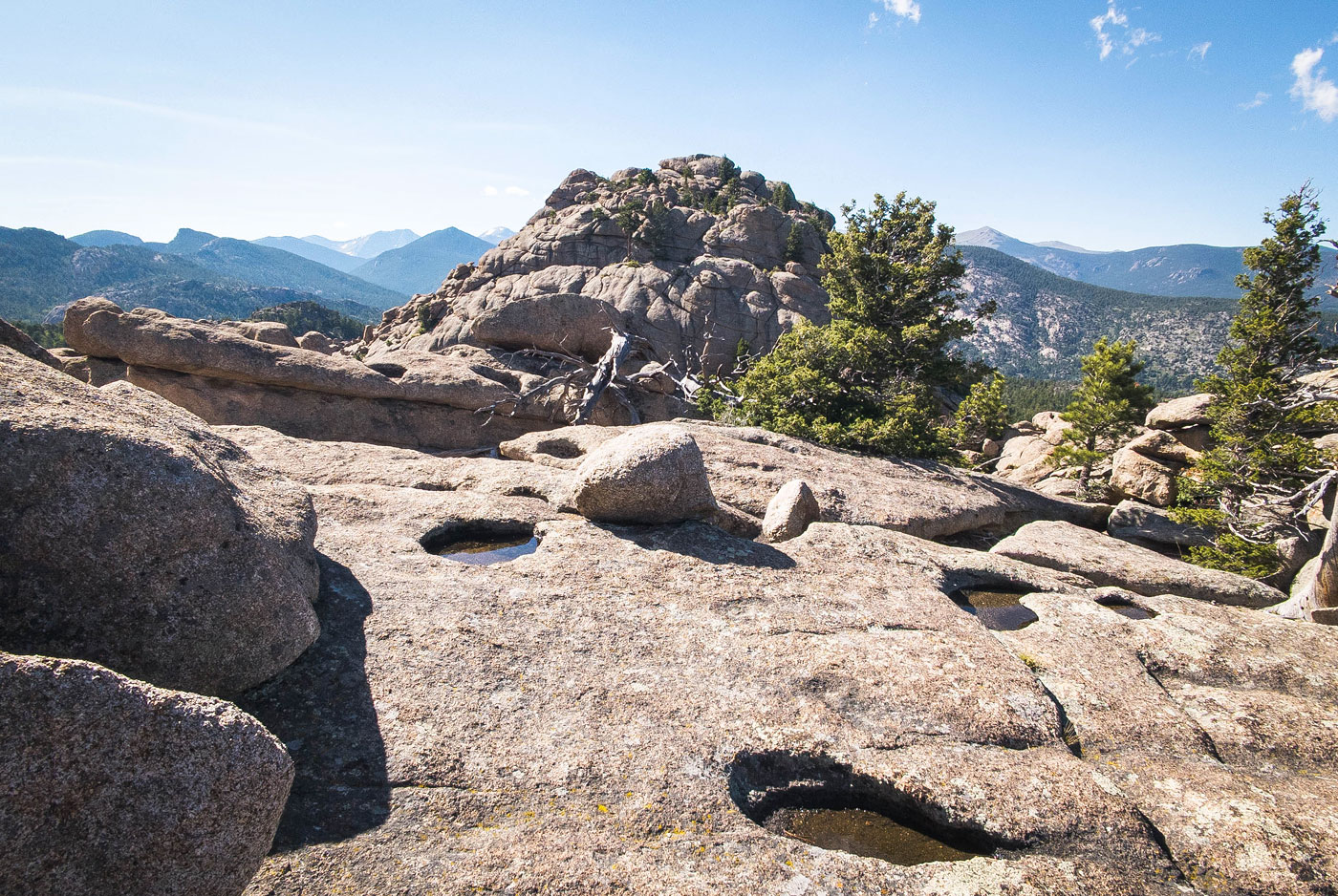
False summit, a great view toward Gem Peak, seen ahead. I descended toward it, down into a notch.
Looking down at the notch (Class 2/3) as I start up Gem Peak.
A natural ledge wrapped me around the southern base of Gem Peak.
And then a really fun Class 2/2+ ascent led me up this convoluted bouldery slope.
Close-up of some of the obstacles I encountered.
View back down at the very fun ascent.
Just below the summit, a wider shot at the ascent (center). The false summit I was on earlier is seen far left.
Gem Peak summit block. I found an easier weakness on the right.
Weakness to gain the summit.
Gem Peak summit, view south toward Estes Park.
Gem Peak summit, view northwest.
After backtracking to the notch, I wrapped around the false summit. There was some light bushwhacking, but it was mostly like this back to the trail.
Hire me or show me some love!
Hire/refer me as a web developer or send me a few bucks if you find my site useful. I’m not sponsored, so all fees are out-of-pocket and my time preparing trip reports is unpaid. I really appreciate it!