I provide a free route map, but you can also download a hike/drive GPX to assist you and to help support my site. Before sharing my GPX tracks with others, please remember my site is a free resource and I'm charging nominal fees to offset my substantial costs.
GPX track added to your cart.
Nov 05, 2022 — Hachita Peak is high prominence peak in a southern New Mexico, the northern neighbor of Big Hatchet Peak. To reach the trailhead, turn south here (31.92625, -108.36139) onto Little Hatchet Mountain Road. The road is overall very good until a major washout here (31.88673, -108.37319) that I can't imagine will be fixed any time soon. There's a very poor detour that people have been driving on to bypass the washout, narrowly avoiding various bushes for about a quarter mile before returning to the road. Past here the road is fine to the trailhead. You may be tempted to come in from the west instead, but more on that later.
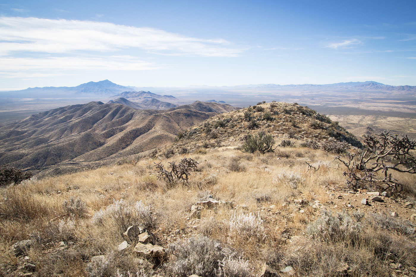
Although an old road continues for a bit longer to the south from where I parked, I chose to walk and get a nice warm-up before the steep ascent ahead. At the end of this road were the remains of an old mining site, complete with an open, deep, scary mine shaft. There's a mess of overgrown old mining roads here that don't seem to connect, so I recommend just heading south up a slope above the mine wherever feels convenient, leading to a spur ridge. At the top of the slope I found an overgrown mining road, which continued for a while before disappearing, an animal trail guiding onward from here. After a few hundred feet of ascent along this spur ridge awarded me a view toward the ridgeline above. Hachita Peak wasn't visible yet, its summit still separated by two false summits. The hiking was pleasant and pretty gradual until reaching the base of the first false summit.
I recommend just ascending the ridgeline since side-hilling around the false summits results in a lot of annoying brush on the steep slope. Instead, the crest has some light Class 2 and adds a little vertical gain opposed to sidehilling, and I certainly preferred it. Once atop the first false summit, I continued along the ridgeline, passed over the second false summit, and progressively made my way to Hachita Peak.
After returning to my car I decided to take Little Hatchet road going west since my next destination was also that way, risking the road being bad. I was happily surprised to find the road was quite excellent, possibly even passable by sedans. Almost at pavement and thinking I'd hacked the approach to Hachita Peak, I was confronted with a heavily locked gate and no trespassing signs. I poked around on a map and quickly realized there wouldn't be any option around this fenced-in property. Frustrated I'd need to possibly drive all the way back, I approached the fence and realized there was a section that was intentionally stuck togeher with wire, completely negating the locked gate. I decided to let myself in, proceeding to the entrance of the compound where a security guard waved at me as I exited. As it turns out, I'd trespassed on the Playas Training Center and avoided trouble. I, um, wouldn't recommend going that way.
Please consider helping me out if you find my site useful. I'm not sponsored, so all site fees are out-of-pocket and my time preparing these trip reports is unpaid. You can also hire me as a web developer. I really appreciate it!


If you find my site helpful, please help me replace my many broken cameras, fund my website fees (hosting, APIs, security), or just support my countless hours of work. I pay for all expenses myself, and all trip reports I post are unpaid and unsponsored, so any support is really appreciated!
If using PayPal, please select their option for "Sending to a friend" so they don't take out fees, thank you.
My site is free to use, but consider sending me a few bucks to help keep it running. Thanks in advance!