I provide a free route map, but you can also download a hike/drive GPX to assist you and to help support my site. Before sharing my GPX tracks with others, please remember my site is a free resource and I'm charging nominal fees to offset my substantial costs.
GPX track added to your cart.
Aug 23, 2021 — Located just off I-70, this hike to a couple of Colorado 13ers makes for a convenient outing. The Herman Gulch Trail, which is what we used to access the peaks, is in great condition. It takes a pretty direct like from the trailhead up through the alternating forested and meadowy valley leading to Herman Lake. About a half mile before reaching the lake, the Jones Pass Trail forms a junction. Yossi and I took this trail, our goal being to hike the loop counter-clockwise, first heading up to Hassel Peak. The Jones Pass Trail wrapped around a ridge, descended a few hundred feet, and then reascended to the saddle on the south side of Hassell Peak.
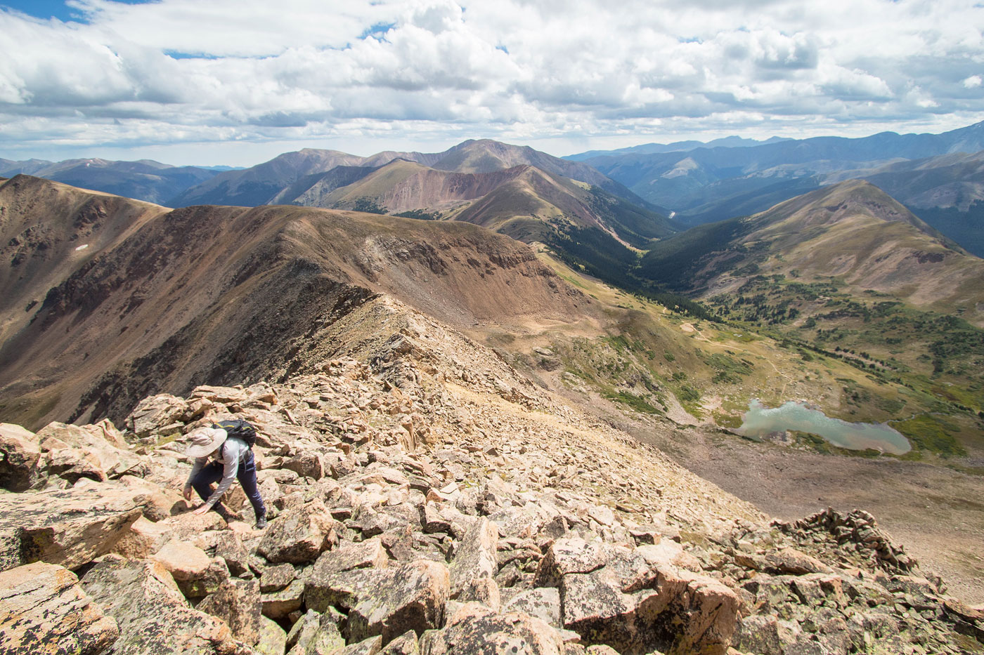
A social trail continued to the summit of Hassell Peak, only some light Class 2 and a couple of ups and downs on the ridge along the way. We returned to the junction and left the trail, heading southwest with our sights on Pettingell Peak, looking forward to the scramble. Hiking along the ridgeline was pretty straightforward, only a bit of Class 2 before reaching the first major rock outcropping on the ridge crest. We chose to stick to the Class 3 ridgeline and get some warm-up scrambling in, but you could keep the first section Class 2 by avoiding the crest and keeping to the right (north) side of the crest. Soon we found ourselves at the base of Pettingell Peak, where the terrain became steeper and introduced a lot more talus-hopping. Class 2 and low Class 3 moves brought us to just below the summit. Nothing was particularly difficult, but it was all quite fun and not exposed. The last hundred feet or so to the summit was mostly flat.
From the summit of Pettingell Peak, we considered attempting the sketchy traverse from Pettingell Peak to The Citadel, but an incoming storm wasn't on our side. Instead we continued west along the ridge crest and dropped down onto a pretty tundra slope. This steep slope led above a cliff and down a gully (Class 2) to the north side of Herman Lake. From here we wrapped around the east side of the lake and picked up the Herman Gulch Trail, taking it back to the trailhead.
Please consider helping me out if you find my site useful. I'm not sponsored, so all site fees are out-of-pocket and my time preparing these trip reports is unpaid. You can also hire me as a web developer. I really appreciate it!


If you find my site helpful, please help me replace my many broken cameras, fund my website fees (hosting, APIs, security), or just support my countless hours of work. I pay for all expenses myself, and all trip reports I post are unpaid and unsponsored, so any support is really appreciated!
If using PayPal, please select their option for "Sending to a friend" so they don't take out fees, thank you.
My site is free to use, but consider sending me a few bucks to help keep it running. Thanks in advance!