I provide a free route map, but you can also download a hike/drive GPX to assist you and to help support my site. Before sharing my GPX tracks with others, please remember my site is a free resource and I'm charging nominal fees to offset my substantial costs.
GPX track added to your cart.
Aug 22, 2021 — Considering you can just hike Rogers Peak and Rosalie from pull-offs on Mount Blue Sky Scenic Byway (formerly Mount Evans Scenic Byway), and Mount Warren from the Summit Lake parking area, this big loop might feel contrived to some peakbaggers. I was looking to get the 13ers surrounding Mount Blue Sky (formerly Mount Evans) via much more interesting route rather than driving up the scenic road and just doing silly out-and-backs. I already hiked Mount Blue Sky years ago so it wasn't really even on my radar for this hike, but you can make this route a bit harder by including it as a detour from the loop. After lots of research on possible trail options in the area, I settled on doing this loop, though it required quite a bit more work than just tackling the peaks individually. This hike also visits a couple of nice lakes and has plenty of solitude in the forest.
Any car can make it to the Camp Rock Campground, though it's a long dirt road with some slightly rougher spots. The trailhead had a lot of cars, and I believe many were for a more popular, shorter loop that heads up to Beartrack Lakes, not ascending to any of the peaks. I started along the loop going counter-clockwise by taking the Beaver Meadows Trail. The trail was mostly uneventful for a few miles, wandering through some pretty forest and passing through Beaver Meadows. The trail was well-marked, and I followed signs to the Lincoln Lake Trail. This trail climbed a bit more steeply through an old burn area up to Lincoln Lake's eastern side. I wandered through some light bushwhacking and Class 2 boulder-hopping along the lake's north side to reach the much steeper slope on its northwest side. I decided to just ascend this slope, encountering some Class 2 on the way, and found myself on the Mount Blue Sky Scenic Drive above. Ah, the sound of motorcyclists. Lovely. The slope was definitely the crux of the day due of 900 feet over a very short distance.
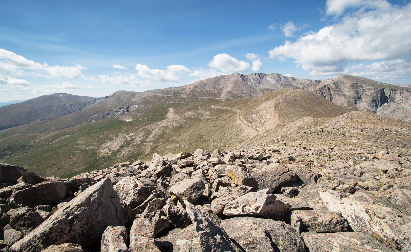
I peered back down at Lincoln Lake before continuing over the road and up to the east ridge of Rogers Peak. This was just a tundra slope, but there was some Class 2 boulder-hopping mixed in. The summit was uneventful, so I continued southwest along the ridgeline. Class 2 led off Rogers Peak and down to its saddle with Mount Warren. More tundra and some Class 2 led to its summit, and then more Class 2 dropped me down its southwest ridge. Rather than continue along the rocky ridge, I dropped onto the tundra below and beelined a route to the extraordinarily crowded Summit Lake Park.
A mile or so of walking along the Mount Blue Sky Scenic Road was unpleasant and loud, but the views were nice. I left the road and headed south to reach Epaulet Mountain, more tundra with some light Class 2. The grassy ridgeline leading from Epaulet Mountain to Rosalie passes over Epaulie, a 13er that's slightly higher than Epaulet Mountain. The tundra is an easy walk with some random boulders to walk over, and the only real obstacle worth noting was some Class 2 down-climbing off Epaulie. There were also decent views down to Beartrack Lakes below, which I'd be visiting in a bit.
Once on Rosalie I took in the views of the route so far and then started down the tundra slope on Rosalie's northeast side. I kind of had no idea what to expect, but the going was very easy for the first 3/4, just gorgeous tundra walking with easily avoidable talus. I was vaguely aware of a good spot to join the Roosevelt Lakes Trail below and headed more-or-less directly to that spot (which I marked on my attached map). Where I would join is a spot that the trail emerges from treeline, meaning I wouldn't have to do any bushwhacking at all. About a half mile before this point the slope became riddled with boulders, but I was able to avoid all unpleasantness by keeping to the right on tundra and wrapping around the boulder-strewn area. I got to the trail and headed northwest.
Now on the Roosevelt Lakes Trail, I could just follow the trail system back to my car. First, once I hit the Roosevelt Lakes Trail junction with the Beartrack Lakes Trail, I took the latter trail to visit the gorgeous lakes that I had seen from above. I could see the ridgeline I traversed from the lakes and I just kind of sat and enjoyed myself for a few minutes before realizing I was extremely sunburnt. I backtracked along the bear Lakes Trail and continued generally north along the Beartrack Lakes Trail. I followed all signs that pointed me along this trail, since it would be the route to lead back to the trailhead. The first few miles were pretty boring, lots of forest obscuring any views. However, the final descent switchbacks gave great views over some pretty meadows toward rock outcrops to the north. The last half mile followed Truesdell Creek, so that was nice too.
Please consider helping me out if you find my site useful. I'm not sponsored, so all site fees are out-of-pocket and my time preparing these trip reports is unpaid. You can also hire me as a web developer. I really appreciate it!


If you find my site helpful, please help me replace my many broken cameras, fund my website fees (hosting, APIs, security), or just support my countless hours of work. I pay for all expenses myself, and all trip reports I post are unpaid and unsponsored, so any support is really appreciated!
If using PayPal, please select their option for "Sending to a friend" so they don't take out fees, thank you.
My site is free to use, but consider sending me a few bucks to help keep it running. Thanks in advance!