

Starting along the Big Canyon Trail.
Lovely water sounds on this nice trail.
The trail ascends a steep, small spur ridge and leaves the canyon.
Pleasant forest hiking on the steep trail.
Ascending along the spur ridge as the trail makes its way to the saddle seen in the center of this photo.
View back.
The ridge leading to Snow Peak visible up top.
View back again.
Saddle I'm headed to seen left, the ridge leading to Snow Peak visible on the right.
Shortly before reaching the saddle, another view down Big Canyon.
Saddle ahead.
First I decided to head to Haystack Mountain, seen ahead. The trail heads south.
Close-up of Haystack Mountain, which required losing some vertical to reach the saddle below.
Continuing along the ridgeline.
View back toward the descent I came from.
Some undulations along the ridgeline.
At the base of Haystack Mountain.
Steep initial ascent from the base of Haystack Mountain.
Class 2 toward the top of the false summit.
View back at the ascent. Snow Peak seen top left.
Along the ridge crest to the true summit.
View back along the crest.
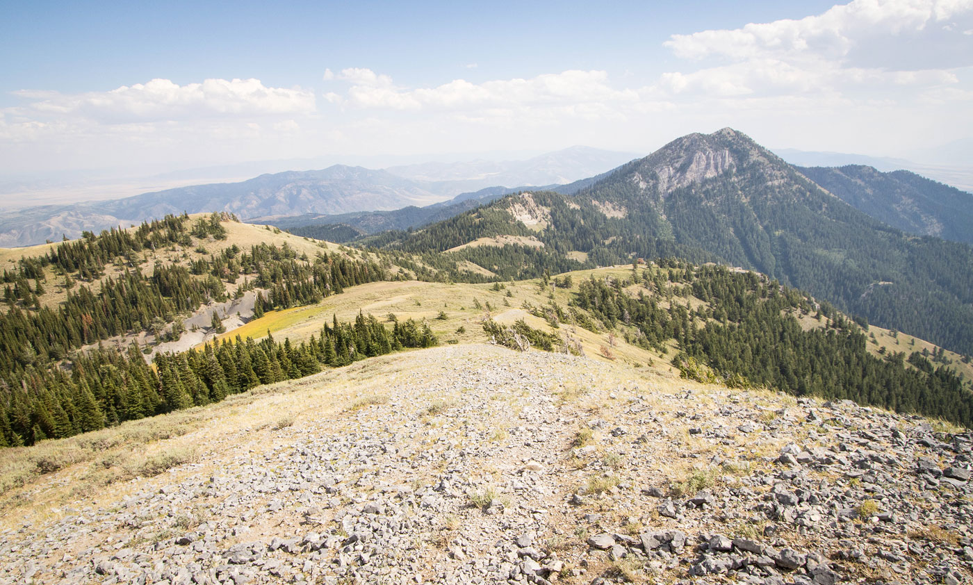
Haystack Mountain summit, view south.
Haystack Mountain summit, view west.
Back at the junction with the Big Canyon Trail, a view north toward Snow Peak (obscured from view).
View back along the ridge as I start up toward Snow Peak. The Big Canyon Trail came in on the left.
Wider shot, farther up. I thought this was such a beautiful section.
Gorgeous tundra on my way to Snow Peak, seen left.
Snow Peak and Bonneville Peak ahead. The trail disappeared for a while.
Trail appears again, leading up the steeper slope.
View back along the ridgeline. Haystack Mountain seen center in the distance.
Just below the summit of Snow Peak, view back.
Snow Peak summit, view north toward Bonneville Peak.
Hire me or show me some love!
Hire/refer me as a web developer or send me a few bucks if you find my site useful. I’m not sponsored, so all fees are out-of-pocket and my time preparing trip reports is unpaid. I really appreciate it!