

Walking along the road after it got too degraded, along the wash.
The wash led into the mouth of an interesting-looking canyon. There was some brush, but I avoided all of it by staying within the drainage.
I worked my way up the canyon, able to avoid all scratches and keeping the route Class 2.
At the head of the canyon looking back down. At the bottom of this photo you might be able to see a poorly-lit loose dirt slope I used to get to the saddle where I'm standing, Class 2+.
At the saddle, view toward the artificial water catchment (center), and Highland Peak (top right). Also visible to the left of Highland Peak is the gully I'd use to get up there later. First I wanted to go do Sleeping Indian Peak, so I headed to the right out of frame.
Dropping down a few feet and wrapping around some cliffy-looking nonsense.
I used the brushy gully on the left to get to the south ridge of Sleeping Indian Peak.
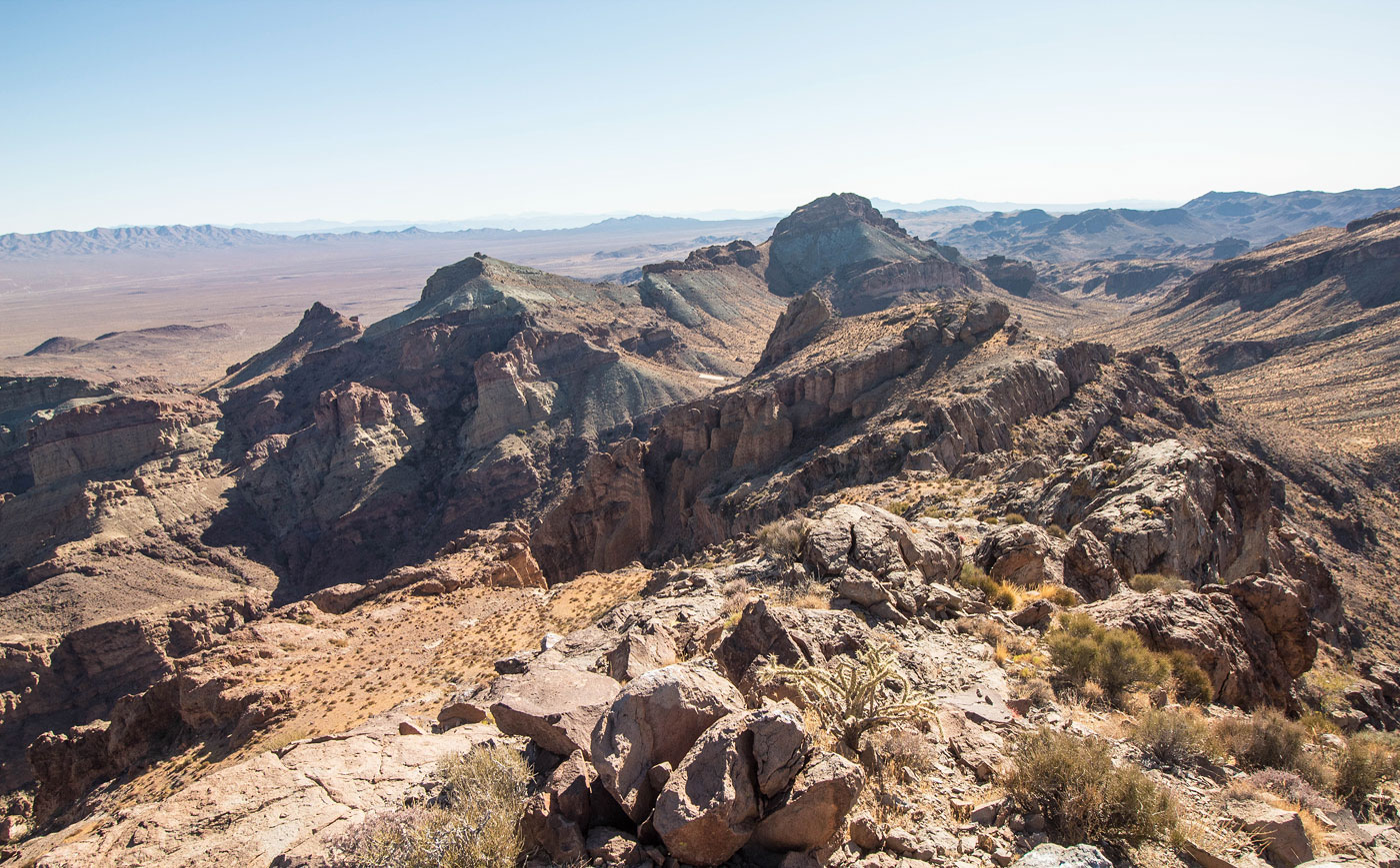
Looking back down into the brushy drainage, Highland Peak top right.
Along the south ridge on my way to Sleeping Indian Peak.
Looking back at the rock outcroppings on Sleeping Indian's south ridge. Mostly all were avoidable.
There was a cliff just below the summit, so I wrapped around the right side of Sleeping Indian Peak to get to its north side. You can see a weakness in the center of this photo that brought me onto a Class 2 slope.
Summit of Sleeping Indian Peak, view south along the ridge I came up. Highland Peak top center. The canyon I ascended from at the start of the hike bottom left.
View toward Highland Juniper Peak (top right).
View toward the mouth of the canyon I ascended.
Back along the south ridge from Sleeping Indian Peak. Highland Juniper visible top right (the banded high point).
Along the ridge to Highland Juniper Peak.
Keeping right of the ridge crest below a cliff, following a burro trail. Highland Juniper Peak visible right of center.
I was able to avoid the obstacle on the left by wrapping around its right side. Highland Juniper Peak visible top right.
Looking back toward Sleeping Indian Peak.
Highland Juniper Peak ahead. I wrapped around the whole thing and think the best route is the spot visible ahead.
Class 3 route I took up Highland Juniper Peak.
It's a bit loose, but not too bad.
View down the crux of Highland Juniper Peak.
Highland Juniper Peak, view north. Sleeping Indian Peak visible top left.
I backtracked along the ridge between Sleeping Indian and Highland Juniper Peaks, then dropped to the right and headed down the steep slope. Highland Peak visible ahead. I am heading for the drainage on its left.
Class 2 drainage.
Looking back the way I came, Sleeping Indian Peak top right somewhere. The saddle where the artificial water catchment is located is on the right. I'll be returning there later to get back to my car.
Scary-looking cliff band protecting Highland Peak. I approached it hoping to find an option.
Class 3 ramp that gets above the cliff band.
Class 2 to the summit of Highland Peak.
Highland Peak summit ridge, view south.
Highland Peak summit ridge, view north. Highland Juniper Peak visible top left.
Hire me or show me some love!
Hire/refer me as a web developer or send me a few bucks if you find my site useful. I’m not sponsored, so all fees are out-of-pocket and my time preparing trip reports is unpaid. I really appreciate it!