I provide a free route map, but you can also download a hike/drive GPX to assist you and to help support my site. Before sharing my GPX tracks with others, please remember my site is a free resource and I'm charging nominal fees to offset my substantial costs.
GPX track added to your cart.
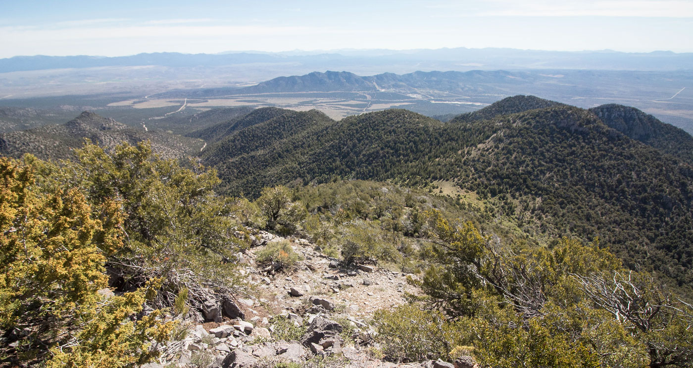
May 16, 2020 — Most peakbaggers will likely just want to drive to the top of Highland Peak, but that's not really my jam. For those who would prefer to drive to the summit, the road was in good shape. I know this because I ran down on the road rather thanr return on my ascent route, making this route a loop. The road to my attached trailhead was fine for any mid-clearance vehicle. I parked at a junction of the main summit approach road and a side road that leads to Connor Spring. The latter road was awful, so I was content to park at the junction and hike to Connor Spring instead. At the end of the road were the remains of an old camp, as well as what seemed to be an overgrown trail guarded by a barbed wire fence with a zig-zag opening. The trail didn't last long and I soon found myself bushwhacking a little. After about five minutes of regretting my life choices, the area opened up and the bushwhacking became minimal for the remainder of my ascent. Locating the path of least resistance was for the most part already solved by ample animal trails. In fact, it was actually pretty pleasant if you're cool with a steep slope. The views to the north as I progressed up the slope were of nice Nevada hills and enjoyable, and soon I was on Highland Peak's east ridge. The ridge was forested but didn't require any bushwhacking.
I encountered a couple of Class 2 rock outcroppings along the ridge, but they're barely worth mentioning. Highland Peak came into view, as did a baby lamb. It followed me for a quarter mile. I could have cried. I didn't know what to do, so I kept walking. My only snacks were high fructose corn syrup bars and I had no bowl to offer it water. So that was a bit of a sad moment of my morning. It was the cutest itty. Anyway, I continued along the ridge, dropping a couple hundred feet along the ridge before reascending and meeting up with the summit approach road. I took the road to the summit of Highland Peak. I continued back down the road all the way to my car via the summit road. Overall a nice little peak.
Please consider helping me out if you find my site useful. I'm not sponsored, so all site fees are out-of-pocket and my time preparing these trip reports is unpaid. You can also hire me as a web developer. I really appreciate it!


If you find my site helpful, please help me replace my many broken cameras, fund my website fees (hosting, APIs, security), or just support my countless hours of work. I pay for all expenses myself, and all trip reports I post are unpaid and unsponsored, so any support is really appreciated!
If using PayPal, please select their option for "Sending to a friend" so they don't take out fees, thank you.
My site is free to use, but consider sending me a few bucks to help keep it running. Thanks in advance!