

Starting up a wash, Peak 1500 seen ahead.
Approaching Peak 1500. We ascended to its east side, seen right.
At the east side of Peak 1500. You can see Tyler and Matt up there in the center, but they couldn't get higher.
Awesome view from the saddle on the east side of Peak 1500.
Back in the drainage after our Peak 1500 attempt.
Ascending a Class 2 slope toward Peak 1420, seen center.
View back as we attempt one of 3 failed gullies up Peak 1420. Peak 1500 seen in the distance.
At the notch on the east side of Peak 1420, view back. Picacho Peak seen distant left.
Class 2 down from the notch, deeper into Indian Pass Wilderness.
Through a nice drainage.
Some fun Class 3 obstacles.
We left the drainage to ascend toward Peak 1280 using this initial slope.
View back into the drainage we just came out of. Peak 1420 up top.
A gorgeous relatively more tame lumpy desert setting. Peak 1280 seen center. To reach it we wrapped all the way around its north side.
View back through the lumpy, more tame section as we ascend toward the north side of Peak 1280.
Wrapping around Peak 1280, burro trails keeping the side-hilling minimal.
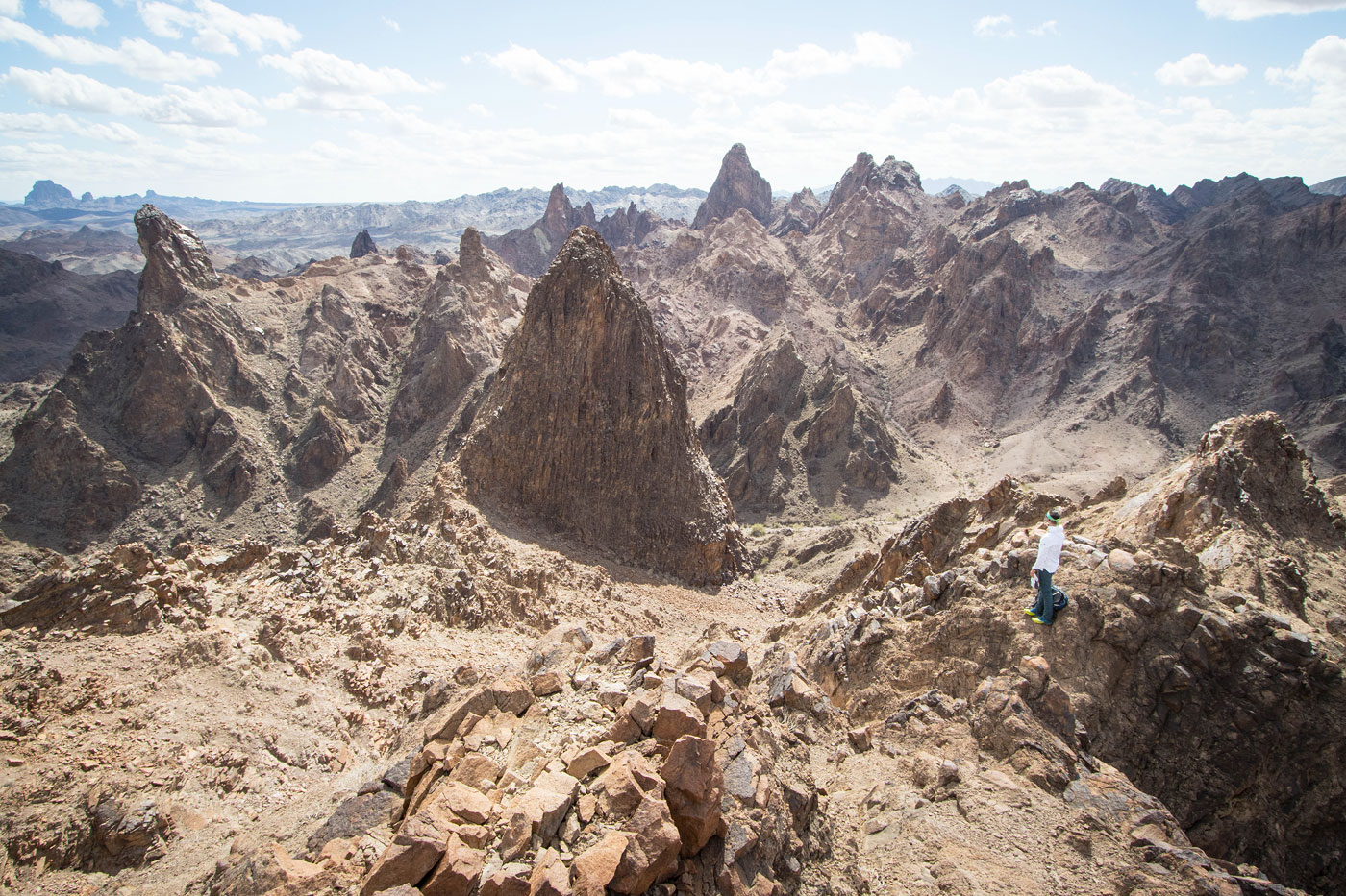
We emerged at the west ridge of Peak 1280 and saw this! Peak 1500 seen center.
Class 2/3 up to the summit of Peak 1280.
Wide-shot back along the ridge.
Close-up at Chris taking in the view.
Close-up toward Picacho Peak, Peak 1250 seen center. We originally thought we could maybe summit that one, but didn't even try after seeing it here, lol.
Peak 1280 summit, view toward the Colorado River. Our descent route heads into the gully on the right.
Class 2 down the gully. We dopped a hump using a burro trail and ascended using the adjacent drainage seen right of center.
Up the adjacent drainage, Peak 1250 seen ahead. Class 2 led to the saddle seen center.
From the saddle, onward through the desert on efficient burro trails. There were gorgeous desert features here too.
Peak 1500 above.
View back toward the wonderland.
Descending from the wilderness back toward Indian Pass Road.
Hire me or show me some love!
Hire/refer me as a web developer or send me a few bucks if you find my site useful. I’m not sponsored, so all fees are out-of-pocket and my time preparing trip reports is unpaid. I really appreciate it!