

Starting up Borrego Palm Canyon.
A nice trail, which crosses the stream a couple of times.
Looking back along the Borrego Palm Canyon Trail.
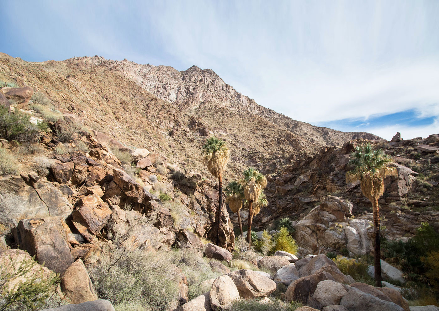
Borrego Palms ahead. A short detour leads to the palms. Keeping to the north side of Borrego Palm Canyon continues around the palms without walking through the oasis.
After the palm oasis, continuing farther up Borrego Palm Canyon. There's a short section of massive granite boulder hopping required.
Boulder-hopping up Borrego Palm Canyon. The palm oasis is visible behind Austin.
Borrego Palm Canyon mellows out shortly after the boulders, now with just occasional obstacles.
Continuing up Borrego Palm Canyon, Indianhead's ascent ridge visible ahead.
Pretty scenery in Borrego Palm Canyon.
More palms farther up Borrego Palm Canyon.
View toward Borrego Palm Canyon (bottom right), Indianhead visible top center. Our ridge ascent on the far left. This photo was taken right shortly before we started up the ridge.
A last view up Borrego Palm Canyon. We didn't explore farther, instead heading up the ridge. It looked pretty and maybe one day I'll come back to go farther.
Austin starting up the ridge, Indianhead visible on the right.
Looking down some Class 2 into Borrego Palm Canyon as we ascend a slope to the main ridge.
Along our ascent ridge, Indianhead top right.
Farther up the ridge, looking back toward Borrego Palm Canyon on the left.
Close-up of the talus that makes up the majority of the ridge ascent.
The ridge starts to curve, false summit visible ahead.
Looking back the way we came, Borrego Palm Canyon visible below.
More Class 2/2+ ridge ascending.
Approaching the Indianhead false summit, lots of massive boulders requiring similar route-finding as we did earlier in Borrego Palm Canyon.
Working our way up the massive boulder-filled ridge. This bit doesn't last long, but it's fun and requires a bit of thinking.
A particularly interesting obstacle we encountered a bit before the summit.
The boulders fade out for the last bit to the summit, giving way to a really interesting landscape of grasses and boulders.
Close-up of the interesting landscape just below the summit.
Indianhead summit, view south. Borrego Palm Canyon is out of frame below on the right.
Hire me or show me some love!
Hire/refer me as a web developer or send me a few bucks if you find my site useful. I’m not sponsored, so all fees are out-of-pocket and my time preparing trip reports is unpaid. I really appreciate it!