I provide a free route map, but you can also download a hike/drive GPX to assist you and to help support my site. Before sharing my GPX tracks with others, please remember my site is a free resource and I'm charging nominal fees to offset my substantial costs.
GPX track added to your cart.
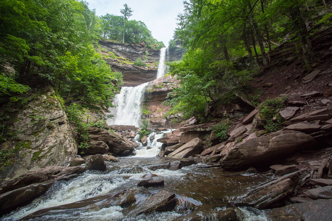
Jul 19, 2021 — Kaaterskill Falls is an extremely popular destination, but I've never seen the falls and felt it was a spot I needed to check out. I extended the hike to reach South Mountain and the various ruins near its summit, plus a loop to view Inspiration Point. The falls are accessible from the north, but I prefered to do the hike from the base of the falls. Unfortunately the normal trailhead is closed (likely permanently), so an alternate parking area farther south requires a half mile walk up the loud and winding highway. Once at the trailhead, a well-manicured trail leads past some lower dalls and up a bunch of stairs to the base of Kaaterskill Falls. More stairs brought me to the top of the falls, where a viewing platform looks over at the falls from a distance.
Once I took a two-minute break to look at Kaaterskill Falls, I decided to head up to summit South Mountain. An uninspiring old roadbed wrapped around the peak's south side, serving as the trail. There's no trail to the true summit, so a hundred feet of bushwhacking was in order. I wrapped around a cute little pond near the summit, a nice trail leading the way. I passed an old well and the remains of Kaaterskill Hotel. Apparently you can sift through the overgrown to find old remnants of the hotel, but in the middle of summer I wasn't willing to risk accumulating ticks. I was content to see some old concrete blocks and move along.
The trail looped me back to the uninspiring road, which I followed southeast to get onto the Inspiration Point Trail. This was a proper trail, and althogh muddy today, had nice views and was definitely the highlight of the hike. It's marked as a road on Google Maps, but it's not at all. There were nice views along the way, and while the true "Inpsiration Point" is nice, there are various other comparable viewpoints. I continued west along the trail and reached a junction, which pointed me north, intersecting my earlier route. I headed back the way I came past Kaaterskill Falls.
Please consider helping me out if you find my site useful. I'm not sponsored, so all site fees are out-of-pocket and my time preparing these trip reports is unpaid. You can also hire me as a web developer. I really appreciate it!


If you find my site helpful, please help me replace my many broken cameras, fund my website fees (hosting, APIs, security), or just support my countless hours of work. I pay for all expenses myself, and all trip reports I post are unpaid and unsponsored, so any support is really appreciated!
If using PayPal, please select their option for "Sending to a friend" so they don't take out fees, thank you.
My site is free to use, but consider sending me a few bucks to help keep it running. Thanks in advance!