stav is lost logo
  • Find Hikes
    • Most recent
    • Trip Report Index
    • Hikes by Region
    • Search Hikes
  • Map
  • About
  • Love
Hike Keg Mountain in Thomas Range BLM, Utah - Stav is Lost

Hike Keg Mountain Thomas Range BLM, UT

Class 2 3.4 miles 1200 gain 1-2 hr Out and Back
Effort
Beauty
Personality
Solitude
DirectionsRoute MapDownload GPX

Keg Mountain GPX Track

I will always provide a free route map, but you can also download a hike/drive GPX to assist you and to help support my site. Before sharing my GPX tracks with others, please remember my site is a free resource and I'm charging nominal fees to offset my substantial costs.

GPX track added to your cart.

Add to Cart ($2.50)
View Cart

Jun 09, 2023 — Keg Mountain is a high-prominence peak in Utah's West Desert, pretty much as isolated as peaks get out here. It's a pretty drab mountain since it's mostly covered by brush, but does have some cool rock features within the drainage I hiked up and decent views from the summit. Head north here (39.71702, -112.85901), passable by any vehicle. Veer right here (39.76306, -112.87750), where the road now requires a Crossover or greater, plus some care to avoid big boulders hugging the road.

I followed an ATV road east, leading to the mouth of a drainage. Aside from zig-zagging to avoid some low limbs, this drainage worked really well. As it bent north, more rocky features were introduced and even some Class 2 scrambling and a dryfall bypass. The drainage then became significantly more steep, now less of a drainage and more just a slope, loose sand forcing me to crawl a bit at points. A few hundred feet of this and then the slope became a lot more tame, a dirt gully/slope hybrid that took me to the top where I got a view of Keg Mountain.

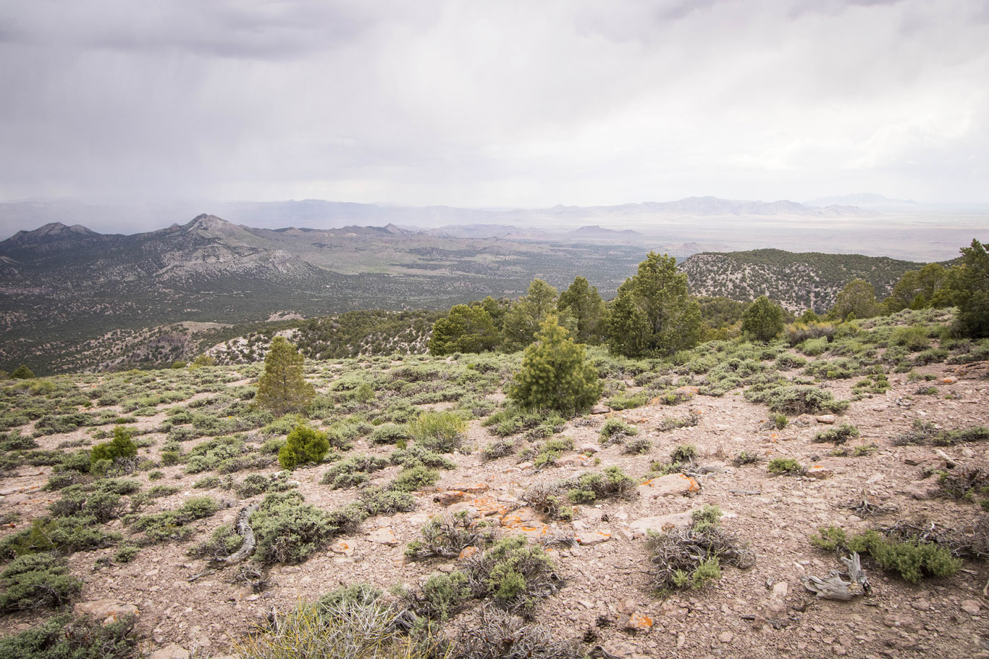
From here it was just a tree-dodging hike on a mellow slope to gain the summit. Along the way were a couple of short Class 2 rock clusters. There are openings within the trees that allow for a nice view to the west, especially at the summit. For the second time today, thunder chased me down from the peak. In fact, I think it was the same storm that passed by me earlier on my previous peak and it had now caught up.

PEAKS ON HIKE
Elevation (ft) / Prominence (ft)
Peaks on hike
Elevation
Prominence
1
Keg Mountain
7305 ft
2205 rise

Show me some love

Please consider helping me out if you find my site useful. I'm not sponsored, so all site fees are out-of-pocket and my time preparing these trip reports is unpaid. You can also hire me as a web developer. I really appreciate it!

Thank you

Next HikePrev Hike
  • Next Hike
  • More Near Here
  • Prev Hike
photo protector Along the ATV trail. Keg Mountain seen top left.
Along the ATV trail. Keg Mountain seen top left.
photo protector ATV trail leading through brushy terrain.
ATV trail leading through brushy terrain.
photo protector The ATV trail ended and I headed up this drainage.
The ATV trail ended and I headed up this drainage.
photo protector Some light Class 2 and tree-dodging.
Some light Class 2 and tree-dodging.
photo protector View back at my progress up the drainage. Here I just bypassed a dryfall.
View back at my progress up the drainage. Here I just bypassed a dryfall.
photo protector Ascending within the drainage.
Ascending within the drainage.
photo protector Just a view at some of the cool rock formations on the sides of the drainage.
Just a view at some of the cool rock formations on the sides of the drainage.
photo protector Narrowing portion of the drainage.
Narrowing portion of the drainage.
photo protector View back at some Class 2 rock-hopping.
View back at some Class 2 rock-hopping.
photo protector The drainage steepens to a slope, no longer really resembling a drainage.
The drainage steepens to a slope, no longer really resembling a drainage.
photo protector View back as I ascend the steep slope, often crawling since the ground was loose.
View back as I ascend the steep slope, often crawling since the ground was loose.
photo protector Then the slope become more tame and led me to the top.
Then the slope become more tame and led me to the top.
photo protector Above the slope, a view toward Keg Mountain.
Above the slope, a view toward Keg Mountain.
photo protector Some light Class 2 along the ridge to Keg Mountain.
Some light Class 2 along the ridge to Keg Mountain.
photo protector View back the way I came.
View back the way I came.
photo protector Keg Mountain summit, view west.
Keg Mountain summit, view west.
photo protector Keg Mountain summit, view southwest.
Keg Mountain summit, view southwest.

Show Me Some Love

If you find my site helpful, please help me replace my many broken cameras, fund my website fees (hosting, APIs, security), or just support my countless hours of work. I pay for all expenses myself, and all trip reports I post are unpaid and unsponsored, so any support is really appreciated!

If using PayPal, please select their option for "Sending to a friend" so they don't take out fees, thank you.

PayPalVenmoCash App

About  Contact  Love

© 2023 Stavros Basis.

DISCLAIMER: All activities you find on this site are dangerous. I am not responsible for anything you do in the outdoors. Please practice good ethics, and don't take any risks that put yourself or others in danger.


Thanks for visiting!

My site is free to use, but consider sending me a few bucks to help keep it running. Thanks in advance!

Sure!Nope.