I provide a free route map, but you can also download a hike/drive GPX to assist you and to help support my site. Before sharing my GPX tracks with others, please remember my site is a free resource and I'm charging nominal fees to offset my substantial costs.
GPX track added to your cart.
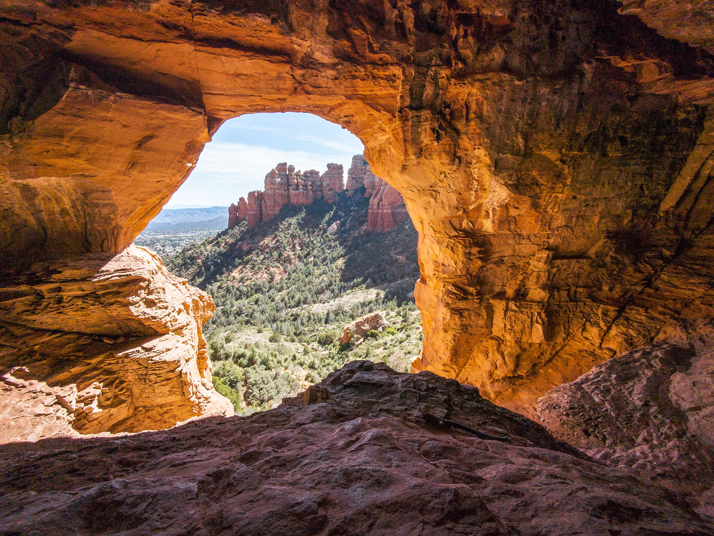
Mar 29, 2024 — Witches Mountain is the local name for Peak 5978, a minor summit located just outside of Sedona. Along the route to reach the summit is a gorgeous cave known as Keyhole Cave, which receives some decent visitation. I should have known better than to start hiking on a crowded Friday afternoon, but the wait for parking at the Sugarloaf Trailhead wasn't too bad. I hiked along the Tea Cup Trail, and when it met a junction with the Thunder Mountain Trail, I continued north on a well-beaten social trail. Witches Mountain sat above, and I could see the grotto that houses Keyhole Cave beneath it.
There are multiple human-carved social trails that generally lead to the cave, so I had no trouble getting there quickly. As I approached the cave's base, the trail became steeper but was still easy to follow. You can scramble (Class 2/3) into the cave to get onto a ledge within, a nice viewpoint toward Capitol Butte's eastern face. Lots of people come here, notable due to the graffiti and boot-slickened sandstone, but it's a nice spot to cool off before starting up to Witches Mountain.
From the base of the cave I was made aware there wouldn't be a clear trail onward. I believe you could get back low and take the wider drainage up to the saddle on Witches Mountain's west side, but rather than do this, I decided to ascend via a minor brushy gully and join the peak's west ridge higher up. This worked out well overall, so I repeated the route on my way back later. The worst part was the first few hundred feet from Keyhole Cave due to some thick brush. I recommend trying to keep high near the base of the peak's sheer face rather than trudge lower down the slope. An animal trail continued beneath the cliff and headed up into the minor gully. The going was easier here, though much steeper and dirtier. I noted a cairn or two and scrambled up a Class 2+ short headwall before gaining the ridgeline above.
Now on the western ridge of Witches Mountain, reaching the summit became a more pleasant endeavor, with only minor brush intruding on my personal space. I stuck to the crest as much as possible, encountering a couple of Class 2 slabs and a Class 3 move up a short cliff band. At a point where a headwall seemed to prevent further access, I wrapped left and scrambled a Class 2+ crack to get a nice view of Witches Mountain directly ahead of me. Aside from some sandy terrain and a brushy finish, the remainder of the ascent didn't exceed Class 2.
Please consider helping me out if you find my site useful. I'm not sponsored, so all site fees are out-of-pocket and my time preparing these trip reports is unpaid. You can also hire me as a web developer. I really appreciate it!


If you find my site helpful, please help me replace my many broken cameras, fund my website fees (hosting, APIs, security), or just support my countless hours of work. I pay for all expenses myself, and all trip reports I post are unpaid and unsponsored, so any support is really appreciated!
If using PayPal, please select their option for "Sending to a friend" so they don't take out fees, thank you.
My site is free to use, but consider sending me a few bucks to help keep it running. Thanks in advance!