

Hennen Canyon Trailhead.
Starting up the Hennen Canyon Trail through the foothills. You can see the silhouette of peaks ahead, obscured by the smoky wildfire haze.
The Hennen Canyon Trail stays out of the drainage most of the time, swapping between meadows and aspen forest.
The canyon begins to narrow.
The canyon continued to narrow. The trail keeps to the left of the brush seen on the right in this photo, hugging the cliffs.
More progress up the canyon.
Looking back toward a Class 2+ section along the trail to get over a cliff band and also avoid the drainage.
More Class 2 along the Hennen Canyon Trail.
Looking back down Hennen Canyon as I approach Griswold Lake.
Griswold Lake ahead, Lee Peak top right.
I continued along the left side of Griswold Lake on a social trail after the official Hennen Canyon Trail ended.
Looking back toward Griswold Lake.
Class 3 headwall on the ascent from Griswold Lake. It's less hard than it looks in this photo.
Looking back again toward Griswold Lake as I make a bunch of progress out of Hennen Canyon.
The route is not obvious as you look, but the social trail is good and leads toward the top center of this photo.
Looking back, Lee Peak top left. Note the notch on the far left - I thought maybe that could be an ascent route to Lee Peak, but once on the ridge looking down at it later, I was happy I didn't try it.
Continuing on the social trail.
Looking back, Lee Peak top left, Griswold Lake right of center.
The social trail ended as the steep ascent petered out. Ahead, the route becomes a little less obvious, cairns the only thing marking the route. Ruby Pyramid is seen center, Ruby Dome on the right. The route heads to the right of the talus hump right of center.
The route heads to the opening to the right of the hump in the center, just below Ruby Dome.
Looking back toward where I came up the steep social trail from Griswold Lake, left of the pointy thing in the center.
Continuing up the opening previously mentioned.
The cairns mark a nice route up the cliffs on the right. After doing Ruby Pyramid later, my return route would bring me back to this spot from the left in this photo.
Looking back along the cliffy route, Class 2.
The standard route heads to the left, keeping low. I recommend following the ridge in the center. Cairns mark the ridge crest for a while before keeping left of the crest and traversing the talus-filled slope.
Looking back toward my progress, Griswold Lake pictured below.
Class 2 route, just left of the ridge crest.
The standard route and this ridge route meet up about here, and continue on this somewhat exposed Class 2 ledge.
Looking back at the slightly exposed section.
Ruby Dome ahead! First, I went to Lee Peak (behind me).
Along the ridge to Lee Peak. Griswold Lake visible on the right. Lee Peak is top center.
Class 2 tedious ridge on my way to Lee Peak. The talus is loose and I got more than one ding on my leg from talus moving out of place when I didn't expect it.
Looking back at my progress, Ruby Dome on the right.
Lee Peak ahead, but first a steep talus slope to a notch separating me from Lee Peak. I would have to reascend this slope later.
At the notch (bottom right) that I thought might work as an ascent route from Griswold Lake, but I'm glad I didn't try it. Lee Peak's summit area visible top left, but there are cliffs making easy access to the summit from this side difficult.
Looking back toward the notch and the talus slope I descended from along the ridge.
Slope up to Lee Peak.
Avoiding the summit cliffs by keeping to the left around them.
Lee Peak summit ahead.
Lee Peak summit, view east toward Ruby Dome.
Griswold Lake below.
Wide shot of Griswold Lake (left), the route from Girswold Lake to the ridge, and Ruby Dome just out of frame on the far right.
After retracing my steps, now at the base of Ruby Dome.
Ruby Dome summit, view toward Lee Peak (far left) and the ascent route I took in the center. Hennen Canyon visible right of center.
The somewhat exposed Class 2 ridge leading down Ruby Dome's east side.
Looking back toward Ruby Dome's summit.
Ruby Pyramid ahead.
Class 3 move coming down from Ruby Dome.
Looking back toward Ruby Dome as I ascent Ruby Pyramid.
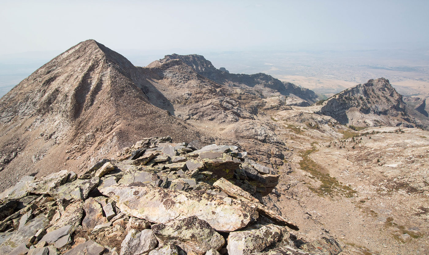
Wide shot from Ruby Pyramid toward Ruby Dome (left), Lee Peak (left of center), and Hennen Canyon (right of center). My descent route from Ruby Pyramid will start at the saddle of Ruby Dome and Ruy Pyramid, traverse the talus in the center of this photo, and lead back to the left side of that unnamed point on the right, where I rejoined the Ruby Dome route.
Ruby Pyramid summit, view east.
Close-up of Mount Fitzgerald (right), Snow Lake Peak (just left of Fitzgerald), Mount Gilbert (left middle), and the other main Ruby Mountains peaks.
Back at the saddle of Ruby Dome and Ruby Pyramid, heading along the tedious talus slope. My goal is to get to the left of the point in the center.
Looking back toward Ruby Pyramid.
Class 2. Keep an eye on the point on the far right. I'm trying to get just to the left of it.
Cairned route for part of my descent. It leads to just left of the point on the right.
Back at Griswold Lake, with better lighting.
Heading back down Hennen Canyon, better light.
Hire me or show me some love!
Hire/refer me as a web developer or send me a few bucks if you find my site useful. I’m not sponsored, so all fees are out-of-pocket and my time preparing trip reports is unpaid. I really appreciate it!