stav is lost logo
  • Find Hikes
    • Most recent
    • Trip Report Index
    • Hikes by Region
    • Search Hikes
  • Map
  • About
  • Love
Hike Mars Canyon and Archenback Canyon Loop in Organ Mountains-Desert Peaks National Monument, New Mexico - Stav is Lost

Hike Mars Canyon and Archenback Canyon Loop Organ Mountains-Desert Peaks National Monument, NM

Class 2 5.2 miles 1900 gain 2-4 hrs Loop
Effort
Beauty
Personality
Solitude
DirectionsRoute MapDownload GPX

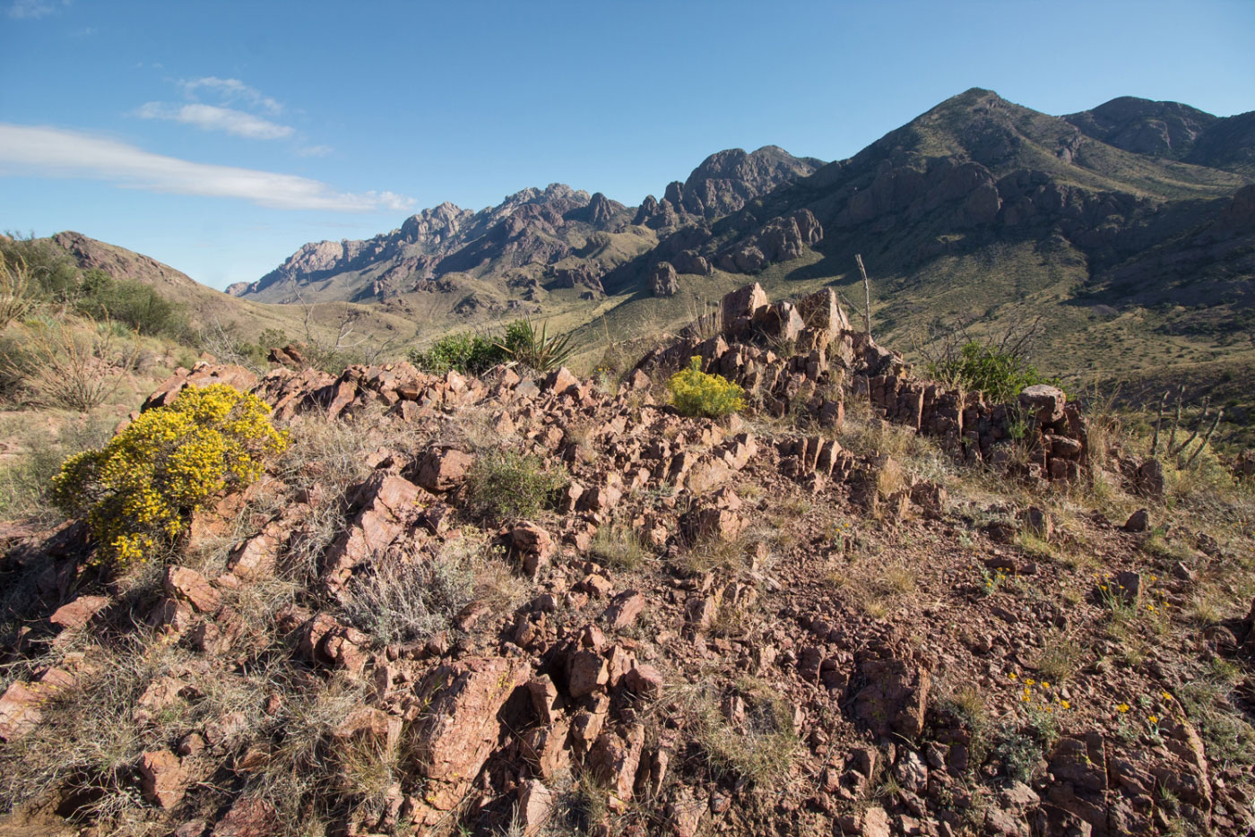
Oct 05, 2018 — This is a really nice loop of a lower ridgeline within the Organ Mountains, separated from the higher peaks. It's also a great hike for getting into desert route-finding: you go up one canyon on a social trail, along a ridge, and down an official trail.

Starting at the Archenback Canyon Trailhead, head up Mars Canyon (Cuates Canyon is the official name for Mars Canyon, I believe) on a rough social trail that helps avoid most cacti, taking you up a couple of Class 2 moves in the narrowest sections of Mars Canyon. Once you get to the ridge, head southeast along the ridgeline and down to a sign (without crossing it) reading "Artillery Firing Range", placed for hikers on the official Archenback Canyon Trail. I suppose this is the end of the Archenback Canyon Trail, even though the trail continues down to the northeast toward Soledad Canyon Road. Anyway, you're not going down to Soledad Canyon Road, so you don't need to pass the sign. Follow the trail past Archenback Tank (dry when I went) all the way back to the trailhead.

PEAKS ON HIKE
Elevation (ft) / Prominence (ft)
Peaks on hike
Elevation
Prominence
1
Peak 6650
6650 ft
467 rise

Show me some love

Please consider helping me out if you find my site useful. I'm not sponsored, so all site fees are out-of-pocket and my time preparing these trip reports is unpaid. You can also hire me as a web developer. I really appreciate it!

Thank you

Next HikePrev Hike
  • Next Hike
  • More Near Here
  • Prev Hike
photo protector Starting from the Archenback Canyon Trailhead, following the Cuates Canyon Road into Mars Canyon.
Starting from the Archenback Canyon Trailhead, following the Cuates Canyon Road into Mars Canyon.
photo protector No caption.
photo protector Entering Mars Canyon.
Entering Mars Canyon.
photo protector A social trail leads through otherwise unpleasant cacti terrain.
A social trail leads through otherwise unpleasant cacti terrain.
photo protector No caption.
photo protector Looking back down Mars Canyon.
Looking back down Mars Canyon.
photo protector Almost at the head of Mars Canyon.
Almost at the head of Mars Canyon.
photo protector Head of Mars Canyon, looking back down.
Head of Mars Canyon, looking back down.
photo protector Head of Mars Canyon, looking north to the Organ Mountains.
Head of Mars Canyon, looking north to the Organ Mountains.
photo protector Continuing east along the ridge to a small peak.
Continuing east along the ridge to a small peak.
photo protector Along the ridgeline, looking east.
Along the ridgeline, looking east.
photo protector Continuing east along the ridgeline.
Continuing east along the ridgeline.
photo protector No caption.
photo protector The ridgeline is super pretty - the pinnacles of the Organ Mountains are behind you and the rolling hills of the southern peaks are in front. Archenback Canyon appears on the right. You could drop down into it any time you want, but I was enjoying the ridgeline too much.
The ridgeline is super pretty - the pinnacles of the Organ Mountains are behind you and the rolling hills of the southern peaks are in front. Archenback Canyon appears on the right. You could drop down into it any time you want, but I was enjoying the ridgeline too much.
photo protector Looking back along the ridgeline.
Looking back along the ridgeline.
photo protector Coming off the ridgeline to join with the Archenback Canyon Trail.
Coming off the ridgeline to join with the Archenback Canyon Trail.
photo protector A no trespassing sign, at the end of the ridgeline. The Archenback Canyon Trail appears, and you can follow it all the way back.
A no trespassing sign, at the end of the ridgeline. The Archenback Canyon Trail appears, and you can follow it all the way back.
photo protector Along the Archenback Canyon Trail.
Along the Archenback Canyon Trail.
photo protector No caption.
photo protector Nice formations along the Archenback Canyon Trail.
Nice formations along the Archenback Canyon Trail.
photo protector Archenback Tank, empty.
Archenback Tank, empty.
photo protector No caption.
photo protector A pretty cliff that the trail avoids, staying high before dropping back down to the trailhead.
A pretty cliff that the trail avoids, staying high before dropping back down to the trailhead.
photo protector Approaching the Archenback Canyon Trailhead.
Approaching the Archenback Canyon Trailhead.

Show Me Some Love

If you find my site helpful, please help me replace my many broken cameras, fund my website fees (hosting, APIs, security), or just support my countless hours of work. I pay for all expenses myself, and all trip reports I post are unpaid and unsponsored, so any support is really appreciated!

If using PayPal, please select their option for "Sending to a friend" so they don't take out fees, thank you.

PayPalVenmoCash App

About  Contact  Love

© 2023 Stavros Basis.

DISCLAIMER: All activities you find on this site are dangerous. I am not responsible for anything you do in the outdoors. Please practice good ethics, and don't take any risks that put yourself or others in danger.


Thanks for visiting!

My site is free to use, but consider sending me a few bucks to help keep it running. Thanks in advance!

Sure!Nope.