I provide a free route map, but you can also download a hike/drive GPX to assist you and to help support my site. Before sharing my GPX tracks with others, please remember my site is a free resource and I'm charging nominal fees to offset my substantial costs.
GPX track added to your cart.
Jun 08, 2021 — Due to an unfortunately very low snow year, Mount Langley was completely clear by June, so I took advantage of nature's misfortune (omg I'm so not excited to see how bad the wildfires are going to be this year) and decided to hike this 14er. The normally very popular Cottonwood Lakes Trailhead wasn't overrun since this was a weekday, so I breathed a sigh of relief that I would get at least a little solitude. Normally people hike Mount Langley via New Army Pass. This trail is really popular, and very well maintained. However, it requires an additional 600 feet of vertical gain/loss. I've included the route in purple on my attached map, but I did not go this way. I'm sure it's really pretty, but my intended loop route made more sense to ascend Old Army Pass instead. Just a note that there is more likely to be snow on this route, and the trail is somewhat exposed, so if you're at all concerned about snow or being scared, take New Army Pass instead. My route would also head over Cirque Peak and descend to the Cottonwood Pass Trail to make this a big, pretty loop.
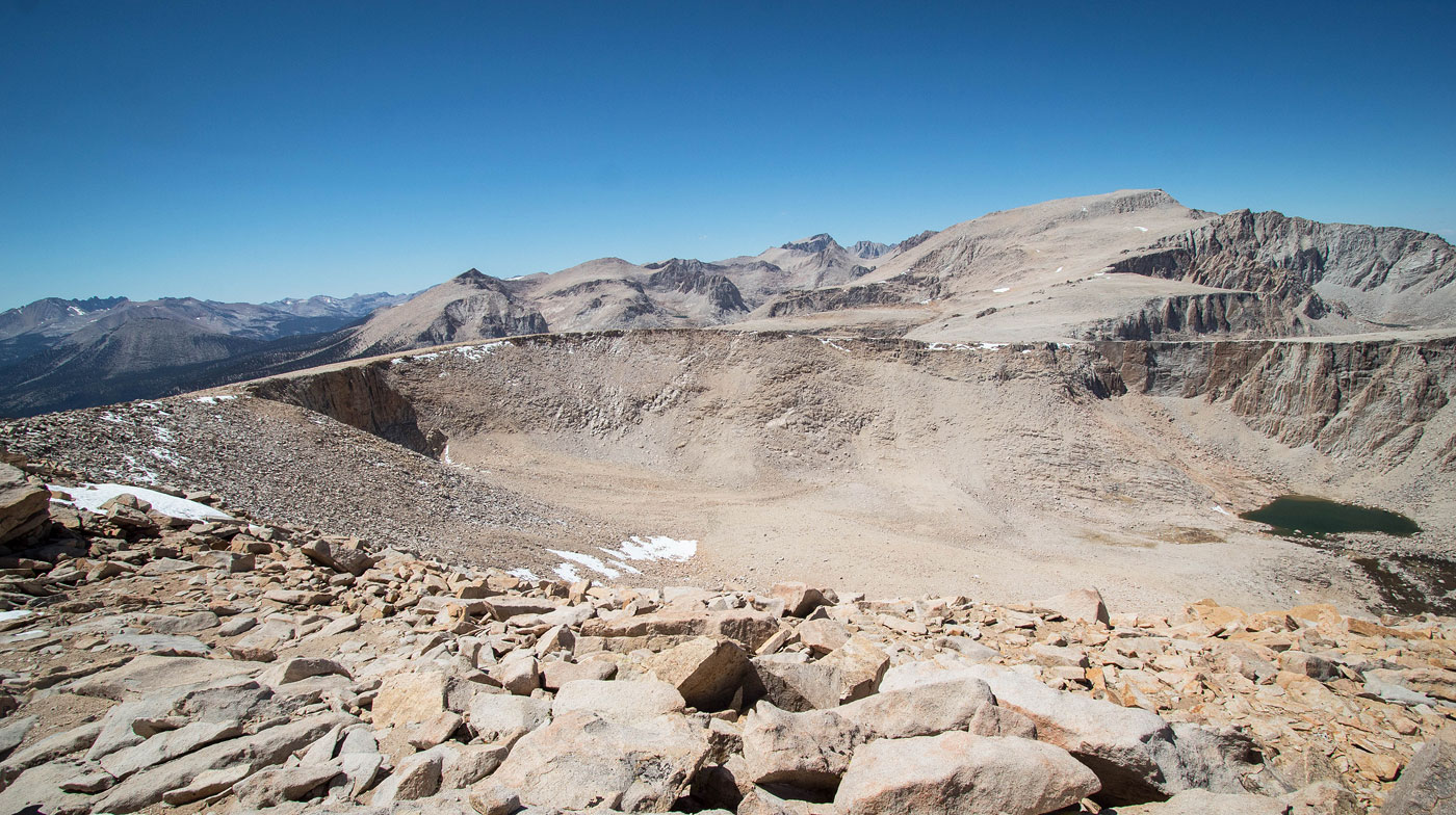
A few miles of forest walking led me to the junction of the New Army Pass and Old Army Pass route, where I kept right. I ascended to Cottonwood Lakes on the really nice trail, Mount Langley's southern cliffs coming into view as I made my way. I passed Cottonwood Lake #4 on its north side and made one big switchback into the eroded cirque. The trail is likely regularly maintained because I can't imagine it holding up for very long without it. I encountered some minor snow that, if I slipped, would result in a pretty bad day. Once at Old Army Pass, I continued on the easy-to-follow trail north toward Mount Langley. A few hundred feet of steep and sandy hiking led to a short, flat section. Here I observed the only Class 2 required for the Mount Langley route. It's only a couple of moves on big boulders required to gain the final ascent slope. Large cairns generally mark the way, but there seem to be unlimited social trail options to ascend the peak from here. Just keep heading up. The last few hundred feet were much less steep and the views from Mount Langley were delightful.
I headed back to Old Army Pass, where I picked up a social trail that led to the popular New Army Pass Trail. I took it up some switchbacks to New Army Pass. Many may want to descend back to the trailhead from here, and honestly the lakes below were quite inviting, but I was more excited to hike up to Cirque Peak to the south. I followed the Class 2 rim of the cirque for which Cirque Peak is named after, the terrain progessively getting more tedious. What started as a social trail finished with Class 2 boulder-hopping to the summit. The view toward Mount Langley from Cirque Peak was my favorite of the day. It gave perspective on quite how big the mountain is. I debated briefly about returning to New Army Pass and descending, but the prospect of making this route a bigger loop by tacking on the Cottonwood Pass Trail to the south was appealing, and I preferred to not backtrack along Ciruqe Peak's not-super-fun rim. I headed south off Cirque Peak on Class 2 boulders, which quickly became just a pleasant sandy slope. I followed the ridgeline more-or-less until it started to ascend again, and then I made a full descent when the terrain was clear of rocks and I could pretty much jog down unencumbered. Farther along the ridge seemed to have more rockiness, but the way I headed down brought me to the Cottonwood Pass Trail without any irritation.
I followed the Cottonwood Pass Trail back, passing the very pretty Chicken Spring Lake. A bunch of short switchbacks brought me down into the valley below, and the trail led me almost back to the Cottonwood Pass Trailhead, which isn't where I parked. Instead, I took a left at a sign that brought me back to my car.
Please consider helping me out if you find my site useful. I'm not sponsored, so all site fees are out-of-pocket and my time preparing these trip reports is unpaid. You can also hire me as a web developer. I really appreciate it!


If you find my site helpful, please help me replace my many broken cameras, fund my website fees (hosting, APIs, security), or just support my countless hours of work. I pay for all expenses myself, and all trip reports I post are unpaid and unsponsored, so any support is really appreciated!
If using PayPal, please select their option for "Sending to a friend" so they don't take out fees, thank you.
My site is free to use, but consider sending me a few bucks to help keep it running. Thanks in advance!