I provide a free route map, but you can also download a hike/drive GPX to assist you and to help support my site. Before sharing my GPX tracks with others, please remember my site is a free resource and I'm charging nominal fees to offset my substantial costs.
GPX track added to your cart.
Jul 07, 2023 — Mount Moosilauke has multiple possible approaches to reach its summit, the most popular of them being from the south using the shorter Gorge Brook Loop, but the Beaver Brook Trail interested me far more. This trail provides the most interesting and strenuous option, complete with waterfalls and a rocky trail, and is reportedly one of the most difficult sections of the Appalachian Trail. I parked at the Beaver Brook Trailhead, just south of Beaver Pond at Kinsman Notch, and started along the pleasantly forested hike. I passed a few through-hikers, one of whom I accidentally spooked into nearly falling since his headphones were blaring and he was belting out some discordant oldies, clearly in his own little world. I can only imagine how bored these long-distance hikers must get.
After a mostly flat walk that crossed Beaver Brook a few times, a couple of which utilized constructed bridges, the trail started ascending as it paralleled the heavily-flowing watercourse. I was surprised at how steep the Beaver Brook Trail abruptly became, especially since this was part of the AT, despite already knowing about this trail's reputation. Waterfalls cascaded loudly to my right as they toppled off the significantly angled streambed. The trail ascended directly next to it, often with a signifcant drop into the brook just inches away. There were no switchbacks, so instead the trail construction included lots of manmade devices to keep the going safer. Often wooden blocks were stapled into the rock face to help prevent slipping, and metal rungs/cables were placed for those who might need them. I was enjoying myself immensely, steep trails like this one being a highlight of the White Mountains. Beneath one of the larger waterfalls, the trail had a methodically-placed metal rung to prevent the potential for a bad slip as it worked around a small headwall. A bunch more wooden block steps, light scrambling, and ledges overlooking the waterfalls continued along the Beaver Brook Trail.
After over 1000 vertical gain in this fashion, the Beaver Brook Trail continued climbing steeply, but away from the watercourse. I passed a marked junction pointing to the Beaver Brook Shelter, one of many well-built structures for through-hikers and complete with a fancy outhouse. Past the shelter, large, wet rocks kept my attention so I could avoid slipping too often as I progressed up to a junction with the Asquam Ridge Trail, marking the east ridge of Mount Moosilauke. I headed west along the ridge, where the Beaver Brook Trail wrapped beneath Mount Blue's south side, losing a bit of elevation before regaining it. The trail continued to be quite rocky here, a couple of scrambly obstacles adding some fun and slowing down trail progress. I could see Mount Moosilauke through the trees along the ridgeline.
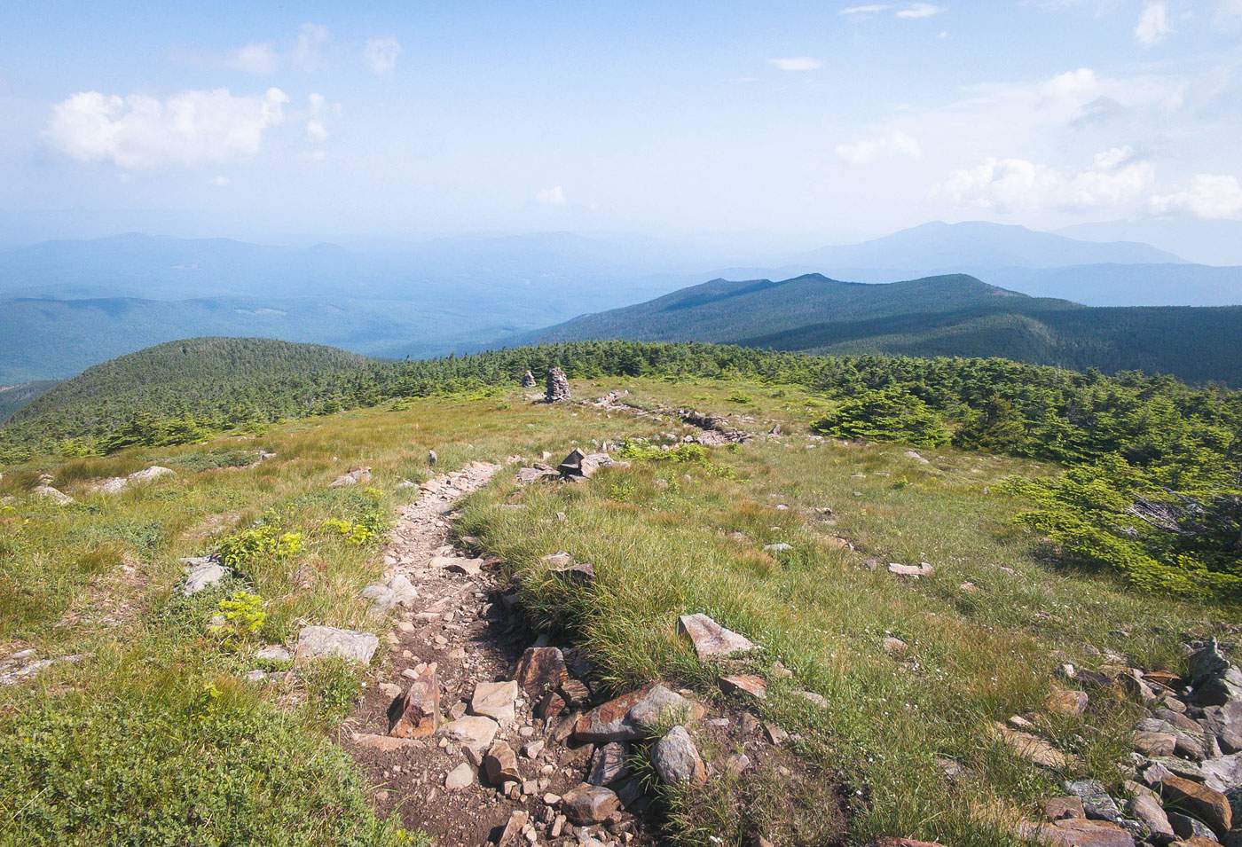
After a quick dip to a minor saddle beyond Mount Blue, the final ascent to the summit began. I passed the Benton Trail junction and emerged above treeline into a gorgeous bald that persisted to the high point. The views were spectacular during this last quarter mile walk.
Please consider helping me out if you find my site useful. I'm not sponsored, so all site fees are out-of-pocket and my time preparing these trip reports is unpaid. You can also hire me as a web developer. I really appreciate it!


If you find my site helpful, please help me replace my many broken cameras, fund my website fees (hosting, APIs, security), or just support my countless hours of work. I pay for all expenses myself, and all trip reports I post are unpaid and unsponsored, so any support is really appreciated!
If using PayPal, please select their option for "Sending to a friend" so they don't take out fees, thank you.
My site is free to use, but consider sending me a few bucks to help keep it running. Thanks in advance!