I provide a free route map, but you can also download a hike/drive GPX to assist you and to help support my site. Before sharing my GPX tracks with others, please remember my site is a free resource and I'm charging nominal fees to offset my substantial costs.
GPX track added to your cart.
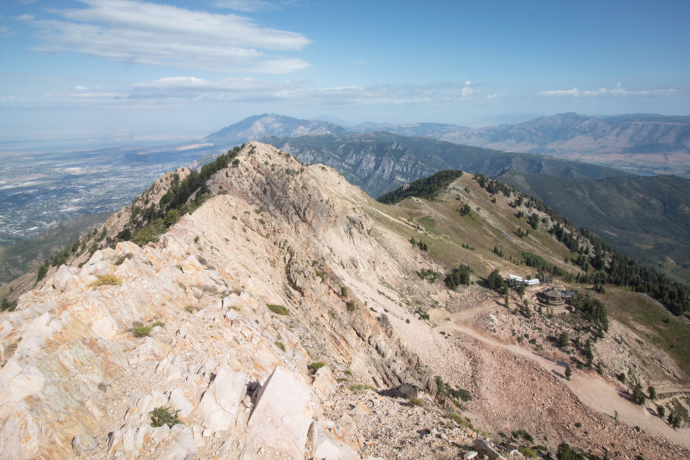
Sep 10, 2019 — My chosen route heads along the ridgeline from north to south, hitting Allen Peak, Mt. Ogden, The Needles, DeMoisy Peak, and Strawberry Peak. I'll preface this trip report with a lengthy note that there are countless route options up to the base of Mt. Ogden when starting from the east within the Snowbasin. The overwhelming web of trails, dirt roads, ski slopes, and mostly brush-free cross-country lends the east slopes to being really flexible for the approach. That being said, the route described in my attached map is not by any means the "best" route. I took the most efficient route I could figure out to get up to get to the summit before it rained, but then on the descent, I decided to meander along the Snowbasin Needles Trail (part of the trail system managed by the people who own the resort, I guess) to get back. Even the trailhead you choose can be different from mine: I parked on the side of the road and just headed past a gate and followed a dirt road. You could drive a bit farther to the Snowbasin Resort and start there. In addition to the web of potential approach options, you could also wait for the weekend and pay to take the gondola up to the Needles Lodge, removing a significant amount of mileage and vertical gain.
Alternatively, you could also come from the west along the Beus Canyon Trail, but I opted to skip that route because all references to it I found online and offline mentioned it being very overgrown. All this being said, it's hard to go too wrong when heading up the east slopes, but honestly none of them are particularly interesting and the hike is pretty boring until the ridgeline.
Assuming you're able to navigate any sort of weird combination of route options and have made it to the base of Mt. Ogden, the route becomes less free-form. I headed north along the Shelby John Trail (just a dirt road) past the Shelby John Lodge and up to the north ridge of Allen Peak. From Allen Peak, a fun Class 2 ridgeline led south to the summit of Mt. Ogden, and then an easy ridge walk continued over to the north ridge of DeMoisy Peak. A trail heads around DeMoisy Peak's west slopes. I decided to follow this since the ridge looked particularly brushy. I ended up ascending the peak's west slope since the trail clearly wasn't going to head to the summit, but I would recommend just following the trail to DeMoisy's south side and taking the much more mellow approach to the summit from the south rather than the steep north or west slopes.
Once down from DeMoisy, I took a quick jaunt up to Strawberry Peak and then followed the dirt road from the saddle of DeMoisy and Strawberry until it met up with the Needles Trail. As you'll see on my map, this trail wanders forever (since it's designed to be a mountain bike trail), and I took it simply because I wanted to enjoy the scenery via a trail rather than descending on dumb dirt roads and ski slopes. I should note that my descent route also leaves the Needles Trail a few times to follow a ski slope in order to avoid a bunch of long and tedious switchbacks. There were some nice views back toward Mt. Ogden and out to the east, but a bit tedious overall. Not doing the Needles Trail would definitely reduce the mileage of this hike significantly.
Please consider helping me out if you find my site useful. I'm not sponsored, so all site fees are out-of-pocket and my time preparing these trip reports is unpaid. You can also hire me as a web developer. I really appreciate it!


If you find my site helpful, please help me replace my many broken cameras, fund my website fees (hosting, APIs, security), or just support my countless hours of work. I pay for all expenses myself, and all trip reports I post are unpaid and unsponsored, so any support is really appreciated!
If using PayPal, please select their option for "Sending to a friend" so they don't take out fees, thank you.
My site is free to use, but consider sending me a few bucks to help keep it running. Thanks in advance!