Hike Mount Olympus, Triangle Peak, Mount Raymond Traverse (Wildcat Ridge) Wasatch-Cache National Forest, UT


Starting up the official Mt. Olympus Trail.
Near the Mt. Olympus summit.
Starting up the scramble to Mt. Olympus.
Looking down the start of the Mt. Olympus scramble.
Approaching Mt. Olympus summit.
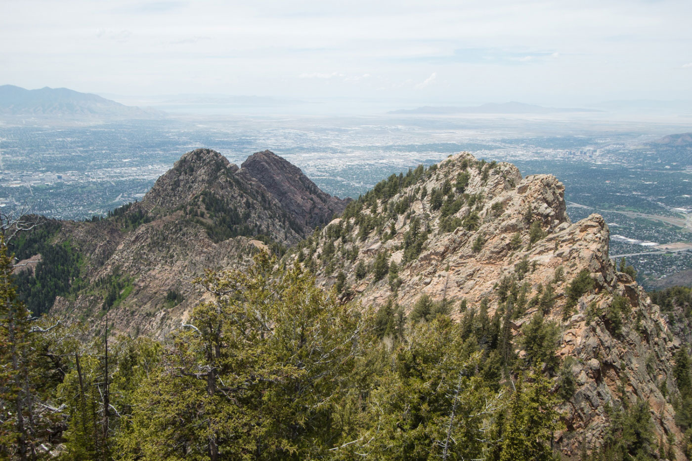
Mt. Olympus summit looking toward Triangle Peak. You can see most of the Wildcat Ridge traverse from here.
Approaching the first short knife edge.
Looking back at the ridgeline scramble.
Some route finding from Mt. Olympus to Triangle Peak, but not much.
A grassy section between Olympus and Triangle before the knife edge.
The highlight of the day, in my opinion.
Super fun knife edge on the way to Triangle Peak.
Obviously it's gorgeous.
Triangle Peak!
Class 2/3 scramble up Triangle Peak, depending on your chosen route.
Summit of Triangle Peak just ahead.
Triangle Peak summit looking toward Mt. Olympus.
Triangle Peak summit, starting toward Heughs Peak.
We left the ridge on the way to Heughs Peak. It seemed crumbly, but it might have been fun?
Headed up the forested section to Heughs Peak.
Heughs Peak summit.
Heughs Peak summit, looking back toward Triangle Peak (right), and Mt. Olympus (left).
Heading down from Heughs Peak, headed toward Mt. Olympus East.
Approaching Mt. Olympus East.
We did some totally unnecessary Class 4 scrambling to get to the summit. You could go up a talus field and keep it at Class 2/3.
After Mt. Olympus East, head down to the saddle between Mt. Olympus East and Wildcat Ridge Peak, where a massive rock pinnacle makes the ridgeline Class 5. Head left (north) away from the ridgeline, losing some elevation, and head up the terrible dirty scree, hugging the treeline.
Some views between Wildcat Ridge Peak and South Thayne Peak. None of the little blips of unnamed high points are difficult, and there are some sections of scrambling, but it's avoidable.
Looking east toward Twin Peaks Dromedary, Sunrise, etc.
South Thayne Peak ahead.
South Thayne Peak base.
Looking back from the base of South Thayne Peak.
Heading up South Thayne Peak.
Some Class 3 stuff to gain South Thayne Peak.
Class 2 scree toward the South Thayne Peak summit.
Almost at the South Thayne Peak summit, looking back toward the ridge we came up.
South Thayne Peak summit, looking toward Mt. Raymond.
Along the ridgeline from South Thayne Peak to Mt .Raymond.
Trail junction on the west side of Mt. Raymond. You could bail here rather than do Mt. Raymond, but it wouldn't take you to the trailhead you parked at.
Up the west ridge of Mt. Raymond.
Heading up to Mt. Raymond, view back.
Mt. Raymond summit.
Looking back along the Wildcat Ridge traverse from Mt. Raymond summit.
Official Mt. Raymond trail along the ridge.
Heading down from Mt. Raymond.
Classic Class 3 Mt. Raymond scramble section.
Approaching the saddle between Mt. Raymond and Gobblers Knob. Head left at the junction and follow the trail back, staying left at all junctions.
The trail becomes very green and forested.
Approaching the Terrace Picnic Area trailhead.
Just before the trailhead, you can look back and see the ridgeline far away.
Hire me or show me some love!
Hire/refer me as a web developer or send me a few bucks if you find my site useful. I’m not sponsored, so all fees are out-of-pocket and my time preparing trip reports is unpaid. I really appreciate it!