I provide a free route map, but you can also download a hike/drive GPX to assist you and to help support my site. Before sharing my GPX tracks with others, please remember my site is a free resource and I'm charging nominal fees to offset my substantial costs.
GPX track added to your cart.
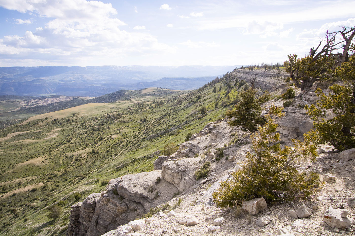
Jun 18, 2023 — I grew infatuated with the Wasatch Plateau last year after exploring the higher peaks in the area, and North Horn Mountain was one of the peaks that stood out on a topo map. Even though this is a short hike, located on its own and with high prominence, I figured North Horn Mountain would likely would have incredibly sweeping views. It sure did! I used to be into bouldering, so I was looking forward to finally driving through a popular bouldering area called Joes Valley within the Manti-La Sal National Forest, where gigantic sandstone blocks riddled the sides of the road. I enjoyed the lengthy drive into the recreation area and then on excellent dirt roads to reach the trailhead. I parked at a fenceline since it felt like a good spot to start. I could have gone higher, but I'd driven way out here and the scenery was lovely. The road continues in decent condition for another half mile, and then burlier vehicles can make it all the way here (39.21204, -111.21801), which would make this an extremely short hike.
The road hike was uneventful except for some pretty wildflowers and the captivating landscape views behind me. I reached a road junction higher up and continued north through the lumpy terrain, very minimal bushwhacking required. I could see the rim of North Horn Mountain just ahead. To reach it, I hiked up a steep Class 2 slope to a toe on the peak's southeast side. A short, flat section led to brief, steep ascent using animal trails and I was on the rim. The views here were comparable to the rest of the hike, but eroded pinnacles on the south rim were cool to look at from above.
Please consider helping me out if you find my site useful. I'm not sponsored, so all site fees are out-of-pocket and my time preparing these trip reports is unpaid. You can also hire me as a web developer. I really appreciate it!


If you find my site helpful, please help me replace my many broken cameras, fund my website fees (hosting, APIs, security), or just support my countless hours of work. I pay for all expenses myself, and all trip reports I post are unpaid and unsponsored, so any support is really appreciated!
If using PayPal, please select their option for "Sending to a friend" so they don't take out fees, thank you.
My site is free to use, but consider sending me a few bucks to help keep it running. Thanks in advance!