I provide a free route map, but you can also download a hike/drive GPX to assist you and to help support my site. Before sharing my GPX tracks with others, please remember my site is a free resource and I'm charging nominal fees to offset my substantial costs.
GPX track added to your cart.
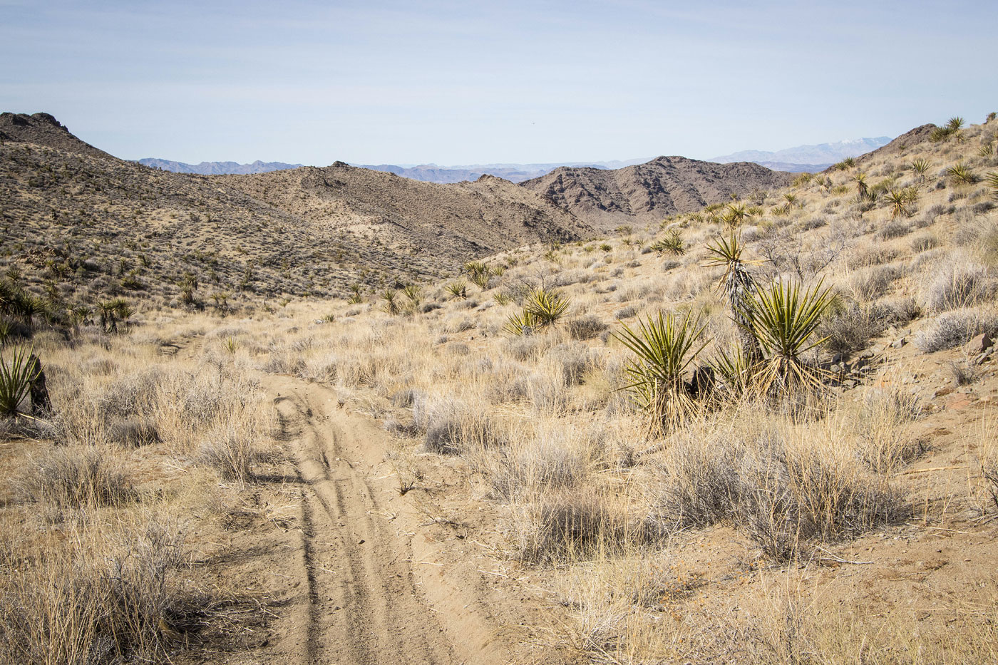
Feb 04, 2023 — Keyhole Peak is a minor summit just off NV-95 within the Eldorado-Newberry Mountains. To access the summit I could have used the popular standard approach route for the technical Keyhole Canyon and then just continued up Keyhole Canyon's upper wash, but I wanted to reach Keyhole Peak from a different direction. A bonus of coming the way I did is that I could also tack on Opal Peak. I recommend reaching the trailhead by using the graded Nelson Cutoff Road. If coming from the south, leave the highway here (35.61019, -114.91997), though the road might be a little difficult for passenger cars at the pass. Head north at this junction (35.69607, -114.87236). I parked where I did along this good road because there was an open gate with an unlocked lock on it. I wasn't sure if I'd get stuck within, so I decided to walk from there.
Opal Peak was just a quick road walk with views to the surrounding hills, so I just continued on to Keyhole Peak. This next summit is lower in elevation than Opal Peak was, so I'd have to lose quite a bit and have to regain on my way back. I set off to the south using a dirtbike trail along the ridgeline, then headed west from the saddle and down into Keyhole Canyon. The upper reaches of Keyhole Canyon are far less interesting than its slot canyon near the mouth, but I enjoyed following the singletrack through the sandy drainage. Keyhole Peak came into view and I decided my best option to reach it would be to ascend out of the drainage and up a steep slope (light Class 2) to gain a minor ridge above on the left. From here I scoped out a potential route that would lead me up Keyhole Peak's steep eastern slope.
With a little bit of route-finding I was able to keep the slope ascent Class 2, but it was mostly just typical loose desert stuff and the scrambling was not particularly interesting. There was some puzzling out to avoid little cliffy sections. Some views and light Class 2 led me along the crest to the high point, where I was hoping to get a glimpse down into Keyhole Canyon's narrows below, but this wasn't the case. This little outing was definitely just a way to reach a couple of desert lumps that I hadn't been to before and to get some exercise, certainly not a highlight of the area.
Please consider helping me out if you find my site useful. I'm not sponsored, so all site fees are out-of-pocket and my time preparing these trip reports is unpaid. You can also hire me as a web developer. I really appreciate it!


If you find my site helpful, please help me replace my many broken cameras, fund my website fees (hosting, APIs, security), or just support my countless hours of work. I pay for all expenses myself, and all trip reports I post are unpaid and unsponsored, so any support is really appreciated!
If using PayPal, please select their option for "Sending to a friend" so they don't take out fees, thank you.
My site is free to use, but consider sending me a few bucks to help keep it running. Thanks in advance!