I provide a free route map, but you can also download a hike/drive GPX to assist you and to help support my site. Before sharing my GPX tracks with others, please remember my site is a free resource and I'm charging nominal fees to offset my substantial costs.
GPX track added to your cart.
Oct 23, 2021 — These unnamed peaklets feature some of the lovely volcanic rock generally found in the Black Mountains, and served as a great add-on to their taller neighbor, Mount Perkins, nearby. I had no information about these peaks, so I contrived a loop that was more about scrambling and exploration moreso than efficiency. To reach the trailhead, leave AZ-93 here (35.6705855, -114.4598691) and follow the Eldorado Powerline Road west until this junction (35.664837, -114.491869), where you should keep left and continue southwest and then south. At this junction (35.63968, -114.50723) head east. High clearance is needed here due to a few big dips into washes, including the first to even get onto the road. There were no signs for wilderness areas and I believe this road is still open and driving on it is permitted, despite the fact that it's faded pretty significantly toward where I parked. Also, don't try continuing past my parking spot heading farther west - I don't think there are actually any other ways to reach this spot, despite roads drawn on maps hinting that there are.
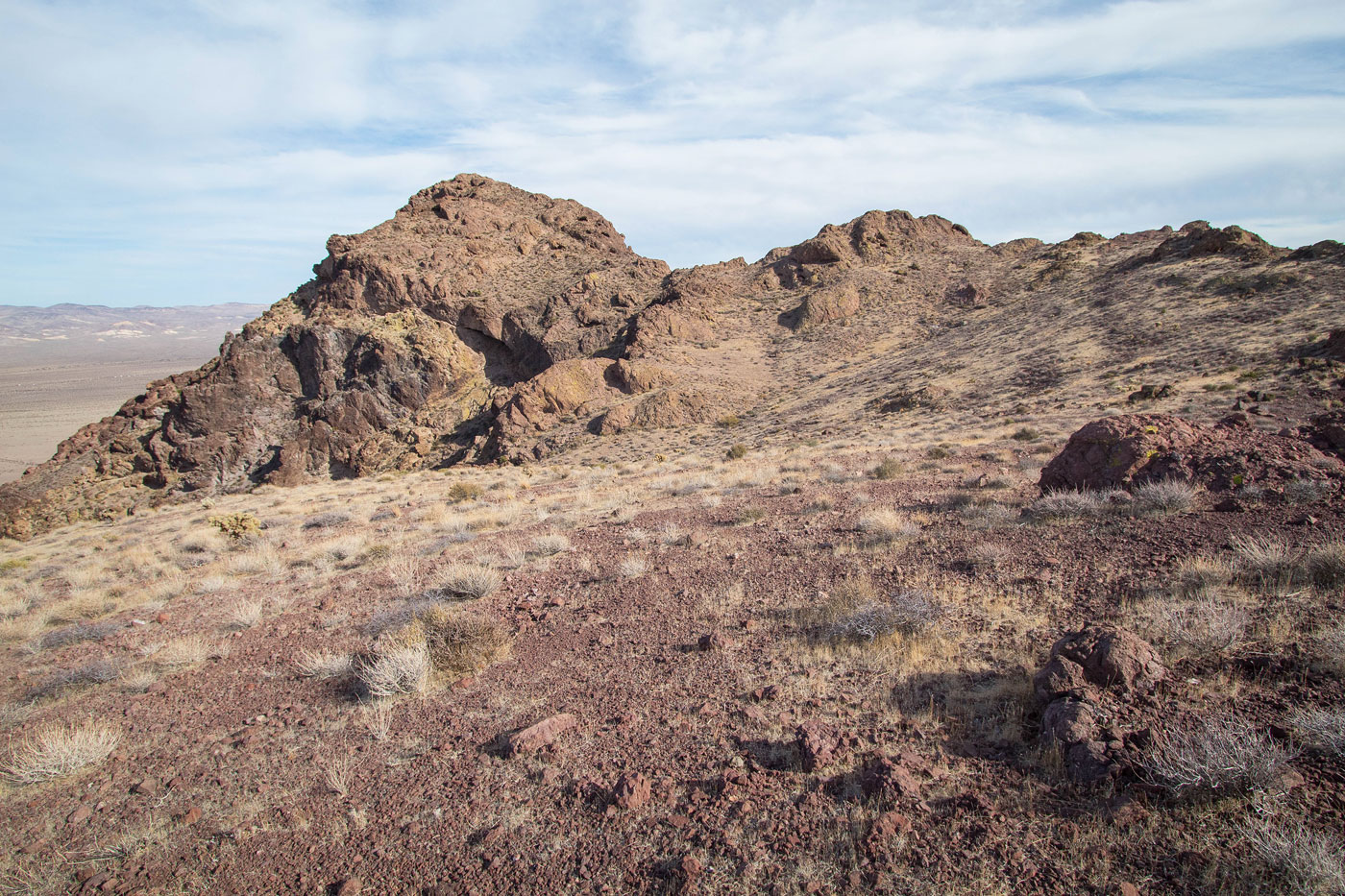
I started south through the open desert, planning to do Peak 4063 first since it's the larger of the three. Peak 4063 can be easily reached via a slope with some Class 2 from the west, but that would have broken my lovely loop and reduced the fun scrambling to a boring desert bump hike. Instead, I left the flat desert and ascended the peak's east face on progressively fun and steepening rock. Class 2 quickly became Class 3. A couple of dryfalls and small cliff bands required some navigating around. It's hard to give a specific description of my route, but is are definitely more than one option. The last few hundred feet did have some interesting Class 3/3+ without exposure and led to a final slope to the Class 2 summit block. This was a great, fun little peak, at least from this direction.
I dropped west off the summit to avoid some cliffs and continued south along the ridgeline down to a very scary-looking horn to the south, Peak 4046. Some navigating around cliff bands and rock outcrops led me to the base of the peak. Here I kept to the left around the ridgeline and then found a notch to get back to the crest. I would use this notch on the way back down as well to escape the ridgeline. Peak 4046 went at only Class 2+, surprising based on how it looked from afar. I backtracked to the aforementioned notch and descended the rocky slope to the open desert below. I contoured to the saddle on the south side of Peak 3722 and then started up its southern slope on Class 2 terrain. Once on the ridge crest, the last of the three summits came into view. I wrapped around some rock outcrops and stayed on flat, easy terrain and then headed up a quick Class 2 jaunt to the high point.
I wasn't really sure how to get down from here to complete the loop, since the west face of Peak 3722 was riddled with serious cliffs, but I attempted a route down a major gully on the northwest side of the peak, which led me down safely with Class 2 and some light bushwhacking. Back in the initial open desert I came in on, it was a light jog back to my car.
Please consider helping me out if you find my site useful. I'm not sponsored, so all site fees are out-of-pocket and my time preparing these trip reports is unpaid. You can also hire me as a web developer. I really appreciate it!


If you find my site helpful, please help me replace my many broken cameras, fund my website fees (hosting, APIs, security), or just support my countless hours of work. I pay for all expenses myself, and all trip reports I post are unpaid and unsponsored, so any support is really appreciated!
If using PayPal, please select their option for "Sending to a friend" so they don't take out fees, thank you.
My site is free to use, but consider sending me a few bucks to help keep it running. Thanks in advance!