

Starting from the trailhead. You can see the Homer Wilson Blue Creek Ranch below. Carousel Mountain visible top right. The Dodson Trail wraps around that peak.
Homer Wilson Blue Creek Ranch.
Starting along the Dodson Trail.
The Dodson Trail wraps around Carousel Mountain as it boops in and out of washes. The trail is cairned and easy to follow.
View back along the Dodson Trail.
Ascending along the Dodson Trail.
A switchback in the Dodson Trail, Carousel Mountain visible on the left.
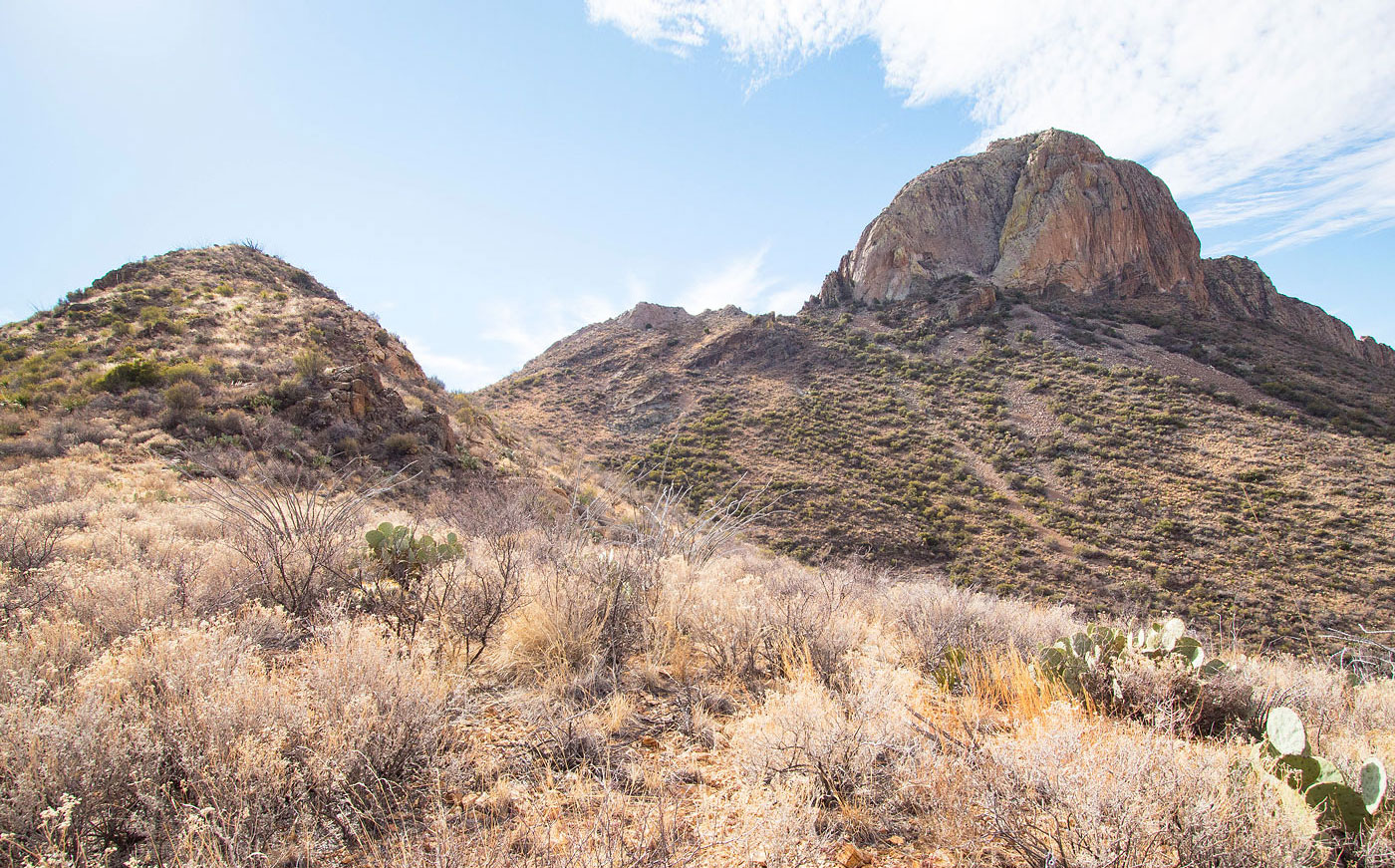
The Dodson Trail ascends to the saddle on the right in this photo.
Just before the saddle, view back the way I came. The Dodson Trail came from the dip in the center of this photo.
At the saddle, a view toward Picacho Peak (right). The Dodson Trail drops to the center of this photo.
View back toward the saddle I came down from.
Along the Dodson Trail, Picacho Peak visible top right.
At the junction with the Smoky Creek Trail. I stayed along the Dodson Trail for a bit (left).
Just before leaving the Dodson Trail and ascending the slope on the right.
View back toward the Dodson Trail after ascending the somewhat brushy slope.
Along the north ridge, a great view of Picacho Peak.
Along the ridge, a close-up toward Picacho Peak.
View back the way I came. Carousel Mountain in the distance on the left and the saddle I descended from previously. The Dodson Trail is on the far right, where I ascended from. My descent route later goes down the brushy drainage left of center, and I don't recommend going that way.
Along the ridge to Picacho Peak.
At the base of Picacho Peak after some light side-hilling.
Close-up of the route. Class 2/2+ and brushier if you start on the left, fun Class 3 if you go directly up the spine.
View back along the ridge. I side-hilled around the rock outcroppings in the center earlier.
Class 3 along the spine.
Fun Class 3.
View back down where the Class 2/2+ route and the Class 3 spine route merge.
Next bit, a Class 2/3 slab.
View down the Class 2/3 slabby stuff.
Wide shot from above the slab, back along the ridge.
Class 2 for a bit.
Short flat section and then the crux, seen center.
View down from the top of the Class 3+ crux.
Picacho Peak summit, view toward the South Rim and Emory Peak.
Picacho Peak, view southeast.
Picacho Peak, view west. Carousel Mountain visible top right.
Close-up southwest.
My less good descent route, view back up toward Picacho Peak.
Hire me or show me some love!
Hire/refer me as a web developer or send me a few bucks if you find my site useful. I’m not sponsored, so all fees are out-of-pocket and my time preparing trip reports is unpaid. I really appreciate it!