I provide a free route map, but you can also download a hike/drive GPX to assist you and to help support my site. Before sharing my GPX tracks with others, please remember my site is a free resource and I'm charging nominal fees to offset my substantial costs.
GPX track added to your cart.
Feb 09, 2023 — I looked across the wide open desert toward Pinto Mountain, which seemed an awfully long desert walk away. Younger peakbagger me had put this hike on the backburner since this big desert lump seemed to be a nuissance, but today I'd finally go for it. In hindsight I don't know why I waited so long since Pinto Mountain is actually a lovely desert peak with outstanding views. Plus the desert walk wasn't bad, especially with headphones and caffeine aiding my cause. Pinto Mountain seems to have three standard routes: a direct central ridge, and two branches on the southeast and southwest sides of the peak. I ascended the central one and descended using the southwestern one. A backtrountry map at the Turkey Flats Trailhead outlines these three routes, but recommends going counter-clockwise. Additionally, for some reason it recommends using the major drainage on the south side of the peak for the descent (my ascent), whereas I took the ridge. Maybe the map is outdated, since the more standard route people take seems to be to use this ridge rather than the drainage? Quick spoiler: I rarely recommend doing a hike as an out-and-back when loops are an option, but I found the descent to be pretty dumb, while the ascent was quite nice. More on that later.
I set out from the Turkey Flats Trailhead and headed northeast through the open desert, basically a flat walk to a minor sand dune. The sand dune provided a nice viewpoint for the three route options to reach Pinto Mountain, and from here I noted my ascent ridge and beelined toward it on lightly descending and easy terrrain. The final quarter mile before reaching the base of this ridge was rockier and had some little arroyos to hike through, formed by an alluvial fan.
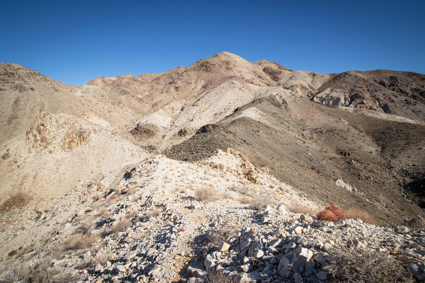
A social trail appeared almost immediately at the base of the ridge, so I followed it up, not even giving a second look at the NPS-recommended drainage option on the left. I definitely preferred taking the scenic high road rather than the rocky wash. Some Class 2 got me to the ridge crest, where the terrain was still a bit rocky. This faded shortly after, and the trail continued pleasantly for the proceeding couple thousand vertical feet. Along the way there was virtually no descending since the social trail wrapped around any minor lumps. At around 2700' the terrain became more colorful and Pinto Mountain looked really scenic. The ridge widened into a slope at around 3200' and climbed much more steeply up to the much more tame, flattish summit area.
From the summit of Pinto Mountain I took in the expansive views for longer than I usually do, really pleased with the route. I wasn't expecting the social trail to be in that good of shape, and I debated briefly just returning the same way. For some reason my brain is unable to allow me to pass on the opportunity for a loop, so I decided to continue northwest along the summit area and descend via the standard western route. As soon as the route dropped west I pretty much immediately regretted coming this way. The slope was steep and without a trail, embedded rocks creating loose terrain. The slope funneled me into a minor rocky drainage, full of rock-hopping and Class 2 slowness. What was this nonsense? The whole was up was a lovely trail with views toward colorful rock layers and this was garbage in comparison. While the terrain is nothing atypical for a desert peak, knowing a notably better/easier option was available had me kicking myself for coming this way. Anyway, I descended through this rocky gully for a short time, leaving it when tamer terrain became available on its right bank. Eventually this met up with a slightly more major drainage that came in on the left, and this funneled me into a short narrow section with more Class 2.
Finally, at around 2500' I was out of this side drainage and within the main wash that sweeps to the west. I followed it, wrapped around the reaches of Pinto Mountain's southwestern toe, and scurried through the now open desert. I actually ran into another hiker who was using this route as her ascent (based on the NPS' map recommendation at the trailhead). I do wonder what the southwestern route would have been like, but it's unlikely I'll return to check it out.
Please consider helping me out if you find my site useful. I'm not sponsored, so all site fees are out-of-pocket and my time preparing these trip reports is unpaid. You can also hire me as a web developer. I really appreciate it!


If you find my site helpful, please help me replace my many broken cameras, fund my website fees (hosting, APIs, security), or just support my countless hours of work. I pay for all expenses myself, and all trip reports I post are unpaid and unsponsored, so any support is really appreciated!
If using PayPal, please select their option for "Sending to a friend" so they don't take out fees, thank you.
My site is free to use, but consider sending me a few bucks to help keep it running. Thanks in advance!