I provide a free route map, but you can also download a hike/drive GPX to assist you and to help support my site. Before sharing my GPX tracks with others, please remember my site is a free resource and I'm charging nominal fees to offset my substantial costs.
GPX track added to your cart.
Feb 09, 2023 — Feldspar Benchmark is a prominent peak outside of Apple Valley CA. I found it odd that a peak so close to civilization wouldn't have an official trail system or more ascent logs, but maybe this is just because it's a peak easily overshadowed by the nearby San Bernardino Mountains. The peak also seems to be known locally as Dead Man's Peak, though there's very little information about it online. You'll want to approach the trailhead by driving in from the west via Yucca Loma Road since coming from the south results in a blocked off road. Yucca Loma Road ends at an old landfill here (34.50088, -117.11185) before continuing east on a road likley not suitable for passenger cars. The base of the peak is honestly just ugly, really just a dumping ground, unfortunately.
Right from where I parked, I located a really obvious trail that made me feel like royalty. It's graded and complete with rocks constructed on either side. I started up, lots of little switchbacks climbing the western slopes of Feldspar Benchmark. The views improved, though they're mostly of suburban sprawl. Who built this trail? It's unmarked on maps or even on any sort of trail app. Such a kind and loving heart someone must have to put in this much effort. I wasn't complaining of course, a rare desert trail always welcome. I started getting glimpses toward the currently snow-capped San Bernardino Mountains, and after about 800 vertical gain I reached a flatter section where the trail continued east. Feldspar Benchmark was visible ahead, and the trail continued. I passed some rusty tools and suspected the mysterious trail would end, but it continued in slightly less well-maintained form all the way to the saddle on the south side of the peak.
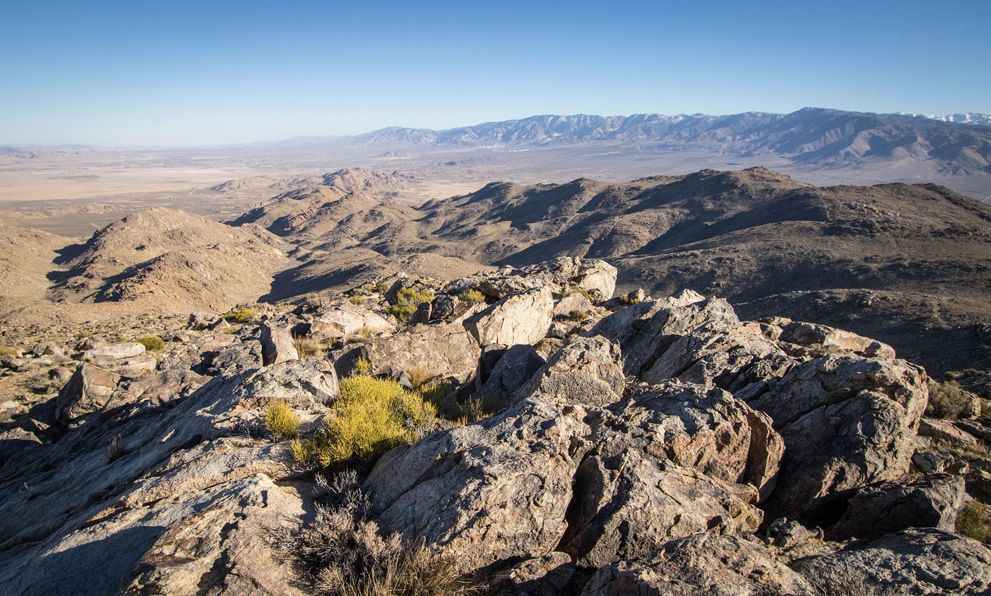
From the saddle, I noticed that a few hundred feet above is a small cliff that looks tempting to head directly toward, but this isn't the summit and there's a lot of rocky terrain beneath it. I actually found that making an ascending traverse to the right avoided much of the Class 2 boulder-hopping terrain and kept me on steep grassier slopes. I reached the eastern side of the peak and continued to the summit from here, where the views were nicer than I expected. I backtracked the way I came.
Please consider helping me out if you find my site useful. I'm not sponsored, so all site fees are out-of-pocket and my time preparing these trip reports is unpaid. You can also hire me as a web developer. I really appreciate it!


If you find my site helpful, please help me replace my many broken cameras, fund my website fees (hosting, APIs, security), or just support my countless hours of work. I pay for all expenses myself, and all trip reports I post are unpaid and unsponsored, so any support is really appreciated!
If using PayPal, please select their option for "Sending to a friend" so they don't take out fees, thank you.
My site is free to use, but consider sending me a few bucks to help keep it running. Thanks in advance!