I provide a free route map, but you can also download a hike/drive GPX to assist you and to help support my site. Before sharing my GPX tracks with others, please remember my site is a free resource and I'm charging nominal fees to offset my substantial costs.
GPX track added to your cart.
Feb 16, 2021 — To wrap up my obsession with the Havasu National Wildlife Refuge region, I recruited Whiley to head to the high point, Powell Peak. We decided to add on a couple of minor peaks in its proximity, creating a nice loop in the eastern reaches of the Refuge. While this isn't a good first visit to the area since the peaks aren't particularly unique, it was a nice loop overall. The road leading to our starting point was fine for any mid-clearance vehicle, the road in surprisingly good shape and less sandy than other roads I've encountered in this area. Google will navigate you here (34.644376480597494, -114.34041486689166), but past that it's just a matter of following the most obvious road leading northwest. We passed a sign that read no vehicles allowed Jan - Apr past this point (34.64413, -114.34019), but I'm not sure if this is accurate or monitored.
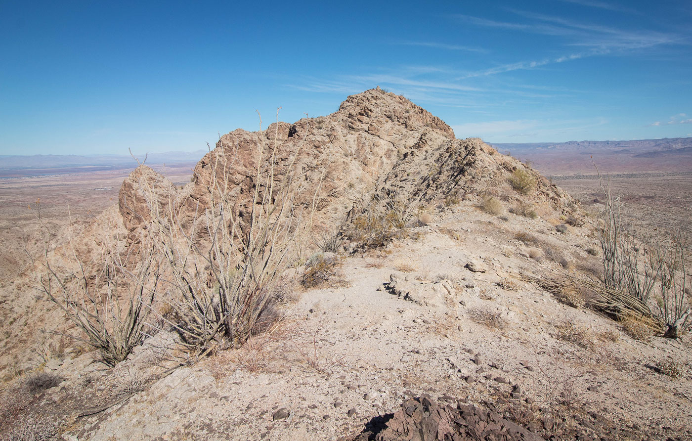
From our parking spot, we headed first to Peak 2274, navigating easy sandy foothills and gaining its east ridge (Class 2), following it to the peak's twin summit blocks. The southern one was higher. Without lingering, we headed down Peak 2274's northwest steep and loose slope (Class 2) and continued along the base of the ridge crest on its right. Although we thought it might be tricky, the route ended up only introducing a Class 2+ move here or there, obstacles created from the rocky terrain. While dropping down to lower and less rocky terrain would have worked, it would have introduced a bit more vertical gain. Once off the ridge, we worked our way through the foothills for a short time before landing in a major wash to the east of Powell Peak, our next objective. We crossed over an ATV road and made our way into a smaller wash to the south of Powell Peak and then continued up its pleasant Class 2 south slopes. At first glance, I got really excited about a cool-looking rocky outcrop that I thought was Powell Peak, but this was just a false summit and not the true peak. We kept to the left of the cool feature and continued on a pleasant ridge to the summit of Powell Peak. There was a single Class 2+ move below the summit block. Tumarion Peak to the west looks far more daunting from here than it actually is.
Whiley and I debated on the best way to get down from Powell Peak. We could return the way we came, but that would require lots of backtracking. Instead, we found the least steep option (Class 2+) on Powell Peak's east face that led down a loose and somewhat unpleasant slope. This was the least fun part of the day, but it still wasn't bad or even sketchy, just slow and loose. Our desert stroll on the way to Peak 1900 to the east began nicely, but we began to realize the many, many bumps and foothills beneath the peak would slow us down quite a bit, the obstacles becomes larger the closer we got to the peak. The bumps aren't obvious on a topo, and caused the approach to Peak 1900 more of an undertaking than anticipated. Our goal was what looked like some old mining ruins at the base of the peak. These turned out to possibly be part of an active mine, a notice on a post reading "Goldspeck 2011". A really nice miner trail brought us to the ridgeline, an unexpected treat. While it will be tempting to side-hill to get to the summit to the north, I recommend sticking to the ridgeline as much as possible. The terrain is loose and slow otherwise. Class 2 brought us to the summit of Peak 1900.
We backtracked along Peak 1900's ridge and followed a miner trail south which led to a dirt road that wouldn't lead us back to the car. Instead, some more winding around and over foothills added some minor annoyance as we made our way back.
Please consider helping me out if you find my site useful. I'm not sponsored, so all site fees are out-of-pocket and my time preparing these trip reports is unpaid. You can also hire me as a web developer. I really appreciate it!


If you find my site helpful, please help me replace my many broken cameras, fund my website fees (hosting, APIs, security), or just support my countless hours of work. I pay for all expenses myself, and all trip reports I post are unpaid and unsponsored, so any support is really appreciated!
If using PayPal, please select their option for "Sending to a friend" so they don't take out fees, thank you.
My site is free to use, but consider sending me a few bucks to help keep it running. Thanks in advance!