I provide a free route map, but you can also download a hike/drive GPX to assist you and to help support my site. Before sharing my GPX tracks with others, please remember my site is a free resource and I'm charging nominal fees to offset my substantial costs.
GPX track added to your cart.
Aug 02, 2023 — Quail Mountain and Mount Hope are a pair of 13ers most efficiently accessed from Hope Pass, which is accessed via the Colorado Trail. Though-hikers on the CDT also seem to enjoy taking a detour to Hope Pass since the views are so nice. I chose to start my hike from the south using the Sheep Gulch Trailhead. Starting tame, the trail led through the forest and past a junction that leads to the ghost town of Winfield. Continuing north from this junction, the trail steepenes, switchbacking occasionally up Sheep Gulch. Behind me I could see Huron Peak, and as I gained elevation, more of the Collegiate Peaks 14ers poked out on the horizon. The trail was in great condition and I quickly reached tree line, leaving the lovely forested setting behind. The Colorado Trail then began to switchback widely through talus fields and tundra as it made its way up to Hope Pass, the views becoming even more amazing.
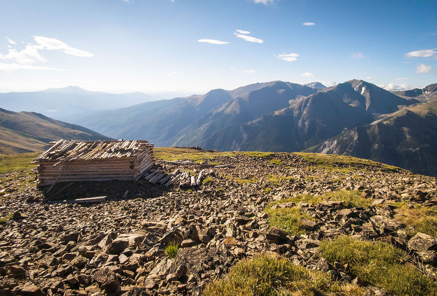
From Hope Pass, I decided to first hike east to Quail Mountain. Later from Mount Hope I noted a social trail that makes one giant switchback on the southern slope of Quail Mountain, but I didn't know about it at the time and instead hiked directly up its west ridge. There was a social trail here too, but it was definitely pretty steep. Never exceeding Class 2, I hiked up to the top of the slope to a false summit and into the morning sunlight. Quail Mountain was about a quarter mile away, a simple tundra walk with some light talus spattered in. An old cabin rested on the summit, an idyllic foreground for the colossal Collegiate Peaks in the distance.
I backtracked to Hope Pass and started up Mount Hope. There's a faint social trail at first, but it soon gets difficult to stay on it as the terrain becomes more covered in talus. I recommend keeping just left of the crest initially to avoid the jagged and loose rock, though this doesn't seem to exceed Class 3/4 if you want to add a tiny bit more spice to the ascent. Keeping left, Class 2 talus led me around the initial outcroppings and then back to the crest. I managed to hike on snippets of social trail, really only visible when the rockiness faded into spurts of tundra. Much of the ascent was straightforward, but there are social/animal trails that may trick you into staying significantly below the crest. I recommend trying to stick to the crest as often as possible since those many social trails ultimately require you to ascend the slope anyway.
The last few hundred feet to the top of Mount Hope's east ridge became steeper and more rocky. At one point a more significant headwall veered me to the left to overcome it more safely. The ascent here creeps into Class 2+ territory due to loose rock and steeper scrambling, but I never really had to pull any climbing moves. More than one social trail has eroded the slope to the point that I was hiking on dirt beneath the talus, an inevitable result of many people hiking on a loose mountain without an official trail. A final Class 2+ move led to the top of the rocky ridge and onto tundra. The open terrain led me the remaining short hike to the summit of Mount Hope. Mount Hope is just under 14,000 feet, so it gets a lot less attention than its slightly taller neighbors. The views are spectacular since it's a front-row seat toward the Collegiate Peaks to the south, as well as toward Twin Lakes and Mount Elbert to the north.
Please consider helping me out if you find my site useful. I'm not sponsored, so all site fees are out-of-pocket and my time preparing these trip reports is unpaid. You can also hire me as a web developer. I really appreciate it!


If you find my site helpful, please help me replace my many broken cameras, fund my website fees (hosting, APIs, security), or just support my countless hours of work. I pay for all expenses myself, and all trip reports I post are unpaid and unsponsored, so any support is really appreciated!
If using PayPal, please select their option for "Sending to a friend" so they don't take out fees, thank you.
My site is free to use, but consider sending me a few bucks to help keep it running. Thanks in advance!