I provide a free route map, but you can also download a hike/drive GPX to assist you and to help support my site. Before sharing my GPX tracks with others, please remember my site is a free resource and I'm charging nominal fees to offset my substantial costs.
GPX track added to your cart.
May 29, 2021 — The road leading to a remote ranch is in amazing shape for any vehicle. The dirt roads from NV-318 are great, whether you come in from the north (38.41492, -115.0274) or south (37.74008, -115.11918). To get to the base of the Quinn Canyon Range, navigate here (38.10997, -115.50978). The road continues to be excellent as you head into a ditch and back out, continuing generally southwest to here (38.02871, -115.58304). Follow this also excellent road west to the trailhead. You'll pass a ranch, where the road begins to degrade significantly here (38.06399, -115.66959). While I didn't experience any difficulties with the ranchers, a couple of other reports seem to elude to the the owners not being particularly friendly toward hikers leaving their cars near the ranch entrance. I'd recommend either parking a bit before the ranch, or driving past the ranch to leave your car as not to step on anyone's toes. My trailhead coordinates above assume you can make it about a half mile past the ranch where the road then becomes truly high clearance. Many vehicles could make it to the 4WD trailhead farther up (38.07217, -115.68669, also marked on my map), cutting off about 2 miles from the round-trip hike distance. ATVers can drive significantly farther along the road from even there, but it's a pretty enough hike on overgrown doubletrack that I'd recommend just walking it.
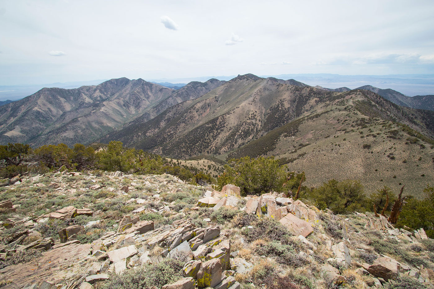
A few miles along the ATV trail led me to the base of Quinn Canyon Range High Point's southern spur ridge. I left the ATV trail and headed north up this steep ridgeline. The tree-dodging was minimal and I had almost no brush to content with, so that was nice. The ridge changed once in a while from steep to less steep and back again as I made my way to the summit. The views were really nice as I got higher up, revealing the really nice and meadowy ridgeline that comprised my traverse to come. The summit was nice as well, but I didn't stay too long, heading west along the very obvious ridgeline. I passed over unranked Peak 10089 (just a big bump) on my way to Stairstep Mountain and aside from this peak it made sense just to follow the lightly undulating ridgeline except for a couple of small humps where animal trails led just below the humps' high points. The last few hundred feet to the summit of Stairstep Mountain was lighty forested, and the views from its summit weren't great. I continued on, but was almost immediately blocked by a big rock outcrop along the southern ridge. I certainly wasn't expecting this after such a casual ridge walk so far. I decided keeping to the left (east) around the rock outcrop would be more wise, and looking back later from below convinced me I was correct in doing so. It was a steep descent down a dirty hill that led to a scree slope, but went at Class 2. In order to make my way back to the ridge crest I had to pick my way around some minor baby cliffs, but I eventually got there.
I avoided a minor bump along the way from Stairstep Mountain, side-hilling being a better alternative for once. I could see the saddle separating me from Sage Mountain ahead, but reaching it would require what looked like some gnarly bushwhacking on the final bump before descending to the saddle. After some light annoyance from sharp bushes, I emerged onto the ridgeline. To my left was a small cliff. I found a Class 2 weakness to escape the brushy ridge and instead finished the descent to the saddle on a steep slope with minimal brush using animal trails for guidance. Honestly this section is the worst part of the day. I basically had decided to keep the left of the loose and brushy ridge and instead descended using the slightly less brushy loose slope to the saddle.
Aside from a short Class 2 section toward the top of Sage Mountain - North, the ascent from the saddle was straightforward. And the traverse from the North summit to the true Sage Mountain had some nice views. I continued east along the ridge from Sage Mountain, deciding to just stick to the crest and head up to Steep Mountain. I noted a brushy-looking ridgeline that could lead me east and down to the ATV trail I came in on quite directly, but the brush deterred me and I opted to instead head northeast along the more friendly-looking ridgeline. Almost immediately after dropping off Steep Mountain I encountered some scree and light talus, but it was short-lived. Some easy grassy walking led steeply most of the way down. Farther down the ridgeline had a couple of rock outcrops along its crest which I avoided on the left. The last hundred feet back to the ATV trail had some minor bushwhacking. Once back on the ATV trail, I followed it back the way I came.
Please consider helping me out if you find my site useful. I'm not sponsored, so all site fees are out-of-pocket and my time preparing these trip reports is unpaid. You can also hire me as a web developer. I really appreciate it!


If you find my site helpful, please help me replace my many broken cameras, fund my website fees (hosting, APIs, security), or just support my countless hours of work. I pay for all expenses myself, and all trip reports I post are unpaid and unsponsored, so any support is really appreciated!
If using PayPal, please select their option for "Sending to a friend" so they don't take out fees, thank you.
My site is free to use, but consider sending me a few bucks to help keep it running. Thanks in advance!