stav is lost logo
  • Find Hikes
    • Most recent
    • Trip Report Index
    • Hikes by Region
    • Search Hikes
  • Map
  • About
  • Love
Hike Sawyers Peak in Gila National Forest, New Mexico - Stav is Lost

Hike Sawyers Peak Gila National Forest, NM

Class 1 7.8 miles 1800 gain 3-5 hrs Out and Back
Effort
Beauty
Personality
Solitude
DirectionsRoute MapDownload GPX

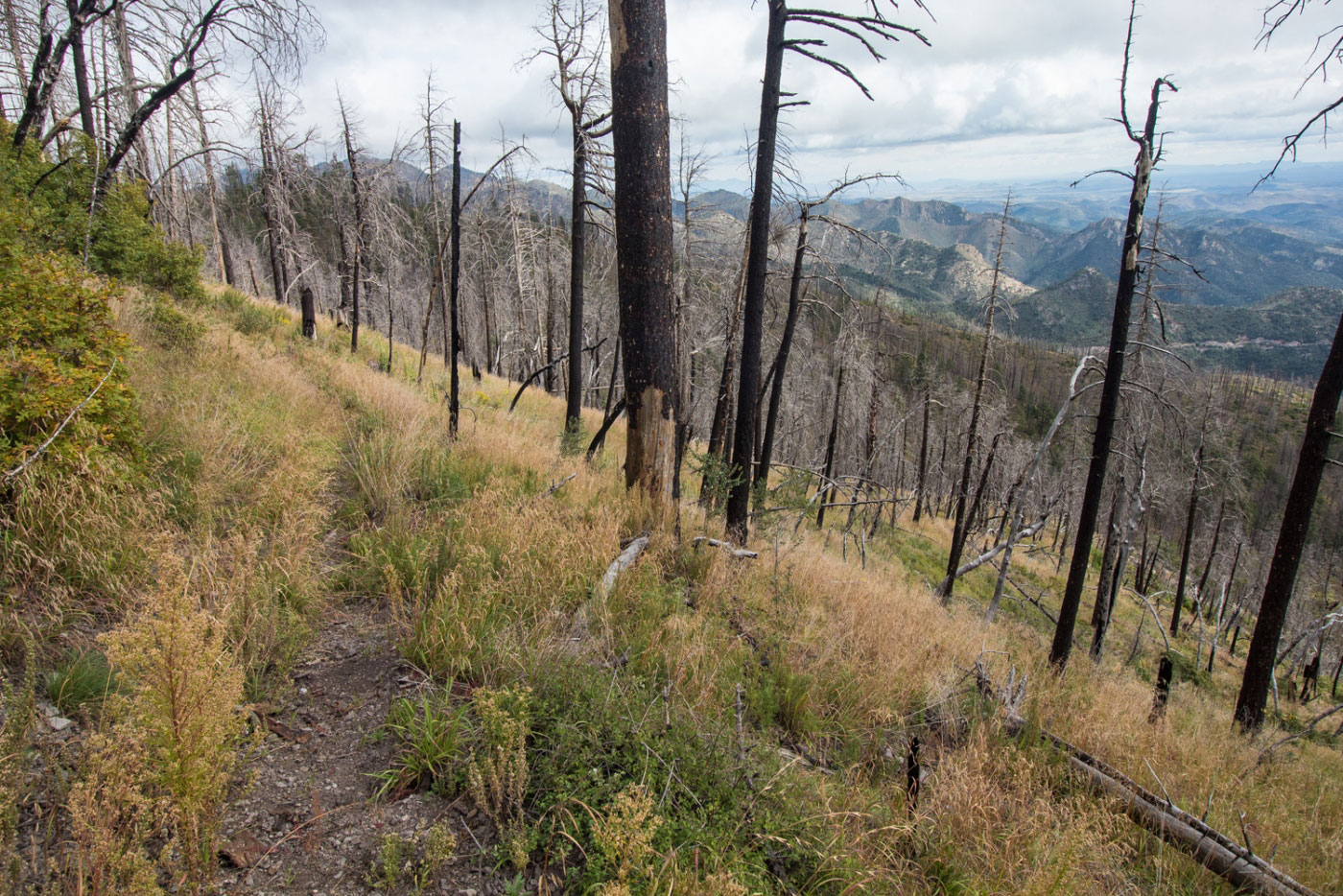
Oct 07, 2018 — I parked at Emory Pass and located the trailhead for Sawyers Peak. Despite being heavily burned in the 2013 Silver Fire, Sawyers Peak is still a nice hike through a strange, blackened landscape. There are some downed trees and thorn bushes encroaching on the trail, but it's still a pleasant walk. I followed the Black Range Crest Trail on a pretty easy grade up to just east of Sawyers Peak. The views toward the northern rolling hills of the Gila are lovely, and more visible due to the dead trees. The trail doesn't lead to the true summit, so when I reached Sawyers Peak's east ridge, I left the trail and bushwhacked up a steeper slope to gain the summit. You might want to also check out Hillsboro Peak just across the street.

PEAKS ON HIKE
Elevation (ft) / Prominence (ft)
Peaks on hike
Elevation
Prominence
1
Sawyers Peak
9672 ft
1506 rise

Show me some love

Please consider helping me out if you find my site useful. I'm not sponsored, so all site fees are out-of-pocket and my time preparing these trip reports is unpaid. You can also hire me as a web developer. I really appreciate it!

Thank you

Next HikePrev Hike
  • Next Hike
  • More Near Here
  • Prev Hike
photo protector Starting from Emory Pass, head up the Sawyers Peak Trail through a burn area. There are some nice views and the burn area is quite pleasant despite being, well... burnt.
Starting from Emory Pass, head up the Sawyers Peak Trail through a burn area. There are some nice views and the burn area is quite pleasant despite being, well... burnt.
photo protector No caption.
photo protector Not much to comment on - it's a nice walk through a burn area with views of the surrounding mountains.
Not much to comment on - it's a nice walk through a burn area with views of the surrounding mountains.
photo protector No caption.
photo protector Eventually you'll get to a trail junction - stay along the ridgeline on the trail.
Eventually you'll get to a trail junction - stay along the ridgeline on the trail.
photo protector No caption.
photo protector Leave the trail eventually to gain the summit, which has no official trail. Cairns mark the way, but as long as you're going uphill, you'll get there.
Leave the trail eventually to gain the summit, which has no official trail. Cairns mark the way, but as long as you're going uphill, you'll get there.
photo protector No caption.
photo protector Sawyers Peak summit, looking north.
Sawyers Peak summit, looking north.

Show Me Some Love

If you find my site helpful, please help me replace my many broken cameras, fund my website fees (hosting, APIs, security), or just support my countless hours of work. I pay for all expenses myself, and all trip reports I post are unpaid and unsponsored, so any support is really appreciated!

If using PayPal, please select their option for "Sending to a friend" so they don't take out fees, thank you.

PayPalVenmoCash App

About  Contact  Love

© 2023 Stavros Basis.

DISCLAIMER: All activities you find on this site are dangerous. I am not responsible for anything you do in the outdoors. Please practice good ethics, and don't take any risks that put yourself or others in danger.


Thanks for visiting!

My site is free to use, but consider sending me a few bucks to help keep it running. Thanks in advance!

Sure!Nope.