I provide a free route map, but you can also download a hike/drive GPX to assist you and to help support my site. Before sharing my GPX tracks with others, please remember my site is a free resource and I'm charging nominal fees to offset my substantial costs.
GPX track added to your cart.
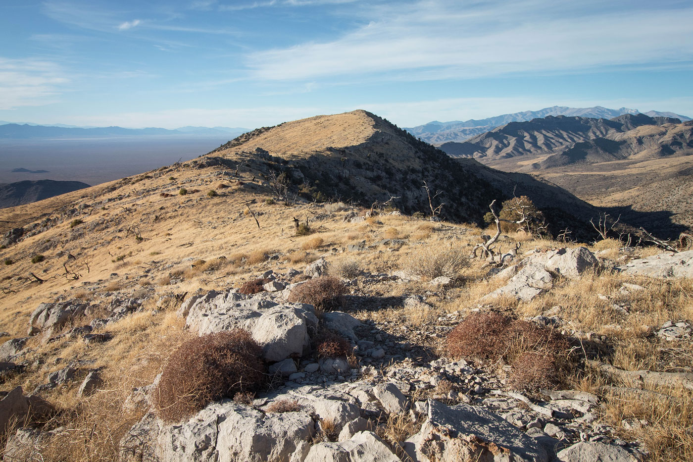
Jan 15, 2021 — This pleasant hike on mellow terrain summits two peaks to the west of Goodsprings, NV. They don't seem interesting summits in any way when viewed from the surrounding area, but the views from above are great. Both Shenandoah Peak and Ridge View Peak had only a couple of short Class 2 sections, allowing us to mostly stroll through the grassy desert terrain rather than deal with loose rock, as is often the case. Austin and I parked at Wilson Pass (fine for any car) and headed south to Shenandoah Peak first. This would be the easier of the two peaks, mostly due to the vertical gain. There was an animal trail for the first half mile or so, but then the sloping ridge served as a perfectly obvious route. Halfway up was a cliff band we were able to mostly avoid with a single Class 2 section among a short, steep slope. The last half mile was along the summit ridge leading to Shenandoah Peak, where we could see Devil Peak and the other Stateline Hills area summits.
Back at Wilson Pass, we headed north along a short-lived slope before making it to the gradual ridge that would lead us to Ridge View Peak. Along the way we were able to avoid a couple of minor cliff bands, but found one Class 2 (2+ maybe?) spot that we decided was much easier to just climb over than try to wrap around. Ahead we could see a steeper section with some rocky terrain that likely wouldn't cause problems, but would be steeper and slightly out of character for the rest of the hike. We stuck to the ridge crest and were able to avoid this rocky terrain, emerging above onto a delightful meadow-like setting. There was very little vertical gain from here to Ridge View Peak, and the ridge's broadness gave a unique sensation of feeling like we were very high up on something that resembled more of a mesa or island than a peak. The way the slopes on either side fell away along with the golden sunset lighting might have made this seem more interesting than it really was, but I felt like I wanted to frolick through the grasses. We could see Mount Potosi, Kingston Peak, and others. Nice perspective of the other peaks in the area.
Please consider helping me out if you find my site useful. I'm not sponsored, so all site fees are out-of-pocket and my time preparing these trip reports is unpaid. You can also hire me as a web developer. I really appreciate it!


If you find my site helpful, please help me replace my many broken cameras, fund my website fees (hosting, APIs, security), or just support my countless hours of work. I pay for all expenses myself, and all trip reports I post are unpaid and unsponsored, so any support is really appreciated!
If using PayPal, please select their option for "Sending to a friend" so they don't take out fees, thank you.
My site is free to use, but consider sending me a few bucks to help keep it running. Thanks in advance!