I provide a free route map, but you can also download a hike/drive GPX to assist you and to help support my site. Before sharing my GPX tracks with others, please remember my site is a free resource and I'm charging nominal fees to offset my substantial costs.
GPX track added to your cart.
Apr 08, 2023 — I've been spending a bunch of time hiking silly bumps around Las Vegas, resulting in quick out-and-back hikes that are too short to write a trip report for. These peaks are a few of those, but this loop seemed worthwhile enough, even though there are probably like three other people in the world who would ever want to hike these minor summits. Nestled on the northern side of McCullough Mountain, the hike is located within the South McCullough Wilderness area and is obscure enough to not have any named peaks or landmarks nearby.
Driving out to this hike was the first time I passed the hideous art installation called Seven Magic Mountains, and I thought that maybe, just maybe, I might want to check it out since it was right there. Nope. Leave Las Vegas Boulevard here (35.82763, -115.28382) and follow the pavement to this good dirt road (35.76508, -115.26181). This road is fine for passenger vehicles until the last couple of miles, where it gets a bit rockier. I parked right at the wilderness boundary. A legal ATV route is carved through the wilderness, and I used that for my return portion of the loop. It didn't make sense to drive on it since I'd be returning to the same spot on foot anyway to complete my loop.
I set out up the wash, leaving it for a minimally rocky, steep slope to gain Peak 4637. This peak is set apart from the other two I'd be hiking to on this outing, and it ended up being a bit of an inconvenience. On my first inspection of a map when planning this loop, it somehow slipped my notice that this peak is separated from the main ridgeline via a meandering, lumpy ridgeline. I dropped significant elevation and was ultimately spit out into a wash to the southeast. I followed this wash a short time and decided to ascend toward my next peaks via a slope that seemed the most rational for where I was attempting to go.
My next peak, Peak 5107, is set apart from the main McCullough ridgeline as well. This being the second inconveneint peak to reach for the day amongst the lumpy hills, I decided it was best reached second. I side-hilled (Class 2) around a steep, rocky-looking outcrop to gain Peak 5107's west ridge. From here I dropped several hundred feet of vertical, all of which I'd need to make back up on my return. It was already too hot, but I persisted. Nothing exceeded Class 2, and anything even resembling a scramble is found just before reaching the saddle.
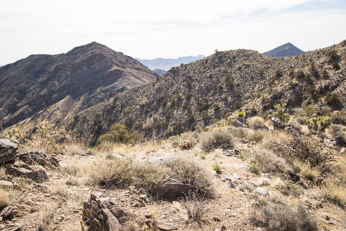
I started up from the saddle toward Peak 5107. I immediately noticed a change in the terrain. The rest of the hike was mostly comprised of dirt ground with embedded boulders, while this was much more volcanic and deserty-feeling, the terrain loose and steep. Beginning as a steep slope, I was soon confronted with a Class 2/3 set of moves along the crest using surprisingly solid volcanic rock. Shortly after I encountered some more light scrambling, and then was pushed off the crest by an impassable outcropping and onto an extraordinarily loose slope. I found myself crawling once in a while on the way up since I kept losing my footing. I'd think I was stable, then a dozen small rocks would displace under my feet. I've got plenty of hiking on volcanic rock under my belt, but this was ridiculous. The views from Peak 5107 were nice, the Highland Range seen to the east.
I backtracked from Peak 5107 and re-ascended my lost vertical to regain the main ridge crest. A pleasant stroll followed by some light Class 2 brought me to the summit of my third peak, Peak 5302. I chose to descend via one of many slope/ridge options. It was steep at times, but I don't think any of the other options would have been better. The slope/ridge led me back into the wash, where I picked up an ATV road and followed it to my car.
Please consider helping me out if you find my site useful. I'm not sponsored, so all site fees are out-of-pocket and my time preparing these trip reports is unpaid. You can also hire me as a web developer. I really appreciate it!


If you find my site helpful, please help me replace my many broken cameras, fund my website fees (hosting, APIs, security), or just support my countless hours of work. I pay for all expenses myself, and all trip reports I post are unpaid and unsponsored, so any support is really appreciated!
If using PayPal, please select their option for "Sending to a friend" so they don't take out fees, thank you.
My site is free to use, but consider sending me a few bucks to help keep it running. Thanks in advance!