I provide a free route map, but you can also download a hike/drive GPX to assist you and to help support my site. Before sharing my GPX tracks with others, please remember my site is a free resource and I'm charging nominal fees to offset my substantial costs.
GPX track added to your cart.
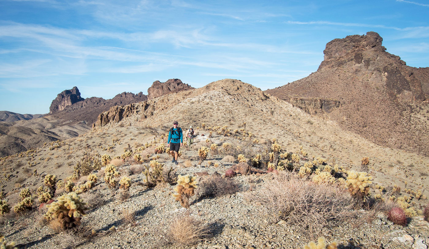
Dec 12, 2021 — The Whipple Mountains have consistently been one of my favorite desert areas, and the loop planned for today would hit the majority of what I had left over. Last year, Whiley and I did the humpier peaks just north, and while gorgeous, those peaks are more about the scenery, while these more craggy peaks today would provide a lot more interesting route-finding. I met up with the same group from a couple of days ago to tackle the area. Each of us had slightly different goals since we'd each gotten to different peaks at various points in our lives, which was fine because there were so many options in this area. Chris Kerth and Bob Burd formulated a loop that would accomodate mostly everyone, but ultimately we all separated more-or-less after the first peak.
Note that Parker Dam is closed at certain hours, so make sure to check before driving out late at night or super early in the morning. We made our way along the sandy (4WD likely required) Bowmans Wash Road, the public access road into Copper Basin. It's a long drive and had substantial washboarding along with a couple of big rocks requiring high clearance.
I set out before everyone else in order to bag Peaks 2700 and 2710 because nobody else showed any initial interest in those and I knew I'd never let myself hear the end of it had I skipped them. After leaving the parking spot, I headed through a wash and stumbled on an ancient mining road Chris said would take me a couple of miles to just below Peak 2710. Easy to follow, I quickly made my way along this road until it reached the saddle separating Peak 2710 and Peak 2380. I'd be meeting the group on Peak 2380, but first headed northeast along the mining road and found myself at Peak 2710's base. Class 2 led to its summit, and I continued south along the ridgeline to get a pretty crazy view with an 800-foot cliff. I worked my way northwest to get to Peak 2700, a straightforward undertaking until just below the summit, where a few fun Class 2+/3 moves brought me up.
I backtracked to the saddle with Peak 2380 and headed west along the Class 2 slope, where I reached the ridgeline and spotted the group ahead. Some Class 2 along the ridge led to some very intersting Class 3 route-finding on the left (southwest) side of the ridgeline. The crest begins jagged and steep, but a few ups-and-downs on the left provided a more reasonable route to gain the ridgeline. Here there was a fairly exposed Class 3 shallow chute on solid rock which led to the summit.
We all backtracked, but then Bob, Chris, Tom Grundy, and I dropped west off the ridge on a Class 2 slope, our next goal being Peak 2660. We decided to head up to it by starting along its eastern slope. It might have been more efficient to just continue on the peak's south side and ascend when just below the summit, but we were happy to get nice views and see a particularly cool canyon-looking feature before the summit. All was Class 2 until the summit block, which if you'll notice on my attached map that there are two. We couldn't discern which was higher, but both go at Class 3/4, and are equally cool.
Bob decided to head out on his own, so Chris, Tom, and I continued onward to Peak 2940. It looked pretty daunting from here, and none of us were confident that it would have a route to its summit. We made our wy to a major gully on the southwest side and started up this Class 2 undertaking, which led the majority of the way up. A smaller gully continued north and ended at a narrow Class 4 cactus-filled ramp. On the ascent we went up this ramp, but on the descent we found that a Class 3 slab just to its left that went a lot more cleanly. Above the ramp was a Class 2 narrow ledge on the solid black volcanic rock I love about this area, which led with full exposure to a short Class 4 move and then a short Class 3 ramp that required crawling. We emerged on the rim above, overjoyed we found a route on the first attempt. Class 2 brought us to the summit, where the views into Whipple Wash and the surrounding peaks were excellent.
After slowly backtracking along the scary Class 3/4 cruxes, we made our way back to the saddle of Peak 2940 and Peak 2660. Initially we intended to go hike out to the distant Peak 3357, but unfortunately that peak would elude me yet again due to time constraints. Chris was hoping to get this one as well, so we mourned for only a short time before dropping south into a drainage. This drainage led to the base of Peak 2573, where a Class 2 slope led to just below its summit area, maybe low Class 3.
Peak 2525 would be our last for the day. We debated dropping directly east and getting to it more directly, but we'd have to cross over a bunch of little arroyos and decided we wanted to take the scenic route instead. Keeping to the ridge crest, we made quick progress up and over minor humps and down to the north side of Peak 2525. The summit was on the opposite end, but the significant cliffs below meant keeping high would be a more likely recipe for sucess. We started up on Class 2 terrain, keeping to the right (west) of the ridge crest. We encountered a few Class 2/3 moves, but nothing too crazy. There are also likely many options for ascending, but for the most part I recommend keeping below the ridge until just below the summit, reached via Class 2. We took in the sunset for a little bit, specifically toward the collossus of Copper Mountain, and then dropped south along the ridge crest. We left the ridge when the cliffs faded away and descended on stupid, loose Class 2 for a few hundred feet. The most reasonable descent after clearing the cliffs seemed to be to sidehill over to a sloped ridge, avoiding the extra steep and loose crap. This led to more tame desert below and we found ourselves following burro trails back to the cars.
Please consider helping me out if you find my site useful. I'm not sponsored, so all site fees are out-of-pocket and my time preparing these trip reports is unpaid. You can also hire me as a web developer. I really appreciate it!


If you find my site helpful, please help me replace my many broken cameras, fund my website fees (hosting, APIs, security), or just support my countless hours of work. I pay for all expenses myself, and all trip reports I post are unpaid and unsponsored, so any support is really appreciated!
If using PayPal, please select their option for "Sending to a friend" so they don't take out fees, thank you.
My site is free to use, but consider sending me a few bucks to help keep it running. Thanks in advance!