I provide a free route map, but you can also download a hike/drive GPX to assist you and to help support my site. Before sharing my GPX tracks with others, please remember my site is a free resource and I'm charging nominal fees to offset my substantial costs.
GPX track added to your cart.
Apr 06, 2022 — Stonewall Mountain is a big lump in the desert just off NV-95. The summit is located just over the border into military property within the Nellis Air Force Base, but there is no signage anywhere reading that it isn't permitted to hike to the summit. That being said, I won't claim to have hiked to the peak. For those who want to get up there, all route information here and the attached map is hypothetical.
To reach the trailhead, head east from NV-95 on a good dirt road here (37.50621, -117.1858). Turn right here (37.51017, -117.18047) onto another dirt road, much more difficult to locate than you'd expect. This road is still great, suitable for crossovers or better and continues to be so until where I parked. This road heads southeast, then bends east and heads through a junction here (37.49544, -117.16634), then continues east to here (37.49555, -117.16452) where it curves north for 300 feet before heading east again. Keep right at this junction (37.4975, -117.15158) and follow this road to the trailhead. Thanks to Dean Gaudet, who provided these very helpful driving directions.
I hiked the last quarter mile of this deteriorated dirt road until its end, then dropped into the obvious wash. This wash led northeast, all easy hiking. At roughly the 6600' contour, a cairn and stick blockage marked where to keep right, the route leaving the main drainage and continuing up a slightly more brushy side-drainage. I continued along this steepening gully until it seemed to make more sense to leave the watercourse and instead ascend the steep, somewhat rocky slope leading to the ridge above.
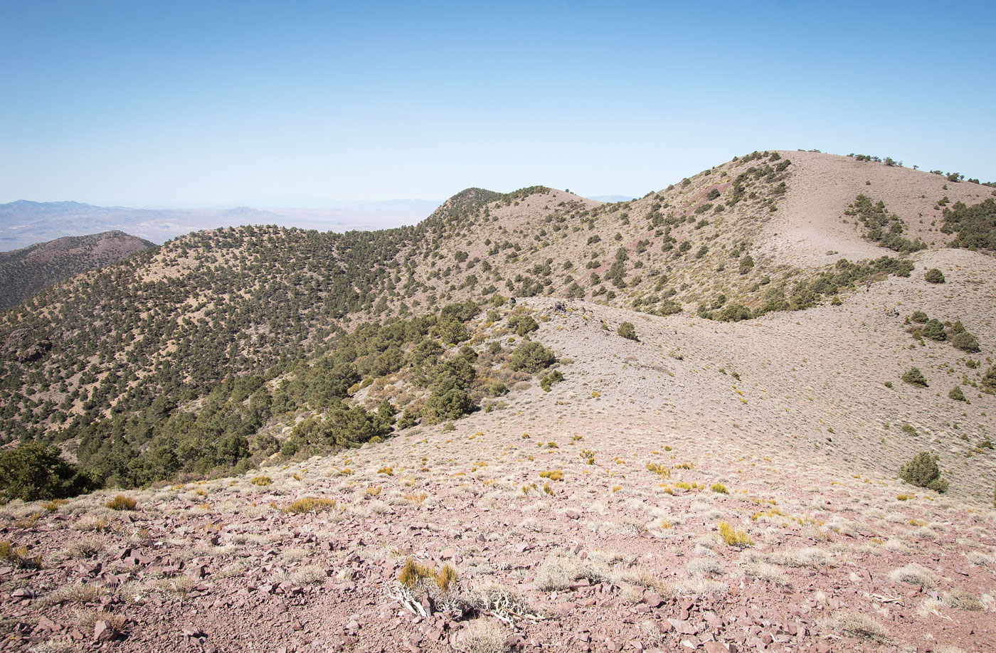
Once on the ridge, Stonewall Mountain comes into view to the east. The remainder of the route to the summit (mostly) follows the ridgeline as it leads northeast before curving back southeast. First the route leads to the base of an avoidable lump on the ridgeline. To wrpa round it I recommend staying low. Class 2/3 stuff is required for about a couple hundred feet, but higher up is steeper with more rockiness/brush/scrambling. Side-hilling here isn't particularly fun, but it's also short-lived.
After the dumb side-hilling section, the ridgeline tames out substatntially and undulates over a few brushless lumps with nice views and up to a false summit of Stonewall Mountain, where some sort of radio contraption is located. It's a quick jaunt to the high point from there.
Please consider helping me out if you find my site useful. I'm not sponsored, so all site fees are out-of-pocket and my time preparing these trip reports is unpaid. You can also hire me as a web developer. I really appreciate it!


If you find my site helpful, please help me replace my many broken cameras, fund my website fees (hosting, APIs, security), or just support my countless hours of work. I pay for all expenses myself, and all trip reports I post are unpaid and unsponsored, so any support is really appreciated!
If using PayPal, please select their option for "Sending to a friend" so they don't take out fees, thank you.
My site is free to use, but consider sending me a few bucks to help keep it running. Thanks in advance!